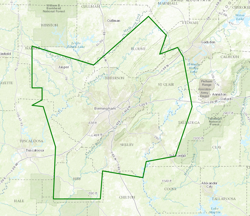
Flood Warnings For Parts of Walker, Jefferson, Blount, Shelby, Bibb, Tuscaloosa, St. Clair, & Talladega Until 7:00PM
BULLETIN – IMMEDIATE BROADCAST REQUESTED
Flood Warning
National Weather Service Birmingham AL
358 PM CDT THU JUN 22 2017
ALC007-009-073-115-117-121-125-127-230000-
/O.NEW.KBMX.FA.W.0009.170622T2058Z-170623T0000Z/
/00000.0.ER.000000T0000Z.000000T0000Z.000000T0000Z.OO/
Walker AL-Talladega AL-Tuscaloosa AL-Blount AL-Shelby AL-Bibb AL-
Jefferson AL-St. Clair AL-
358 PM CDT THU JUN 22 2017
The National Weather Service in Birmingham has issued a
* Flood Warning for Urban Areas and Small Streams in…
Walker County in Alabama…
Western Talladega County in east central Alabama…
Eastern Tuscaloosa County in west central Alabama…
Blount County in Alabama…
Shelby County in Alabama…
Bibb County in Alabama…
Jefferson County in Alabama…
St. Clair County in Alabama…
* Until 700 PM CDT
* At 357 PM CDT, Doppler radar indicated rainfall of 2 to 4 inches
the past 24 hours. Locally higher amounts have been reported. Any
additional rain will cause ponding of water on roadways, small
creek flooding and urban flooding. Runoff will last for several
more hours.
* Some locations that will experience flooding include…
Birmingham, Hoover, Vestavia Hills, Alabaster, Bessemer, Homewood,
Pelham, Mountain Brook, Trussville, Helena, Hueytown, Talladega,
Jasper, Gardendale, Sylacauga, Pell City, Irondale, Leeds, Moody
and Calera.
PRECAUTIONARY/PREPAREDNESS ACTIONS…
Turn around, don’t drown when encountering flooded roads. Most flood
deaths occur in vehicles.
Keep children away from storm drains, culverts, creeks and streams.
Water levels can rise rapidly and sweep children away.
Category: Archived Warnings
About the Author (Author Profile)
Scott Martin is an operational meteorologist, professional graphic artist, musician, husband, and father. Not only is Scott a member of the National Weather Association, but he is also the Central Alabama Chapter of the NWA president. Scott is also the co-founder of Racecast Weather, which provides forecasts for many racing series across the USA. He also supplies forecasts for the BassMaster Elite Series events including the BassMaster Classic.Subscribe
If you enjoyed this article, subscribe to receive more just like it.


