

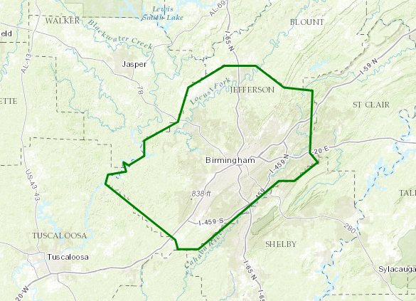
Urban and Small Stream Flood Advisory for Jefferson County Until 515 PM
Flood Advisory
National Weather Service Birmingham AL
214 PM CDT FRI JUN 23 2017
ALC073-232215-
/O.NEW.KBMX.FA.Y.0064.170623T1914Z-170623T2215Z/
/00000.N.ER.000000T0000Z.000000T0000Z.000000T0000Z.OO/
Jefferson AL-
214 PM CDT FRI JUN 23 2017
The National Weather Service in Birmingham has issued a
* Urban and Small Stream Flood Advisory for…
Jefferson County in Alabama…
* Until 515 PM CDT
* At 212 PM CDT, Doppler radar indicated thunderstorms producing
heavy rain were moving northeast across the area. These
thunderstorms were moving across areas that received two to three
inches of rain during the past twenty four hours. One to two
inches of rain is possible in some areas during the next two
hours. This will produce localized flooding of streets and
roadways in the area…especially in low-lying flood prone areas
with poor drainage or near small creeks and streams.
* Some locations that will experience flooding include…
Birmingham, Hoover, Vestavia Hills, Bessemer, Homewood, Mountain
Brook, Trussville, Hueytown, Gardendale, Irondale, Leeds, Moody,
Fairfield, Fultondale, Sumiton, Pinson-Clay-chalkv, Center Point,
Pleasant Grove, Clay and Pinson.
PRECAUTIONARY/PREPAREDNESS ACTIONS…
Turn around, don’t drown when encountering flooded roads. Most flood
deaths occur in vehicles.
Category: ALL POSTS, Archived Warnings
About the Author (Author Profile)
Scott Martin is an operational meteorologist, professional graphic artist, musician, husband, and father. Not only is Scott a member of the National Weather Association, but he is also the Central Alabama Chapter of the NWA president. Scott is also the co-founder of Racecast Weather, which provides forecasts for many racing series across the USA. He also supplies forecasts for the BassMaster Elite Series events including the BassMaster Classic.Subscribe
If you enjoyed this article, subscribe to receive more just like it.


