

Strong Storms About To Affect Walker, Tuscaloosa, Blount, Shelby, Hale, Bibb, Jefferson & St. Clair
Heads up for everyone in the path of the line of storms that are about to affect the area. Strong gusty winds, torrential rainfall, and the possibility of a brief isolated spin-up tornado can be expected.
Special Weather Statement
National Weather Service Birmingham AL
240 PM CDT FRI JUN 23 2017
ALZ015-017-023>026-032-034-232045-
Walker-Hale-Bibb-Jefferson-Shelby-Tuscaloosa-St. Clair-Blount-
240 PM CDT FRI JUN 23 2017
…A LINE OF STRONG THUNDERSTORMS WILL AFFECT EASTERN WALKER…
SOUTHEASTERN TUSCALOOSA…BLOUNT…CENTRAL SHELBY…NORTHEASTERN
HALE…BIBB…JEFFERSON AND WEST CENTRAL ST. CLAIR COUNTIES…
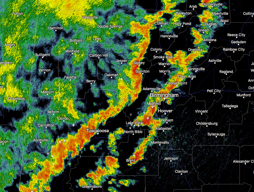
At 239 PM CDT, radar indicated strong thunderstorms were located
along a line extending from 7 miles east of Helicon to near Oak Grove
to near Knoxville. Movement was east at 25 mph.
Winds in excess of 40 mph are possible with these storms.
Locations impacted include…
Birmingham, Tuscaloosa, Hoover, Vestavia Hills, Alabaster, Bessemer,
Homewood, Northport, Pelham, Mountain Brook, Trussville, Helena,
Hueytown, Gardendale, Irondale, Leeds, Moody, Fairfield, Chelsea and
Fultondale.
Torrential rainfall is also occurring with these storms, and may
cause localized flooding. Do not drive your vehicle through flooded
roadways.
Frequent cloud to ground lightning is occurring with this storm.
Lightning can strike 10 miles away from a thunderstorm. Seek a safe
shelter inside a building or vehicle.
Category: Archived Warnings
About the Author (Author Profile)
Scott Martin is an operational meteorologist, professional graphic artist, musician, husband, and father. Not only is Scott a member of the National Weather Association, but he is also the Central Alabama Chapter of the NWA president. Scott is also the co-founder of Racecast Weather, which provides forecasts for many racing series across the USA. He also supplies forecasts for the BassMaster Elite Series events including the BassMaster Classic.Subscribe
If you enjoyed this article, subscribe to receive more just like it.


