

Hot And Humid Out There At Midday On The 4th, With Some Showers Out There In The North
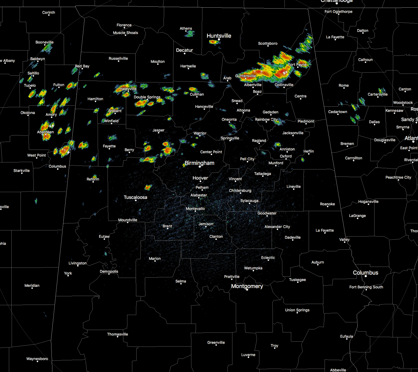
RADAR CHECK AT 11:10AM
So at this point, National Weather Service Radar located in Calera that supports the Birmingham area is currently down, and technicians have been dispatched. So I’m having to use data that are a few minutes old when making this post.
Before the radar went kaput, we could see that showers and a few storms are currently in progress over the northern half of Central Alabama and up into North Alabama. The strongest of these at that moment was located in the northeast corner of the state in Marshall and Dekalb counties. No warnings on this batch, but you can expect heavy downpours along with dangerous cloud-to-ground lightning as it continues to move to the east.

TEMPERATURES ACROSS CENTRAL ALABAMA AT 11:15AM
There is actually a big range in temperatures at this time across the area… Cullman is currently the cool spot at 82 degrees, while Montgomery and Eufaula are tied currently as the warm spots at 91 degrees.
WEATHER FOR THE REMAINDER OF INDEPENDENCE DAY
Showers and storms will most likely continue to form over mainly the northern-half of Central Alabama throughout the day, as there is a slightly drier airmass over much of the southern part of the state. I still believe from my morning forecast email that most of the activity will be north of the I-20 corridor, but there could be a shower or two that could stray south of that. We’ll have a mix of sun and clouds throughout the remainder of the day, with highs reaching the upper 80s to the mid 90s throughout Central Alabama, with head indicies ranging from the mid 90s to the lower 100s. Use common sense when outside today, whether if it is heat or lightning (and not heat lightening).
There will be a few showers and storms that will linger into the evening hours tonight, but I do think that it will be dry by the time the fireworks start launching at Vulcan. The latest HRRR model run is trending that way. Temperatures at 8PM will be around the lower to mid 80s throughout the area, and only falling into the lower to mid 70s.
BACK TO WORK ON WEDNESDAY
With slightly drier moisture levels across the southern half of Central Alabama, our usual risk of the standard summertime scattered afternoon showers and storms will be over the northern half of the area, mainly north of a line from Eutaw to Calera to Lineville. We’ll start off with mostly clear skies, but will become partly to mostly cloudy during the afternoon hours with the convective heating of the day. Highs will be in the lower to mid 90s throughout the area.
HEADING TO THE BEACH
For a detailed look at the weather from Fort Morgan over to Panama City Beach, click here to see the AlabamaWx Beach Forecast Center page. The Beach Forecast is partially underwritten by the support of Brett/Robinson Vacation Rentals in Gulf Shores and Orange Beach. Click here to see Brett/Robinson’s “Own Your Summer” specials now!
BUSINESS IS ABOUT TO PICK UP IN THE TROPICS
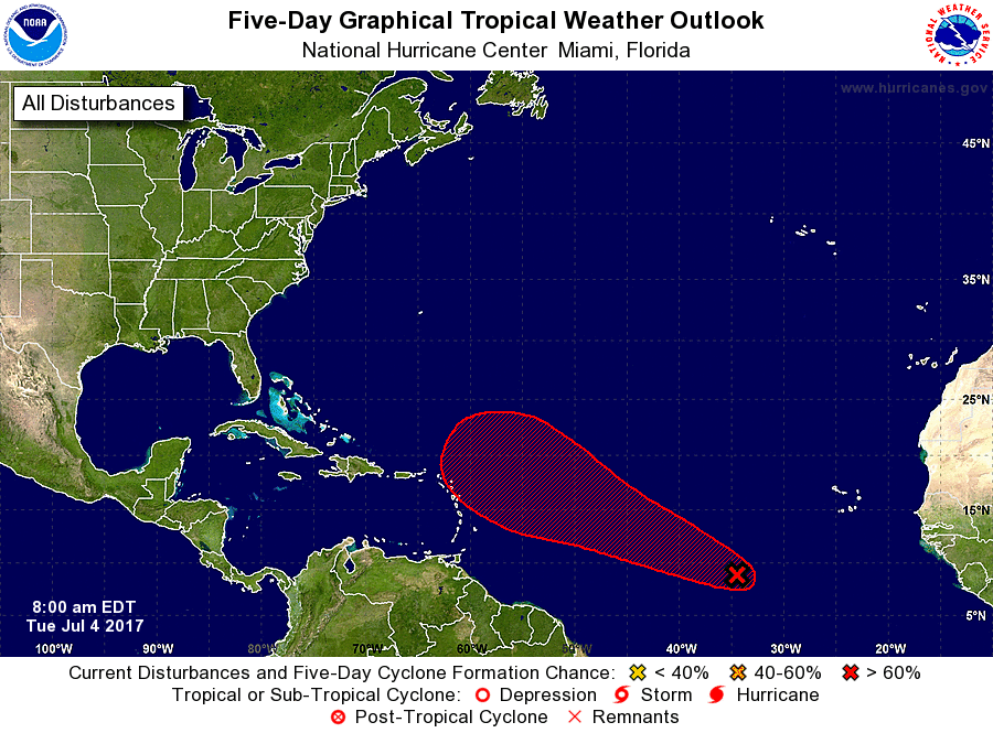
It looks like the low pressure system out in the eastern Atlantic is starting to get its act together, and we’ll either have a tropical depression or Tropical Storm Don within the next day or so. It will start to make a move to the west-northwest at 10-15 MPH today. Models have it going in several different places, so be sure to read Bill Murray’s great post by clicking here (after you finish reading my post first).
TODAY IN WEATHER HISTORY
July 4, 1776 – Thomas Jefferson paid for his first thermometer, and signed the Declaration of Independence. According to his weather memorandum book, at 2 PM it was cloudy and 76 degrees.
WEATHERBRAINS
Don’t forget you can listen to our weekly 90 minute netcast anytime on the web, or on iTunes. This is the show all about weather featuring many familiar voices, including our meteorologists here at ABC 33/40. you can watch it live here on Monday nights at 8:30PM CDT.
Category: Alabama's Weather, ALL POSTS
About the Author (Author Profile)
Scott Martin is an operational meteorologist, professional graphic artist, musician, husband, and father. Not only is Scott a member of the National Weather Association, but he is also the Central Alabama Chapter of the NWA president. Scott is also the co-founder of Racecast Weather, which provides forecasts for many racing series across the USA. He also supplies forecasts for the BassMaster Elite Series events including the BassMaster Classic.Subscribe
If you enjoyed this article, subscribe to receive more just like it.


