A Brief Check On North/Central Alabama’s Weather
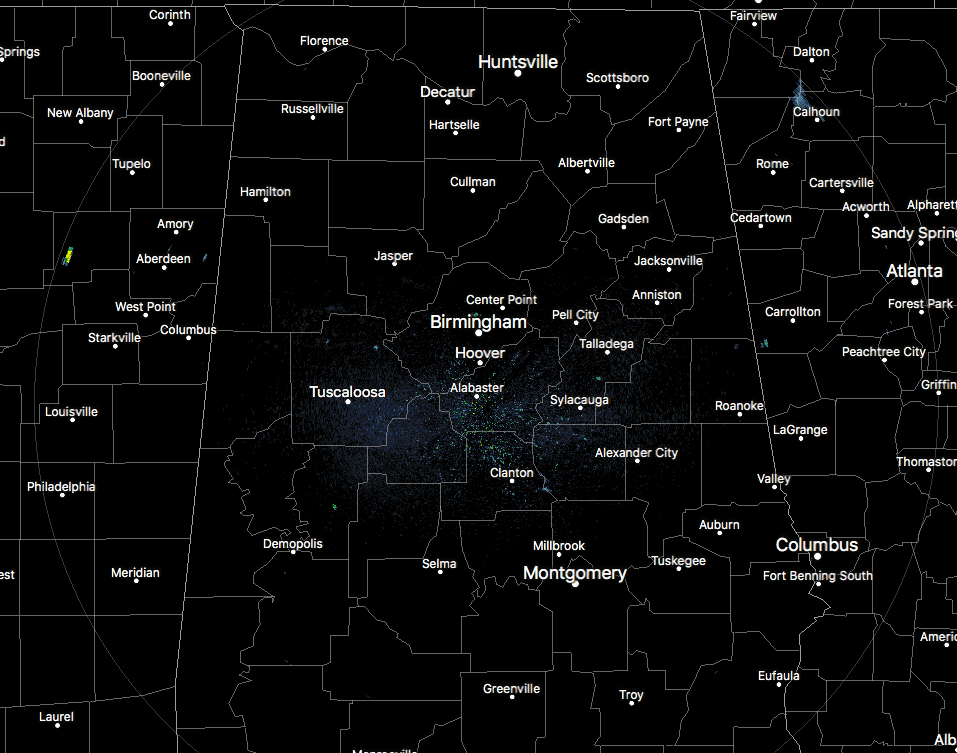
RADAR CHECK AT 10:20AM
At this time across North/Central Alabama, we have a few small showers starting to pop up on radar as we are approaching that magical time of the day when convective showers and storms start firing. We have a small shower just to the southwest of Fultondale, along with very few showers popping in the north Tuscaloosa and in southcentral Talladega counties. These will most likely continue to grow while more will develop within the next hour or so.
Once again, we have a very moisture-rich environment over the area, as precipitable water values are once again in the 1.75-2.00 inch range. Surface-based instability values are already running in the 2500-3500 J/kg range across much of the area, and with the convective temperature at 86 degrees, storms should fire up and develop quickly once that temperature is reached.
Looks like the main area for development will be in Central Alabama around and near the I-20 corridor, but I wouldn’t be surprised that there will be a hot spot up in the northeastern part of the state as well.
As the lunch time arrives and we start to move through the early afternoon hours, Downdraft CAPE values will be over 1000 J/kg once again, so there will be a potential for strong downdraft thunderstorm winds that could knock a few trees down, especially with this soggy soil we have.
We do not have an organized threat for severe storms today, but a few of these could be strong, and we may have one or two to briefly reach severe limits, mainly for damaging winds.
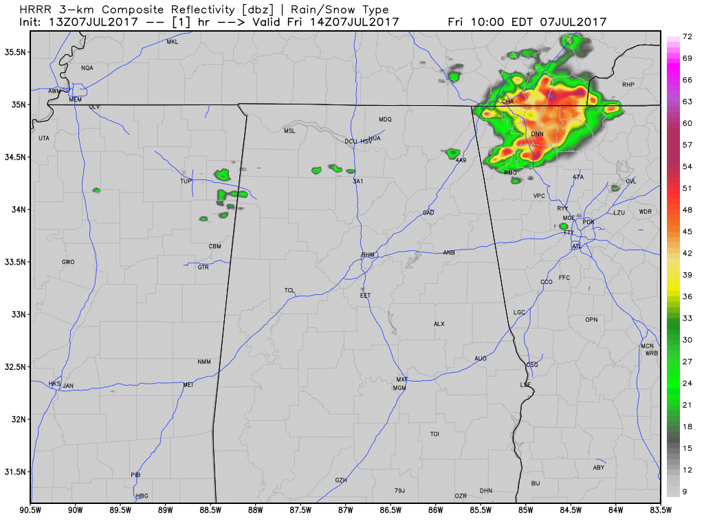
This is the latest HRRR model run through 2AM Saturday morning. As you can see, it shows scattered shower and storm activity picking up as we move later into the day, but I actually think it is underestimating the overall coverage in storms.
We’ll keep you informed on the AlabamaWx Weather Blog throughout the day.
Category: Alabama's Weather, ALL POSTS
About the Author (Author Profile)
Scott Martin is an operational meteorologist, professional graphic artist, musician, husband, and father. Not only is Scott a member of the National Weather Association, but he is also the Central Alabama Chapter of the NWA president. Scott is also the co-founder of Racecast Weather, which provides forecasts for many racing series across the USA. He also supplies forecasts for the BassMaster Elite Series events including the BassMaster Classic.Subscribe
If you enjoyed this article, subscribe to receive more just like it.


