Checking The North/Central Alabama Weather Situation At 1:40PM
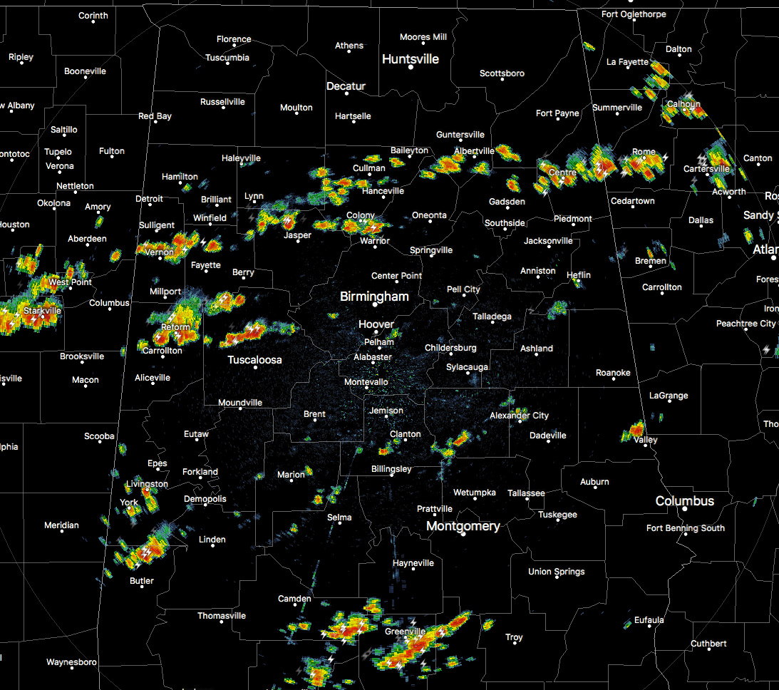
RADAR CHECK AT 1:40PM
It is definitely clear to see by looking at the latest radar image that a boundary has set south of a line from Hamilton to Guntersville to Fort Payne. That is where much of the activity has fired at this point, with more activity a little farther south of that. There may be a rogue shower or storm that forms north of that line, but much of the Tennessee Valley could stay dry for the remainder of the afternoon hours.
The good news is that none of the activity has been deemed strong enough as of yet to warrant a warning or a significant weather advisory. The strongest of the storms at this point are located over portions of Tuscaloosa and Pickens counties, and the southern parts of Lamar and Fayette counties. All of these storms are generally moving to the east-southeast at around 10 MPH.
These showers and storms will be heavy rain producers, as the precipitable water values are around 1.70-2.10 inches across the area. Rainfall rates could be as high as 1.00-2.00 inches per hour if you’re caught under one of these heavier storms, and localized ponding or flash flooding could occur.
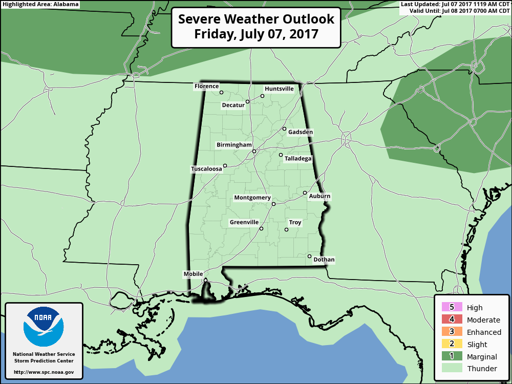
The Storm Prediction Center currently does not have any part of the state in a risk for severe storms, but that doesn’t mean that a few storms could get strong, or that one or two could become severe briefly.
Surface-based instability values (CAPE) is ranging in the 3000-4000 J/kg range at this point throughout Central Alabama. Downdraft CAPE values are approaching 1000 J/kg, so that means the threat will be there for a few strong downdrafts from some of these storms. Remember, a storm doesn’t have to reach severe criteria to knock down trees with the already saturated soil. Winds of 40 MPH could bring some trees in weaker soil down, so please stay weather aware if a storm affects your location.
Dangerous cloud-to-ground lightning will be possible with nearly all of these thunderstorms. Use common sense and go indoors when you hear thunder. If you can hear thunder, you are close enough to the storm to be struck by lightning.
We will keep you posted on the AlabamaWx Weather Blog throughout the day if any advisories or warnings are issued. Be sure to follow us at @AlabamaWxBlog on Twitter as well to receive those advisories or warnings even faster.
Category: Alabama's Weather, ALL POSTS
About the Author (Author Profile)
Scott Martin is an operational meteorologist, professional graphic artist, musician, husband, and father. Not only is Scott a member of the National Weather Association, but he is also the Central Alabama Chapter of the NWA president. Scott is also the co-founder of Racecast Weather, which provides forecasts for many racing series across the USA. He also supplies forecasts for the BassMaster Elite Series events including the BassMaster Classic.Subscribe
If you enjoyed this article, subscribe to receive more just like it.


