Urban and Small Stream Flood Advisory Issued for Parts of South/Central Alabama Until 8PM
The National Weather Service in Birmingham has issued a
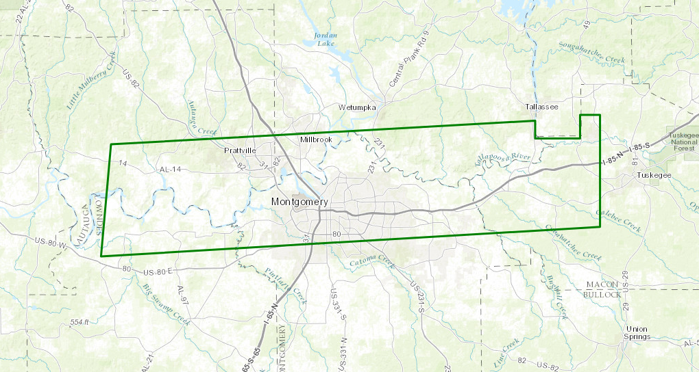
* Urban and Small Stream Flood Advisory for…
Southeastern Autauga County in Alabama…
Southern Elmore County in east central Alabama…
Northeastern Lowndes County in south central Alabama…
Northwestern Macon County in southeastern Alabama…
Northern Montgomery County in south central Alabama…
* Until 800 PM CDT
* At 455 PM CDT, Doppler radar indicated heavy rain due to
thunderstorms. This will cause urban and small stream flooding in
the advisory area.
* Some locations that will experience flooding include…
Montgomery, Prattville, Millbrook, Tuskegee, Wetumpka, Tallassee,
Milstead, Coosada, Autaugaville, White Hall, Shorter, Franklin,
Bob Woodruff Lake, Autauga County Airport, Woodcrest, Emerald
Mountain and Maxwell Air Force Base.
PRECAUTIONARY/PREPAREDNESS ACTIONS…
Turn around, don’t drown when encountering flooded roads. Most flood
deaths occur in vehicles.
Excessive runoff from heavy rainfall will cause flooding of small
creeks and streams, urban areas, highways, streets and underpasses
as well as other drainage areas and low lying spots. This will
particularly be the case within Downtown Montgomery.
A Flood Advisory means river or stream flows are elevated, or ponding
of water in urban or other areas is occurring or is imminent.
Category: Archived Warnings
About the Author (Author Profile)
Scott Martin is an operational meteorologist, professional graphic artist, musician, husband, and father. Not only is Scott a member of the National Weather Association, but he is also the Central Alabama Chapter of the NWA president. Scott is also the co-founder of Racecast Weather, which provides forecasts for many racing series across the USA. He also supplies forecasts for the BassMaster Elite Series events including the BassMaster Classic.Subscribe
If you enjoyed this article, subscribe to receive more just like it.


