The Rush Hour Look At North/Central Alabama’s Weather
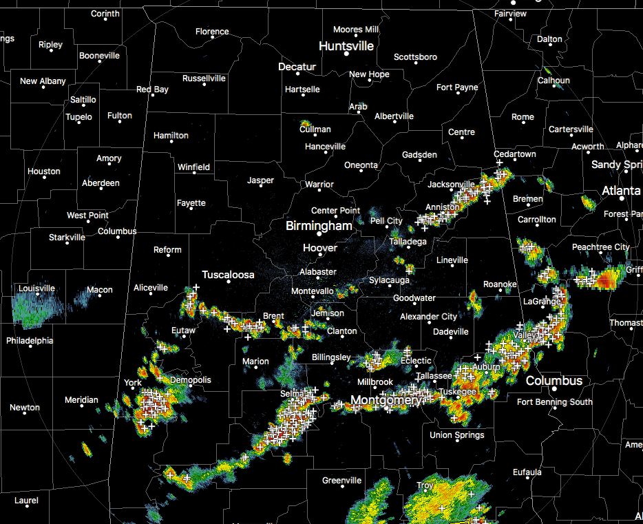
RADAR CHECK AT 4:45PM
A boundary of drier air has set up over the northern parts of the state, and this is really inhibiting any storm development in the Tennessee Valley and into the northern communities of Central Alabama. At this point, just about all of the shower and storm activity has pushed south of the I-20 corridor, with the exception for the storms located over Calhoun and Cleburne counties.
As of now, the stronger storms, especially the ones that currently have significant weather advisories on them, are south of a line from Livingston to Billingsley to Roanoke. The good news is that there are no current severe thunderstorm warnings for Central Alabama, but the stronger storms could have strong enough wind gusts to knock a couple of trees down due to the saturated soil conditions.
SPC continues to keep us out of any severe storm risk for this afternoon and evening hours. We are still seeing surface instability values (CAPE) ranging in the 2500-3500 J/kg range across much of the area, and Downdraft CAPE values are just above 1000 J/kg, so a few stronger storms can be capable of producing strong downburst winds that could knock down a few trees and cause damage. The overall severe weather threat is really low, nearly but not zero, but we could have a storm go severe before the end of the daylight hours over the southern half of the area.
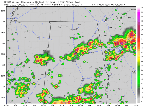
The latest HRRR model run is really keeping the northern half of the state dry after 7PM tonight, with the rest of North/Central Alabama dry throughout the late night hours tonight and throughout the mid morning hours on Saturday.
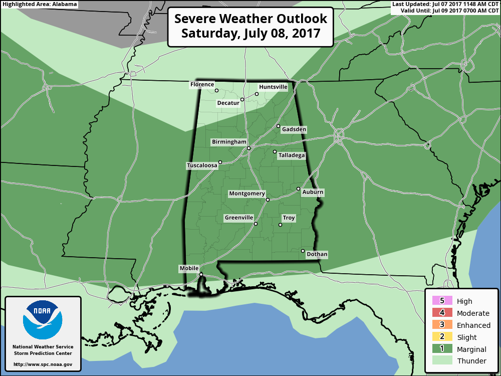
Tomorrow could be a more active day with strong to severe storms throughout much of the state. SPC has all of North/Central Alabama south of a line from roughly Hamilton to Guntersville to Bridgeport (north Jackson County) in a marginal risk for severe storms. Much of the storm activity should be in the southern 2/3rds of the state with less coverage for the northern 1/3rd.
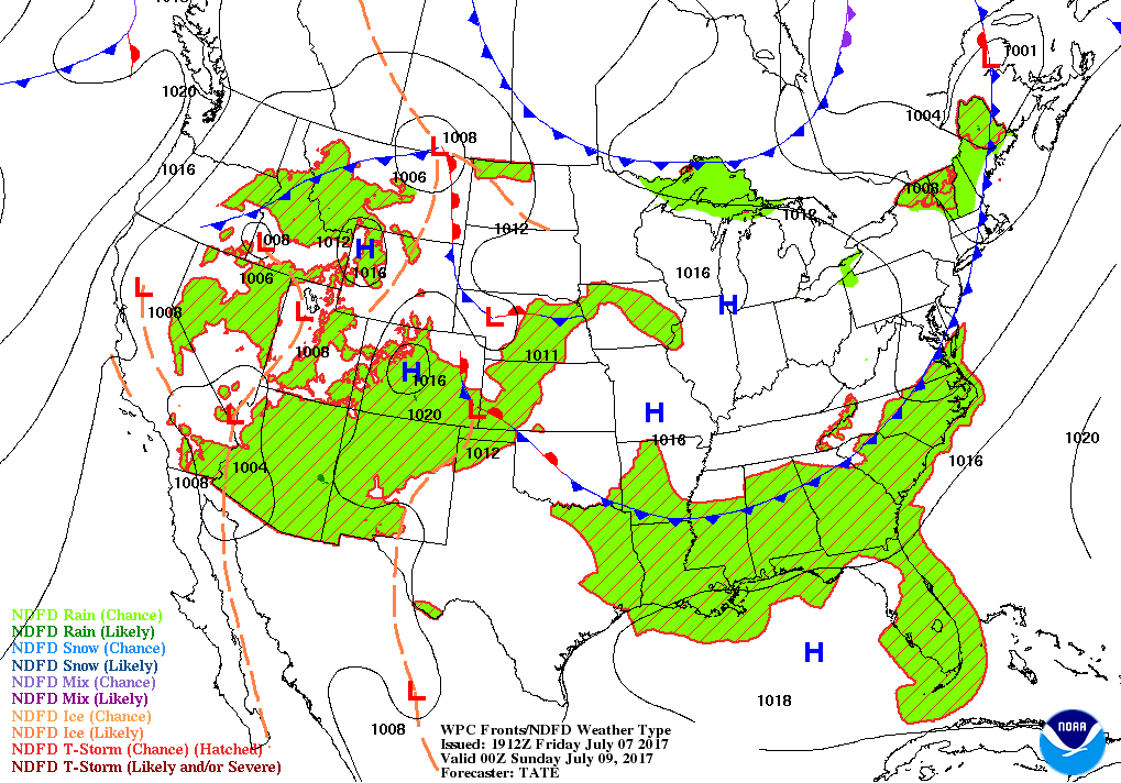
A cold front will start Saturday of just north of the state and move through the northern half by 7PM tomorrow evening. Storms will be most active out ahead and along the front. After the front passes, conditions should start to dry out even though a few isolated showers could pop up, but these will be small and amounts should be very light.
We’ll keep you informed on the AlabamaWx Weather Blog throughout the evening.
Category: Alabama's Weather, ALL POSTS
About the Author (Author Profile)
Scott Martin is an operational meteorologist, professional graphic artist, musician, husband, and father. Not only is Scott a member of the National Weather Association, but he is also the Central Alabama Chapter of the NWA president. Scott is also the co-founder of Racecast Weather, which provides forecasts for many racing series across the USA. He also supplies forecasts for the BassMaster Elite Series events including the BassMaster Classic.Subscribe
If you enjoyed this article, subscribe to receive more just like it.


