Severe Weather Tomorrow?
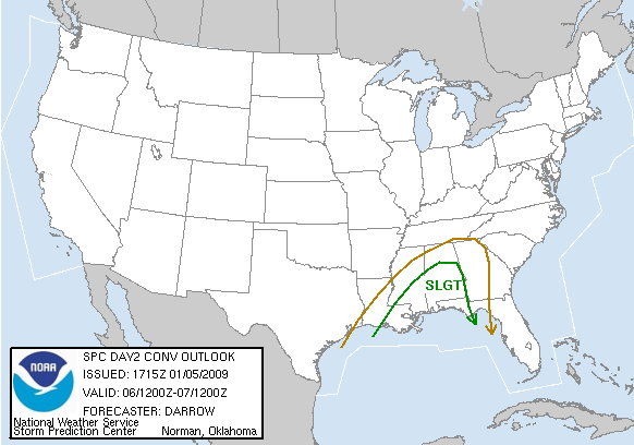
A very dynamic and wet pattern is setting up over Alabama for tomorrow. As James discusses in his morning video (scroll down to see that), there is a chance for severe storms in parts of Alabama tomorrow and tomorrow night. SPC has southern and central Alabama, roughly south of I-20, in a slight risk for severe weather.
The morning computer models do not seem quite as aggressive in bringing the warm, moist air northward. Right now, a stationary front lies from near Weiss Lake to Clanton to Grove Hill. North of that front, temperatures are in the 40s and lower 50s in HSV and BHM, with temps 65-70 in Anniston, MGM, Dothan, and Eufaula. A large upper-level storm system to our west will move slowly east over the next two days, finally moving this front south and out of Alabama on Wednesday. But, until then, upper-level impulses will move rapidly east, generating surface lows along the front.
As these move through, warm, moist air will flow up and over the cold air over north Alabama, producing rain and maybe a few thunderstorms. Much of the northern half of Alabama will see 1-3″ of rain by Wednesday, and some places in the Tennessee Valley may get 5″.
The main threat for severe weather will be tomorrow afternoon and evening. According to the models, wind shear will be fairly strong, but not extreme. Instability is rather weak, with the best instability from about Clanton south. Right now, it looks like South Alabama has the best chance of any severe weather. And, even in south Alabama, it doesn’t look like a major event. However, with wind shear in place, strong winds are likely with a squall line as it moves through tomorrow night, and a few storms are possible ahead of the line tomorrow afternoon.
If the sun comes out tomorrow, or the warm air moves a little farther north than indicated, the threat could be a little more in the BHM area. But, right now, it looks like a primarily south Alabama event, with only a few isolated wind damage events around BHM. With the wind shear, an isolated tornado or two can’t be ruled out, especially in south Alabama. So, it’s best to keep an eye on the weather tomorrow and tomorrow night anywhere from I-20 south. And, with the very heavy rain expected in north Alabama, this event will be a big deal for everybody.
Category: Uncategorized
About the Author (Author Profile)
Subscribe
If you enjoyed this article, subscribe to receive more just like it.


