Another Dry, Mostly Sunny Day
Satellite image this morning showed a few clouds, mainly high clouds, across the northern half of Alabama. The radar was clear over much of the Southeast US and temperatures in Central Alabama were in the 60s. Not too shabby for the first day of August. July and August are the two warmest months for Central Alabama based on climatological records.
SPC has forecast thunderstorms over a large portion of the US for the next three days with a marginal risk area confined to the North Central US each of those days.
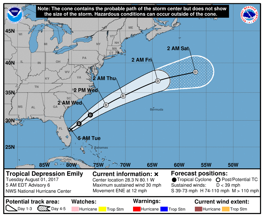
The Atlantic Basin is relatively quiet with the exception of Emily. Emily was downgraded to a depression yesterday after moving ashore on the Florida West Coast just west of Bradenton, FL (Anna Maria Island). While Emily will be moving over the warm water of the Gulf Stream, it has ingested some dry air, so the prognosis for this storm is not good. The current NHC forecast maintains the system as a depression, but as the hurricane forecasters noted, there is a good deal of uncertainty in the intensity forecast. Fortunately the system should remain away from the US East Coast as it moves on a northeasterly track. Just two systems being watched in the eastern North Pacific.
Our upper air pattern remains in a pattern of a western ridge and an eastern trough. A weak short wave over Missouri today will bring some clouds to Alabama over the next couple of days, but moisture levels remain fairly low, so we should stay dry today and Wednesday. Dew points will be gradually rising into the lower 60s for today and Wednesday and should reach the upper 60s by Thursday. Highs today and Wednesday should top out around the 90-degree mark.
With moisture levels up on Thursday, we’ll have to mention the potential for scattered showers. I think the best chances for showers and thunderstorms comes on Friday. By Friday a fairly strong short wave will be moving through the Great Lakes area. This feature will generate a surface low over eastern Iowa on Thursday that will move into Lower Michigan on Friday. This drags a cold front into the Southeast US creating the potential for more numerous showers and thunderstorms. Still, because of the nature of showers, not everyone will get wet. Highs should be in the middle and upper 80s for the end of the week and into the weekend.
The upper short wave moves into New England by Sunday, so the upper air flow over the Southeast US goes nearly zonal into the first of next week. With moisture in place and the presence of a front that should be washing out, it looks like we’ll remain with persistent chances for showers and storms through the weekend and into next week. Once again, though, temperatures are projected to remain in the upper 80s for highs and lower 70s for lows. Once again not too shabby for the first part of August when the 30-year average highs and lows should be 91 and 72.
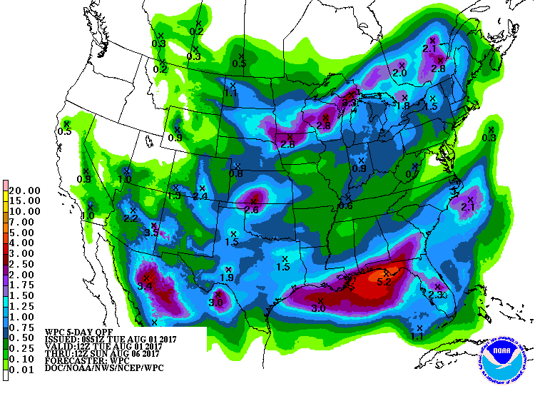
Rainfall will remain quite varied due to the nature of showers, but places that do get rain should see amounts in the range of one half to three-quarters of an inch.
Another dry day for the beach areas of Alabama and Northwest Florida. Chances of showers return Wednesday and into the latter half of the week ahead. No complete washouts but showers could be fairly numerous. You can expect to see highs mainly in the middle 80s. Click here to see the AlabamaWx Beach Forecast Center page. The Beach Forecast is partially underwritten by the support of Brett/Robinson Vacation Rentals in Gulf Shores and Orange Beach. Click here to see Brett/Robinson’s Own Your Summer specials now!
Looking out into voodoo country, the GFS maintains the pattern of a trough over the eastern half of the country. The latest run breaks down this pattern by the 13th of August as the upper ridge over Bermuda pushes into the Southeast US. The pattern returns to a trough along the East Coast once again by the 16th of August. Overall, while we will see warm days, the projected pattern does not signal any excessive heat for us in Alabama.
Don’t forget you can listen to our weekly 90 minute netcast anytime on the web, or on iTunes. This is the show all about weather featuring many familiar voices, including our meteorologists here at ABC 33/40.
Just a reminder that we are on a one-a-day schedule for the videos. I expect to have the next video on Wednesday morning. But you can check back often for updates on weather happenings in Alabama. Have a great day and Godspeed.
-Brian-
Category: Alabama's Weather, ALL POSTS
About the Author (Author Profile)
Brian Peters is one of the television meteorologists at ABC3340 in Birmingham and a retired NWS Warning Coordination Meteorologist. He handles the weekend Weather Xtreme Videos and forecast discussion and is the Webmaster for the popular WeatherBrains podcast.Subscribe
If you enjoyed this article, subscribe to receive more just like it.


