Not Too Bad In Central Alabama At Midday, Harvey Is Back On The Board
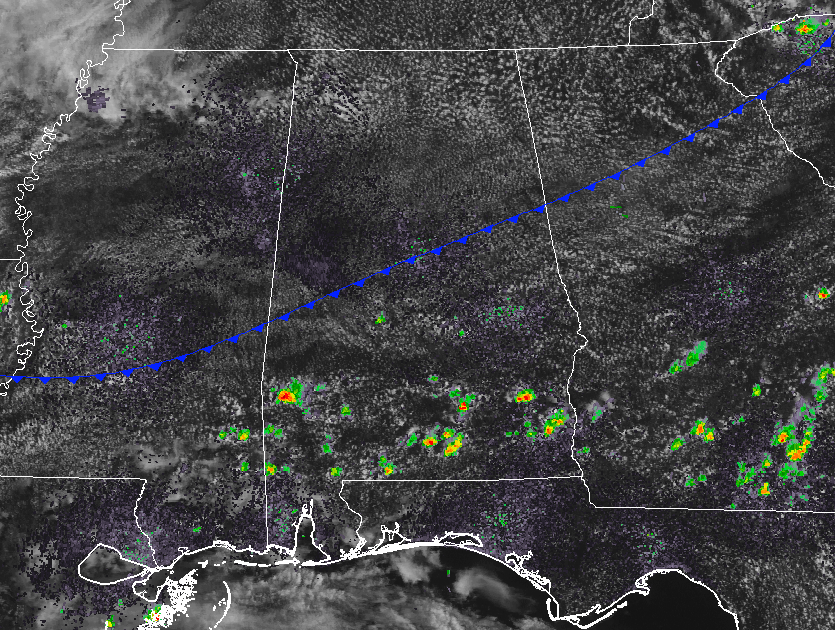
At 12:40 PM, we have a few cumulus clouds overhead with only a few isolated showers in the extreme southern parts of the area at this point. The cold front is currently draped across Central Alabama at this point, and most of the convective thunderstorms expected to form this afternoon will be mainly south of the front. That means that locations north of a line from Tuscaloosa to Birmingham to Anniston will more than likely stay dry today. South of that, there will be a decent chance of scattered showers and thunderstorms. Not everyone will get rain today south of the front, with the chance of rain for any one spot around 30-40% (higher chances as you go south). Afternoon highs will be in the mid-80s to the low-90s.
The front will continue to slowly push south during the evening and overnight hours, and so will those rain chances. Skies will be partly cloudy with the better chances for rain south of a line from Demopolis to Clanton to Alexander City. North of that line, a dry night can be expected. Overnight lows will be in the low-60s to the low-70s from north to south.
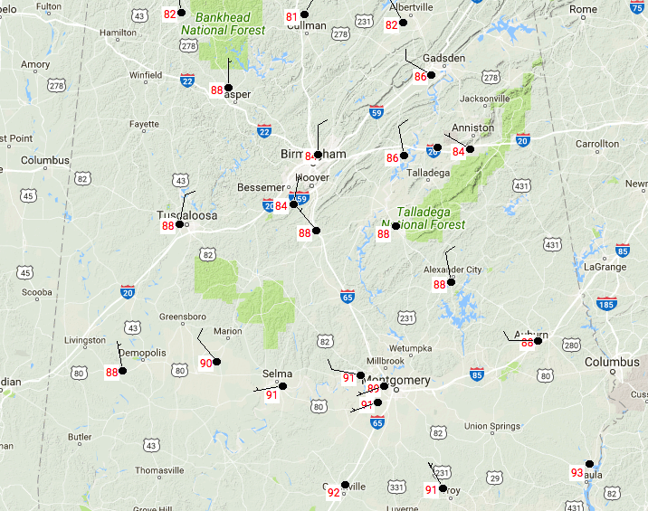
Temperatures across Central Alabama are ranging in the low-80s to the low-90s, with Eufaula topping out as the warm spot at 93 degrees. Birmingham is currently at 84 degrees.
Thursday’s Weather
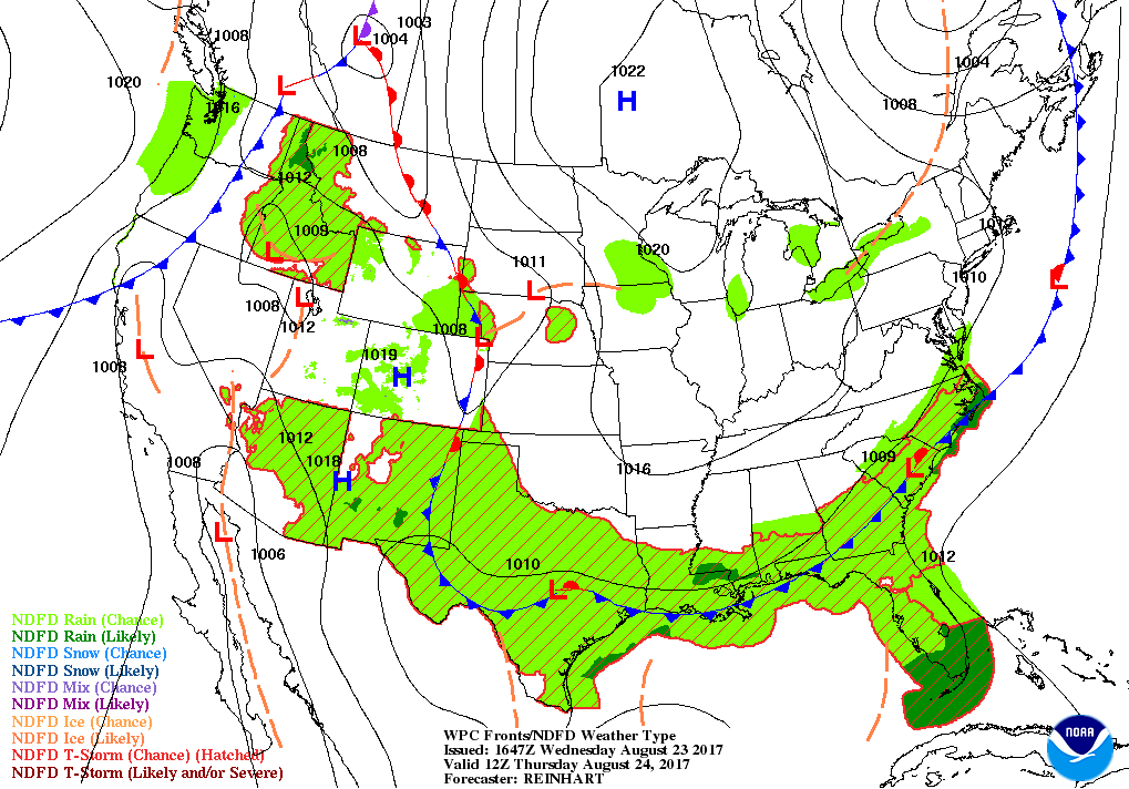
The cold front will be just south of the state tomorrow morning and this will keep most, if not all, of Central Alabama dry throughout the whole day on Thursday. There will be a very slight chance of isolated showers and thunderstorms over the extreme southern locations in the area, but the odds for any one spot in that part getting wet will be around 1-in-5. With that being said, skies will be mostly clear and dewpoint values will be low, allowing tomorrow to be a refreshing late summer day. Afternoon highs will be in the mid to upper 80s across much of the area, with upper 80s to the low-90s possible in the extreme southern locations.
Taking A Peek At The Tropics
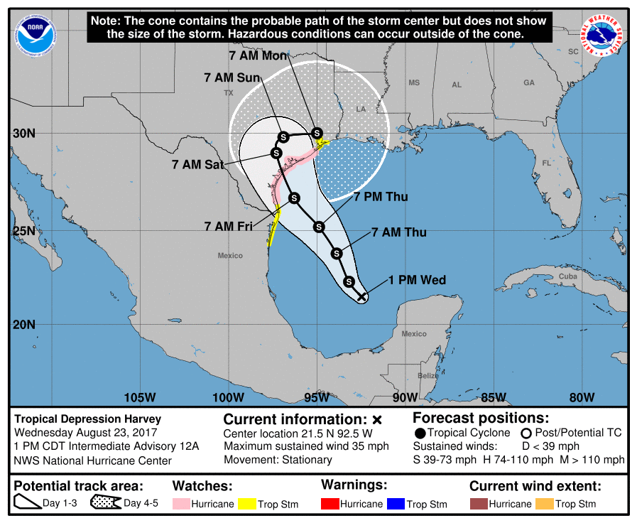
Harvey has now regenerated into a tropical depression and now sets its sights onto the southeastern Texas Gulf Coast. The NHC has the latest forecast track making landfall between Corpus Christi and Port O’Connor sometime on late Friday or very early Saturday morning as a strong tropical storm. Tropical storm and hurricane watches are already up for most of the Texas coast. Most of the forecast models have Harvey moving to the northeast during the weekend and will be bringing rain to Alabama by the beginning of the week. We’ll keep you posted.
Invest 92L is hanging around the Florida Keys and will probably meander around the Florida Peninsula for a few days before ultimately being forced out to sea by a deep trough that will form over the eastern U.S. by the weekend. Strengthening may occur once over the Atlantic by next week.
Stay up-to-date with the latest posts in the Tropical Weather category on the AlabamaWx Weather Blog home page. Click here to see the latest on the Tropical Weather.
Got Beach Plans?
Be sure to keep up to date with the detailed forecasts from Fort Morgan over to Panama City Beach, especially with Harvey out in the Gulf. We can expect the conditions to deteriorate as we approach the weekend. Click here to see the AlabamaWx Beach Forecast Center page.
The Beach Forecast is partially underwritten by the support of Brett/Robinson Vacation Rentals in Gulf Shores and Orange Beach. Click here to see Brett/Robinson’s Hot Deals now!
Advertise With Us!
Now is the time to set your marketing campaign on AlabamaWX. The site has enjoyed a 71% jump in page views this year! The website has already enjoyed 10,157,915 page views this year. We can customize a creative, flexible and affordable package that will suit your organization’s needs. Contact Bill Murray at (205) 687-0782.
E-Forecast
Get the AlabamaWx seven-day forecast delivered directly to your inbox by email twice daily. It is the most detailed weather forecast available in Central Alabama. Click here to subscribe. It’s free!
On This Day In Weather History
1933 – The Chesapeake-Potomac hurricane moved over Norfolk VA and Washington D.C. A tide seven feet above normal flooded businesses in Norfolk, and damage in Maryland was estimated at seventeen million dollars.
WeatherBrains
Check out the show at www.WeatherBrains.com. You can also subscribe on iTunes. You can watch the show live at live.bigbrainsmedia.com on Monday nights starting at 8:30 PM CDT. You will be able to see the show on the James Spann 24×7 weather channel on cable or directly over the air on the dot 2 feed.
Category: Alabama's Weather, ALL POSTS
About the Author (Author Profile)
Scott Martin is an operational meteorologist, professional graphic artist, musician, husband, and father. Not only is Scott a member of the National Weather Association, but he is also the Central Alabama Chapter of the NWA president. Scott is also the co-founder of Racecast Weather, which provides forecasts for many racing series across the USA. He also supplies forecasts for the BassMaster Elite Series events including the BassMaster Classic.Subscribe
If you enjoyed this article, subscribe to receive more just like it.


