Another Dry One While Harvey Soaks SE Texas
Starting the day off behind the eight ball. My normal source for the graphics, WeatherBell, seems to have a problem, so the graphics will look somewhat different since I’ll be using a different source.
The sky remained mostly cloudy across Alabama this morning thanks in part to what remains of tropical storm Harvey. Early morning temperatures were in the lower half of the 70s for most locations. The sounding from last night at the Shelby County Airport continued to show a reasonably thick dry layer between about 900 and 600 millibars. Some echoes were present on the radar over Mississippi, but like yesterday, most of that precipitation was evaporating. You can expect to see highs in the middle and upper 80s today.
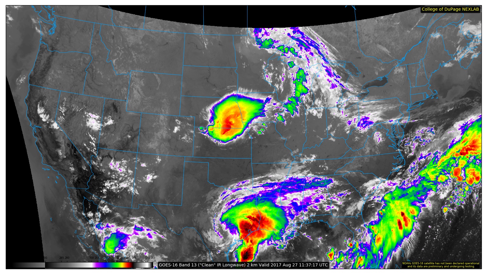
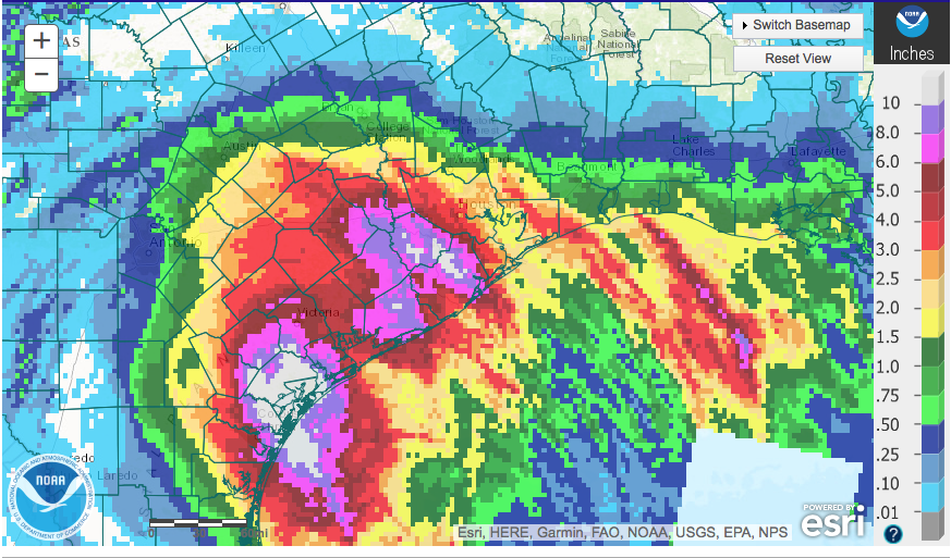
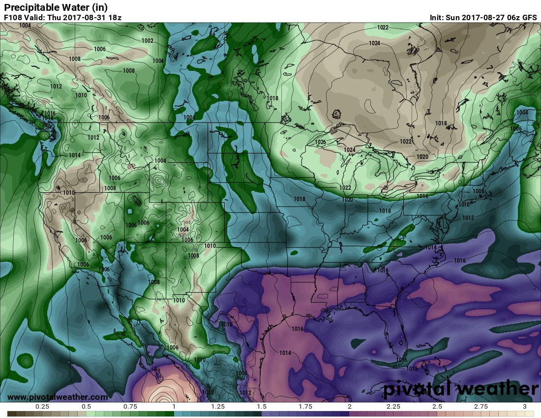
We’re still going to be dealing with a great deal of uncertainty with Harvey and that translates to uncertainty in the forecast beyond about 48 hours. While a strong trough with a closed low moves across the Great Lakes region, there is a question as to whether or not that will have any influence on Harvey. It would seem that that trough will be close enough to have some influence on Harvey, but the GFS continued to stick with the notion of keeping Harvey over Southeast Texas through midweek and then gradually moving it southwest as it dissipates. The ECMWF, on the other hand, continued to project a southeastward motion before turning it northward across East Texas and dissipating it. In the meantime, Harvey was producing catastrophic flooding in the area from Houston to San Antonio to Corpus Christie. Rainfall amounts have already exceeded 10 to 15 inches and more is expected.
For us, we remain under the rather persistent trough that has helped to keep us out of any excessive heat this summer while the West continues under the upper ridge. As that upper trough moves by Tuesday, we need to be keeping a watchful eye on whether or not it will influence Harvey enough to bring that system northeastward. Should the trough do that, as we saw in the case of Elena in 1985, then our forecast would require significant revision. For now, we’ll continue with the GFS projections. So moisture will return as the upper trough moves by to our north. This means that we should stay dry today and Monday with cloud cover helping to limit our highs in the middle and upper 80s.
A weak front will move into the Tennessee River Valley around midweek, so with moisture levels up substantially and the presence of the weak frontal zone, we should see our rain chances rise as showers become more numerous by Thursday. The addition of more showers should also limit our highs to the lower 80s Wednesday and Thursday.
The frontal boundary should stall and wash out during the end of the week leaving us in good moisture. So this means a good deal of clouds along with scattered showers so temperatures should edge upward a tad with highs mainly in the middle 80s.
Looking out into voodoo country, the GFS remains pretty strong on the idea of maintaining the trough over the eastern US. An upper ridge develops briefly around the 7th of September indicating a couple of days of warmer temperatures before the trough develops once again moving into the 9th and 10th of September. The GFS still showed a tropical system in the Atlantic well away from the East Coast of the US.
At the beaches of Alabama and Northwest Florida, there will be passing showers today with highs mainly in the upper 80s. Shower chances ramp up into next week as moisture from Harvey becomes more prevalent across the Southeast US. This will help to keep highs a tad cooler, mainly in the lower 80s. Click here to see the AlabamaWx Beach Forecast Center page. The Beach Forecast is partially underwritten by the support of Brett/Robinson Vacation Rentals in Gulf Shores and Orange Beach. Click here to see Brett/Robinson’s Hot Deals now!
WEATHER BRAINS: Don’t forget you can listen to our weekly 90 minute netcast anytime on the web, or on iTunes. This is the show all about weather featuring many familiar voices, including our meteorologists here at ABC 33/40.
James Spann will have the next Weather Xtreme Video posted here by 7 am or so on Monday. Remember, you can always check back here for the latest thinking on Alabama’s weather. Have a great day and Godspeed.
-Brian-
Category: Alabama's Weather, ALL POSTS
About the Author (Author Profile)
Brian Peters is one of the television meteorologists at ABC3340 in Birmingham and a retired NWS Warning Coordination Meteorologist. He handles the weekend Weather Xtreme Videos and forecast discussion and is the Webmaster for the popular WeatherBrains podcast.Subscribe
If you enjoyed this article, subscribe to receive more just like it.


