Mid-Afternoon Check Of Our Weather In Central Alabama
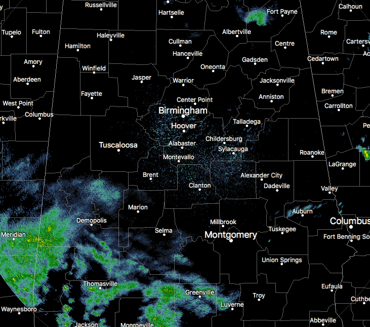
We have mostly cloudy skies at this time across Central Alabama at the 2PM hour, along with some shower activity moving into and over the southwestern parts of the area. Most of the activity is rather light and some may not be reaching the ground at this point.
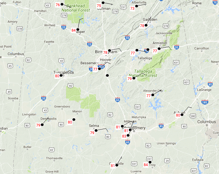
Temperatures are mostly in the 70s across Central Alabama at this time, with a few lower 80s showing up in the southern parts of the area. Birmingham is currently at 78 degrees, while Cullman is the cool spot at 75 degrees.
How Does The Last Monday In August Look?
Most everyone in Central Alabama will stay dry throughout the day, but the extreme western locations in the area might get a few sprinkles to an isolated shower or storm. The risk for those is very small, less than 1-in-5 odds for anyone getting rain. Afternoon highs will be in the lower to mid-80s. Those rain chances will diminish as we lose the heating from the sun, and skies will remain partly to mostly cloudy. Overnight lows will be in the mid to upper 60s.
Tuesday Will Have An Slight Increased Risk Of Showers
We believe the tropical moisture from Harvey will stay out of the area for one more day, but moisture levels will increase enough for a slight risk of isolated showers or storms throughout the area during the day. Afternoon highs will top out in the mid to upper 80s, and the odds for any one location getting any rain will be less than 1-in-5.
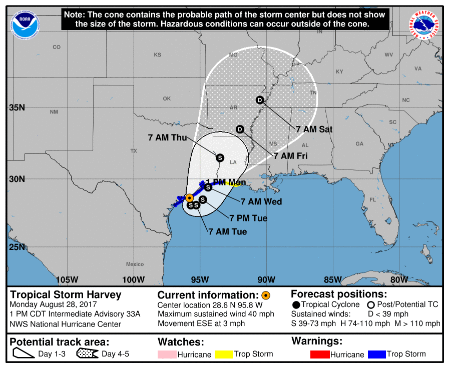
Will Harvey Impact Central Alabama’s Weather?
As of now, the answer is yes, but it will be in the second half of the week before we get any of the tropical rains from Harvey. Tuesday will be partly to mostly cloudy once again, and there will be a very slight chance of an isolated shower or two. Odds for any one spot getting rain will be less than 1-in-5. Highs will be in the mid to upper 80s. Here is what the latest model runs are saying for the remainder of the week…
GFS: The latest run of the GFS model has Harvey pushing back over the Gulf of Mexico very close to where it came on shore by later this afternoon and staying along the coast until Wednesday morning when it starts to head northward. It will finally move out of Texas on Thursday afternoon and continue to move north-northeastward until it dissipates on Sunday in northeastern Arkansas and southeastern Missouri.
Rain chances will start to increase in Central Alabama on Wednesday as tropical moisture from Harvey finally makes it to the state. We’ll have increased risk of tropical showers and storms throughout the remainder of the week and through the weekend. Looks like we’ll have more standard summertime weather to start off the new work week on Monday.
EUROPEAN: The European model is in pretty close agreement with the GFS about the movement of Harvey throughout the week ahead, except maybe moving just a tad faster. With that being said, rain chances increase on Wednesday and those chances will continue through Saturday afternoon before we dry out.
RAINFALL AMOUNTS: GFS is painting anywhere from 1.5-3.0 inches of rain throughout the area through Sunday morning, while the European is going with lower amounts of 0.5-1.5 inches, probably due to the faster movement in the latest run.
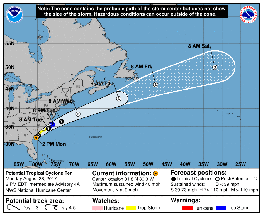
Could We Have Tropical Storm Irma Off Of The Carolina Coast?
The answer to that is… possibly tonight or tomorrow. At this point, the maximum sustained winds have risen to 40 MPH with a minimum pressure of 1006 MB. Hurricane Hunter aircraft is currently investigating PTC 10, but so far has not been able to find a well-defined center. Once that center is determined, it will be called Tropical Storm Irma.
Rainfall amounts of 3-6 inches are expected to occur over the Carolina and Virginia coasts, with isolated amounts possibly reaching 9 inches. It is expected to stay near the coast through Tuesday afternoon before moving out to sea by Wednesday.
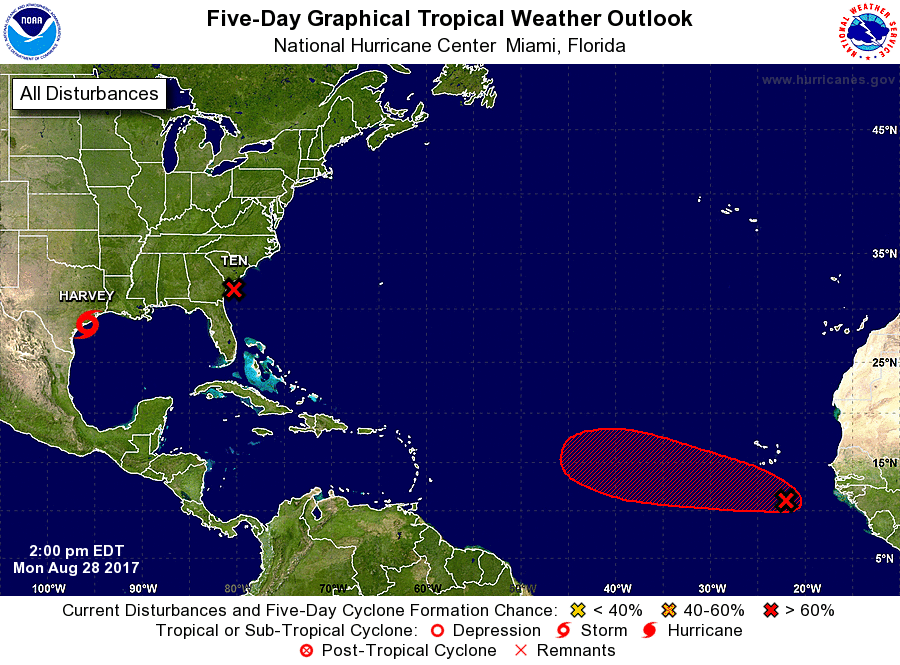
A Possible Third System Out In The Atlantic
A tropical wave is currently located a few hundred miles southeast of the Cabo Verde Islands, and is moving to the west at 15-20 MPH. This has an 80% chance of developing into a depression or storm within the next 5 days. The GFS has this disturbance moving west for a while then it will start to curve to the north and may come very close to Maine and Nova Scotia in about 14 days. At this point, it does not look likely to affect Alabama, but we’ll keep our eye on it.
Got Beach Plans?
Be sure to keep up to date with the detailed forecasts from Fort Morgan over to Panama City Beach with the AlabamaWx Weather Blog. Click here to see the AlabamaWx Beach Forecast Center page.
The Beach Forecast is partially underwritten by the support of Brett/Robinson Vacation Rentals in Gulf Shores and Orange Beach. Click here to see Brett/Robinson’s Hot Deals now!
Advertise With Us!
Now is the time to set your marketing campaign on AlabamaWX. The site has enjoyed a 71% jump in page views this year! The website has already enjoyed 10,157,915 page views this year. We can customize a creative, flexible and affordable package that will suit your organization’s needs. Contact Bill Murray at (205) 687-0782.
E-Forecast
Get the AlabamaWx seven-day forecast delivered directly to your inbox by email twice daily. It is the most detailed weather forecast available in Central Alabama. Click here to subscribe. It’s free!
On This Day In Weather History
1988 – Tropical Storm Chris spawned a tornado near Manning, SC, which killed one person, and spawned three tornadoes in North Carolina. Chris produced one to two foot tides, and three to six inch rains, over coastal South Carolina. Severe thunderstorms in New York State and Vermont, developing ahead of a cold front, spawned a tornado which killed one person at Hector NY, produced tennis ball size hail at Brandon VT, and produced wind gusts to 80 mph at Lyndonville VT.
WeatherBrains
Check out the show at www.WeatherBrains.com. You can also subscribe on iTunes. You can watch the show live at live.bigbrainsmedia.com on Monday nights starting at 8:30 PM CDT. You will be able to see the show on the James Spann 24×7 weather channel on cable or directly over the air on the dot 2 feed.
Category: Alabama's Weather, ALL POSTS
About the Author (Author Profile)
Scott Martin is an operational meteorologist, professional graphic artist, musician, husband, and father. Not only is Scott a member of the National Weather Association, but he is also the Central Alabama Chapter of the NWA president. Scott is also the co-founder of Racecast Weather, which provides forecasts for many racing series across the USA. He also supplies forecasts for the BassMaster Elite Series events including the BassMaster Classic.Subscribe
If you enjoyed this article, subscribe to receive more just like it.


