Rain and Storms Moving Northeast Across Central Alabama
Showers and some thunderstorms continue to push north northeastward across Alabama tonight.
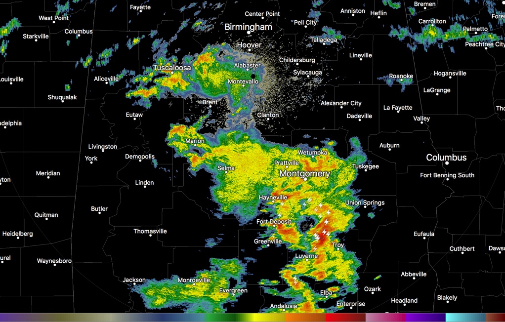
The heaviest storms are over southeastern parts of the area. The strongest storms are over northwestern Pike County into southern Montgomery County. Others are over eastern Butler Couty and eastern Lowndes County.
Folks around Montgomery, Wetumpka and Prattville should get ready for lightning and heavy rain.
The stronger storms have very heavy rain and lightning and some gusty winds. They carry a small tornado threat, but that will be decreasing with time.
Moderate to heavy showers are over southern Tuscaloosa, Bibb, western Jefferson and western Shelby Counties. Some of these are affecting parts of the Birmingham Metro area.
The center of Tropical Storm Harvey is just east of Alexandria LA tonight. The heaviest rain is northwest of the center in that efficient rain producing deformation zone. Flash flood warnings continue there. The center will move into northern Mississippi and western Tennessee over the next 48 hours. It will produce a tornado threat for us tomorrow.
Category: Alabama's Weather, ALL POSTS
About the Author (Author Profile)
Bill Murray is the President of The Weather Factory. He is the site's official weather historian and a weekend forecaster. He also anchors the site's severe weather coverage. Bill Murray is the proud holder of National Weather Association Digital Seal #0001 @wxhistorianSubscribe
If you enjoyed this article, subscribe to receive more just like it.


