A Quick Update On Our Weather Situation At 10:00 AM
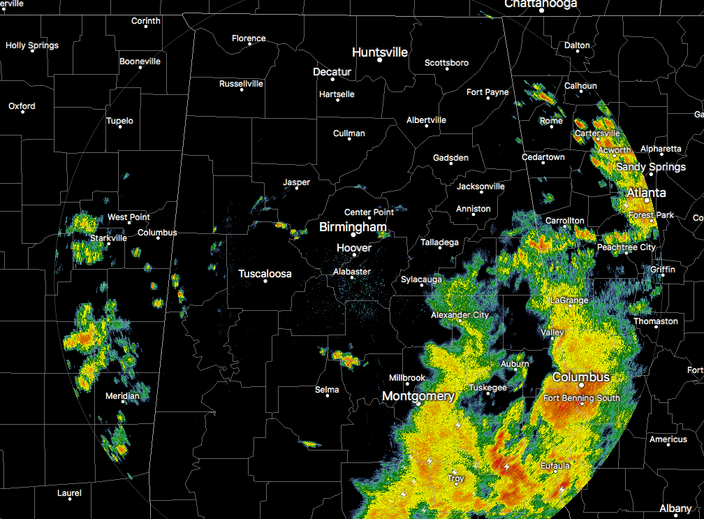
Radar at 9:30AM
For the most part across the Central Alabama area, skies are generally with showers and storms mainly over the southeastern parts, with only a few isolated showers dotting the radar elsewhere. We do note over the western parts of the state that the sun is reaching the surface in some spots, and while it is a nice site to see, it could be a bad sign for later today.
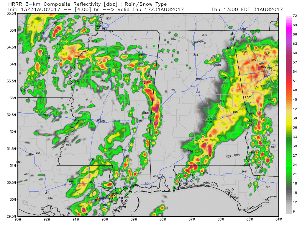
HRRR Simulated Radar at 12PM.
Looking at the latest run of the HRRR Simulated Radar, we’ll have more storms moving in from Mississippi around the noon hour that could bring the beginnings of the tornado threat for today. Remember when I said that the sun could be a bad sign… well here is how. With the tropical atmosphere already in place over Central Alabama, it will not take much to make these feeder band storms stronger than what they already are. Adding heat at the surface to the mix will only make the instability values higher, and with the low-level helicity values already in range to support rotating updrafts, it will be easier for those quick spin-up tropical tornadoes to form.
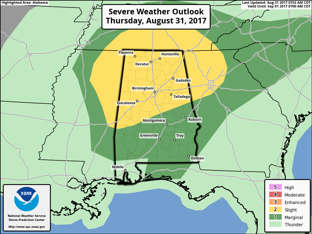
The Storm Prediction Center has much of Central Alabama defined in a Slight Risk for severe storms throughout today and into the night time hours, with the rest of the area defined in a Marginal Risk. There is the potential for a few supercellular-type thunderstorms to develop with the convection that is expected to occur due to the heating, and this will bring the risk of stronger wind gusts and a few tornadoes. Main window for the strong to severe storms will be from noon today until 9:00 PM tonight. As the remnants of Harvey continue to shift off to the northeast, the threat of severe weather will end in the southwestern locations first and that trend will continue to the northeast as well.
Today is a day that you need to keep your source of receiving severe weather alerts handy and your smartphone charged. With these storms being low-topped, the tornadoes will be hard to spot on radar. It will be a big challenge to provide timely warnings, and hopefully we won’t need any. As James said earlier, “Just be weather aware today and we’ll watch the radar like a hawk.”
Category: Alabama's Weather, ALL POSTS
About the Author (Author Profile)
Scott Martin is an operational meteorologist, professional graphic artist, musician, husband, and father. Not only is Scott a member of the National Weather Association, but he is also the Central Alabama Chapter of the NWA president. Scott is also the co-founder of Racecast Weather, which provides forecasts for many racing series across the USA. He also supplies forecasts for the BassMaster Elite Series events including the BassMaster Classic.Subscribe
If you enjoyed this article, subscribe to receive more just like it.


