A Quick Check On Our Weather At Midday
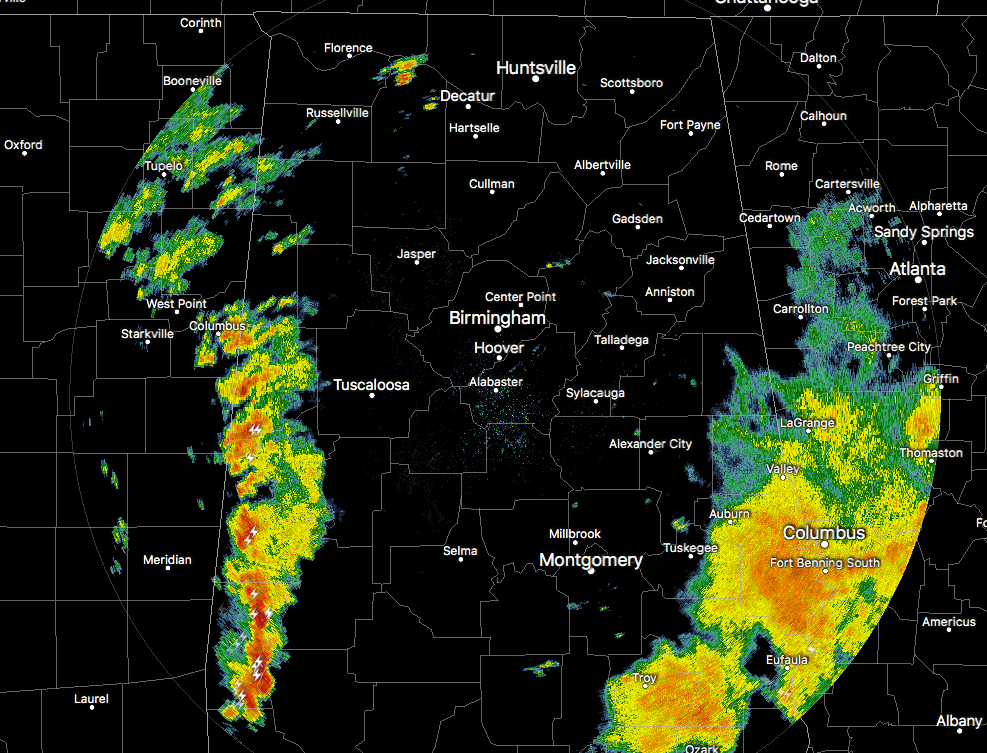
Just like the HRRR model projected, the next band of heavy tropical rain and storms have moved in from Mississippi and are currently affecting the western locations in Central Alabama.
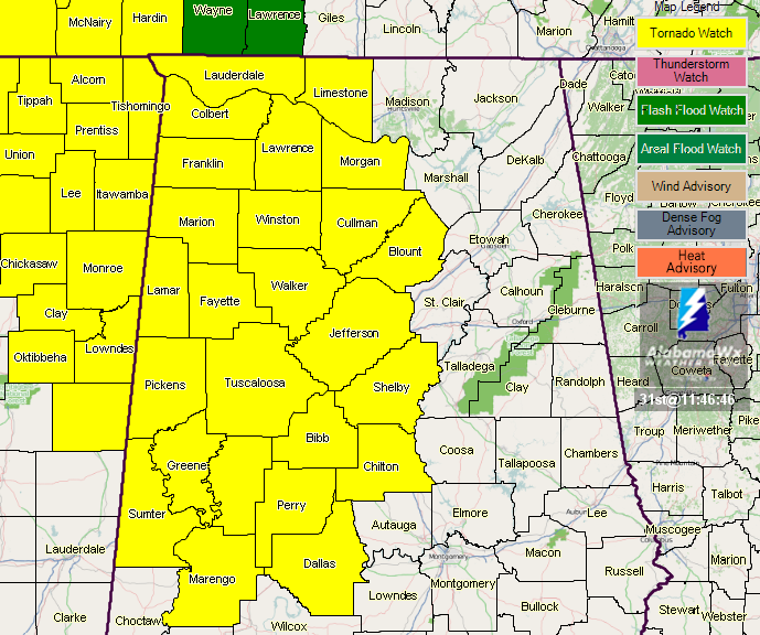
A Tornado Watch has been issued for pretty much the western half of Central Alabama until 8:00 PM tonight. According to how everything unfolds this afternoon, the watch may be extended to the east to include the rest of the area, but we’ll have to wait and see.
The sun that has broken out over the western parts of the state has increased the instability values (CAPE over 2,000 J/kg in some spots) and allowing for the band of storms to either continue to stay strong or intensify in strength.
As of now, we are not really seeing any rotation on the velocity signatures, but this is where we really need to keep our eyes peeled today. Rotation in these low-topped environment storms will be very hard to see and will be a challenge to issue timely warnings. Low-level helicity values are already above 150 m2/s2 across much of the area, meaning that there is good support for rotating updrafts.
Continue to be weather-aware and keep up-to-date throughout the day with NOAA Weather Radio, NWS social media feeds, and the AlabamaWx Weather Blog.
Category: Alabama's Weather, ALL POSTS
About the Author (Author Profile)
Scott Martin is an operational meteorologist, professional graphic artist, musician, husband, and father. Not only is Scott a member of the National Weather Association, but he is also the Central Alabama Chapter of the NWA president. Scott is also the co-founder of Racecast Weather, which provides forecasts for many racing series across the USA. He also supplies forecasts for the BassMaster Elite Series events including the BassMaster Classic.Subscribe
If you enjoyed this article, subscribe to receive more just like it.


