Latest Mesoscale Discussion From NWS Birmingham
Area Forecast Discussion
National Weather Service, Birmingham AL
12:39 PM CDT Thursday, Aug. 31, 2017
MESOSCALE UPDATE and 18Z TAF Discussion
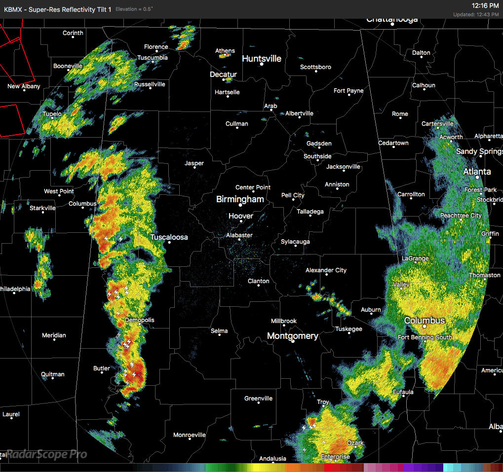
The post-tropical center of Harvey was located across west-central Mississippi with a synoptic scale warm front analyzed from the center of the circulation east across Mississippi to near Meridian and it extended southeast into interior southwest Alabama and extended further east to near the Alabama/Florida state line.
Satellite imagery indicates expansive breaks in the cloud cover across much of central Alabama roughly along and within 50 miles of the Interstate 65 corridor while thicker cloud cover was present across much of our eastern and western counties.
Radar imagery indicated a line of showers and thunderstorms extending from Lamar and Fayette Counties south to Marengo County.
This activity was moving northeast around 30 miles per hour.
Increasing vertical wind shear will support embedded rotation within the stronger convection this afternoon and breaks in the
cloud cover are allowing surface temperatures to rise and increasing low-level destabilization.
The best instability exists from analysis data across much of our west and west-central counties while the best wind shear appears to exist across our far western counties. As the remnants of Harvey continue to move north-northeast, expect wind shear to gradually increase across our west and northwest counties.
A special 18Z upper air sounding is being released to provide additional information that will be analyzed within the next
hour.
Category: Alabama's Weather, ALL POSTS
About the Author (Author Profile)
Scott Martin is an operational meteorologist, professional graphic artist, musician, husband, and father. Not only is Scott a member of the National Weather Association, but he is also the Central Alabama Chapter of the NWA president. Scott is also the co-founder of Racecast Weather, which provides forecasts for many racing series across the USA. He also supplies forecasts for the BassMaster Elite Series events including the BassMaster Classic.Subscribe
If you enjoyed this article, subscribe to receive more just like it.


