Radar Image From the Hurricane Hunter Plane
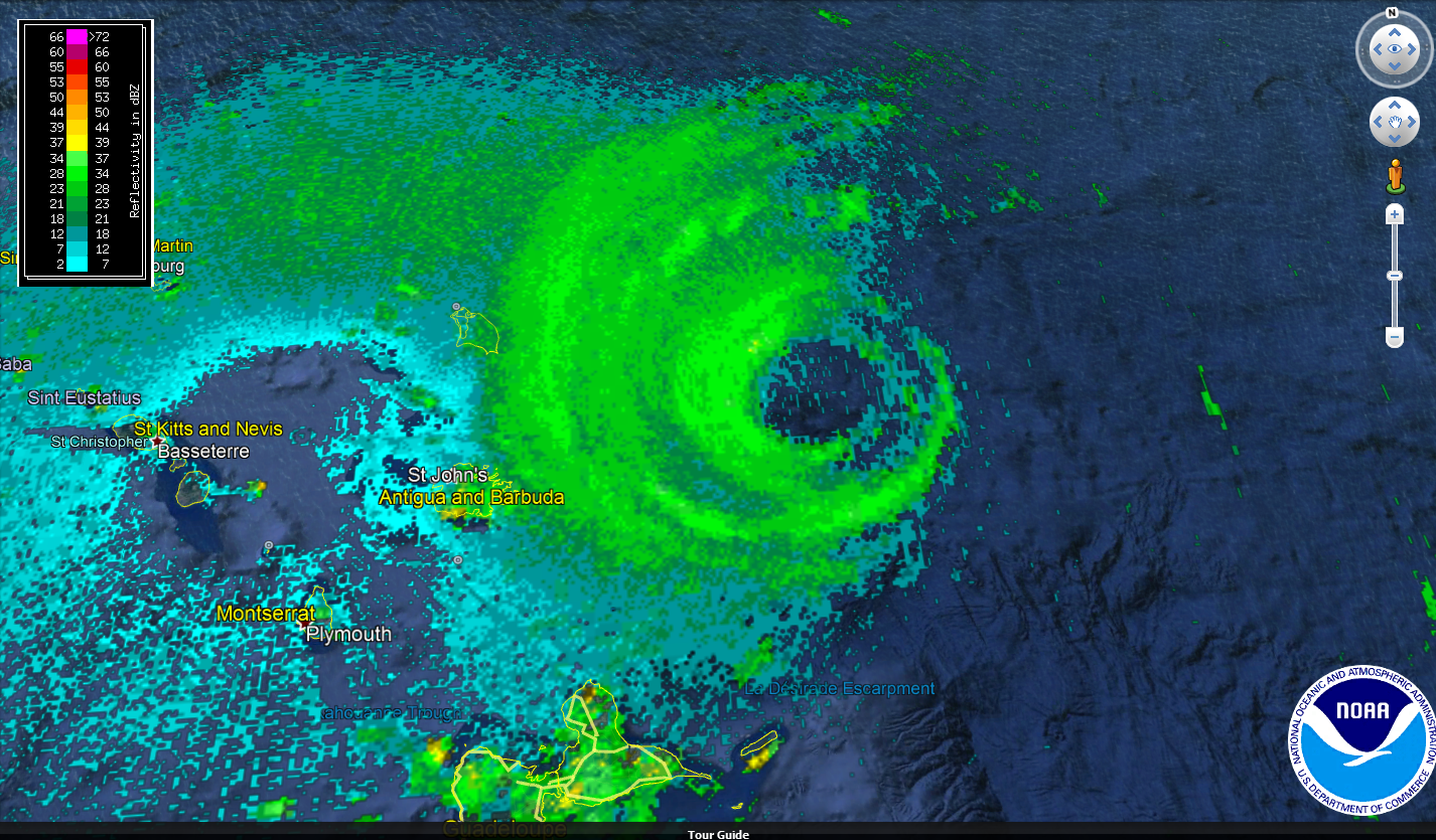
Here an amazing view of the radar tonight from the NOAA WP-3 Orion plane “Kermit”.
You can see the outer bands of the catastrophic hurricane approaching the islands of Antigua and Barbuda. The hurricane appears to be undergoing an eyewall replacement cycle, which means that a fluctuation in intensity will likely occur soon and may already be occurring.
The most recent center fix from the plane found a central pressure of 917 millibars, which is very intense, but was the same as the previous measurement, also indicating the intensification that has gone on all day has leveled off. The eyewall diameter had increased slightly and the radar depiction shows what may be a new outer eyewall forming.
The plane is passing through the center even as I write this at 9:06 p.m. We will get another reading shortly.
About the Author (Author Profile)
Bill Murray is the President of The Weather Factory. He is the site's official weather historian and a weekend forecaster. He also anchors the site's severe weather coverage. Bill Murray is the proud holder of National Weather Association Digital Seal #0001 @wxhistorianSubscribe
If you enjoyed this article, subscribe to receive more just like it.


