A Quick Check On Our Weather Situation At 5:40 PM
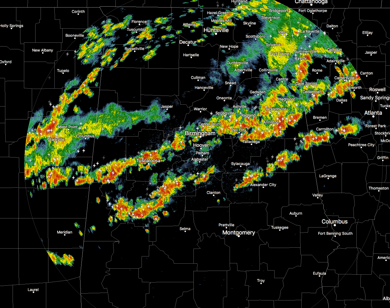
Two separate lines of storms are making their way through the north-central parts of Central Alabama at this point during the early evening. Some of these storms have a history of producing some pea-size hail. We’ve had a few severe thunderstorm warnings issued up in the Huntsville county warning area, mainly in the northeastern corner of the state, but all of the stronger storm activity has moved into the Central Alabama county warning area.
At this point, the strongest storms were located over the northern part of Randolph and into Cleburne counties, and the National Weather Service has a Significant Weather Advisory for those locations until 6:00 PM this evening. These storms are moving to the east at 35 MPH. Winds in excess of 40 MPH and dime-size hail will be possible with these storms.
The threat for severe storms will continue to drop as we lose the daytime heating. The cold front is has moved into the northern parts of Central Alabama and is actually starting to move into the northern part of Jefferson County. There may still be a few scattered showers and storms that move through after the passage of the front, but the threat for severe weather will be finished.
Category: Alabama's Weather, ALL POSTS
About the Author (Author Profile)
Scott Martin is an operational meteorologist, professional graphic artist, musician, husband, and father. Not only is Scott a member of the National Weather Association, but he is also the Central Alabama Chapter of the NWA president. Scott is also the co-founder of Racecast Weather, which provides forecasts for many racing series across the USA. He also supplies forecasts for the BassMaster Elite Series events including the BassMaster Classic.Subscribe
If you enjoyed this article, subscribe to receive more just like it.


