Hurricane Watches, Storm Surge Watches Issued for South Florida
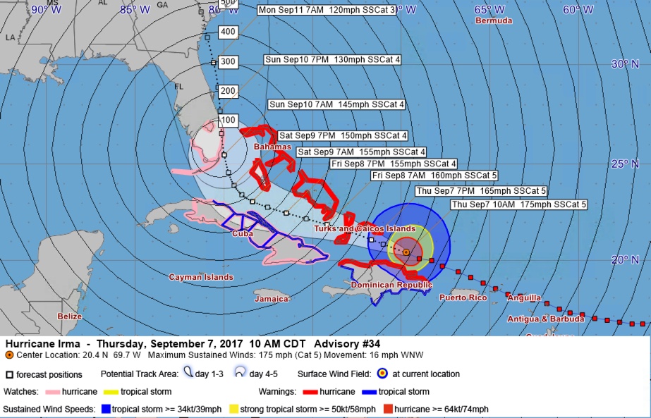
The 10 a.m. CDT advisory on Irma is out. The hurricane is centered some 780 miles southeast of Miami.
Hurricane watches and storm surge watches have been issued for South Florida.
The new official forecast track shows Irma making landfall on the Gold Coast of South Florida between Miami and Palm Beach Sunday morning.
Here is the storm surge watch area:
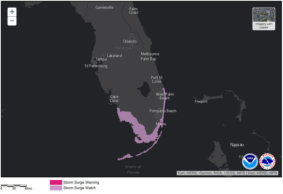
Storm surge in Miami/Dade County is expected to be as high as 7-10 feet above ground and 5-8 feet in Broward and Palm Beach Counties.
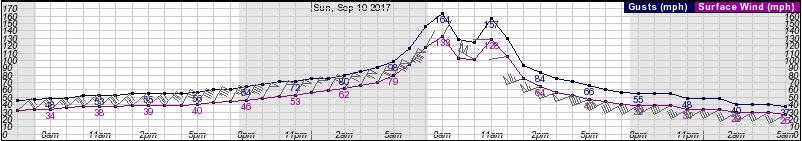
Here are expected wind speeds from the NWS Miami’s grid forecast:
And we’re not forgetting about our friends in Georgia and the Carolinas. The official track brings Irma inland near the Georgia/South Carolina border just after noon on Monday. This would means the center could impact Savannah, Hilton, Head, Beaufort and potentially Charleston, perhaps as far east as Morehead City, NC according to the cone of uncertainty on the NHC forecast.
We have to remember to pay attention to the cone, not the line on the official forecast. That cone represents the average error in NHC forecast positions at each time out into the future. This means the center could be anywhere inside that cone of uncertainty.
About the Author (Author Profile)
Bill Murray is the President of The Weather Factory. He is the site's official weather historian and a weekend forecaster. He also anchors the site's severe weather coverage. Bill Murray is the proud holder of National Weather Association Digital Seal #0001 @wxhistorianSubscribe
If you enjoyed this article, subscribe to receive more just like it.


