Not A Good Look For Miami
We caution everyone to remember that the center of the hurricane will not necessarily be on the skinny black line of the forecast track from the NHC. In fact, the center will likely be somewhere else inside the cone of uncertainty, which is defined by the average track errors of NHC forecasts at each time frame.
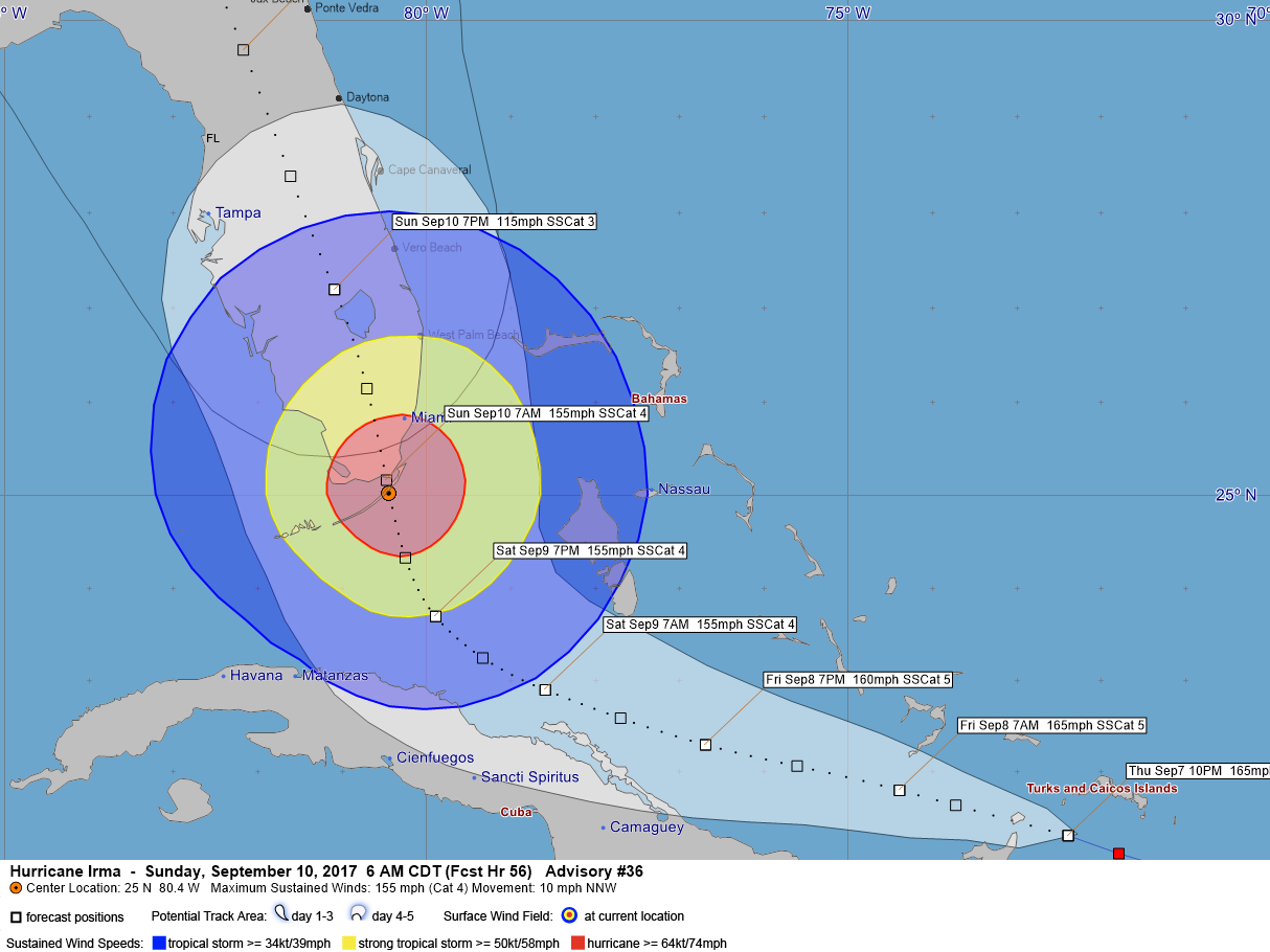
So when the hurricane is forecast to make landfall by the NHC just south of Miami near Key Largo around sunrise Sunday morning, the center of the hurricane could be anywhere from the Dry Tortugas to Freeport in the Bahamas. That’s a wide range of possible locations, and the impacts are quite different on various sides of the cone.
But if the NHC forecast is close to right, Miami is going to experience winds of 125 mph or greater directly out of the east into Biscayne Bay.
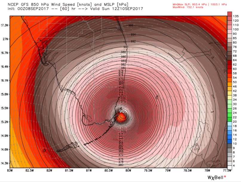
And if tonight’s latest run of the GFS is right, the news is even bleaker. It depicts a 901 millibar hurricane at the southern entrance to Biscayne Bay, with 120-130 mph sustained winds pushing a huge storm surge over Key BIscayne, Virgina Key, Miami Beach and Bal Harbour. Downtown Miami will be severely impacted with surge and sustained winds of 125 mph with gusts to 140 mph.
About the Author (Author Profile)
Bill Murray is the President of The Weather Factory. He is the site's official weather historian and a weekend forecaster. He also anchors the site's severe weather coverage. Bill Murray is the proud holder of National Weather Association Digital Seal #0001 @wxhistorianSubscribe
If you enjoyed this article, subscribe to receive more just like it.


