Saturday Morning Notes On Irma
Here are some notes on extremely dangerous Hurricane Irma, and the expected impact on Alabama, Florida, and the Southeast U.S…
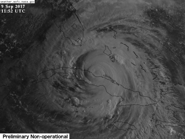
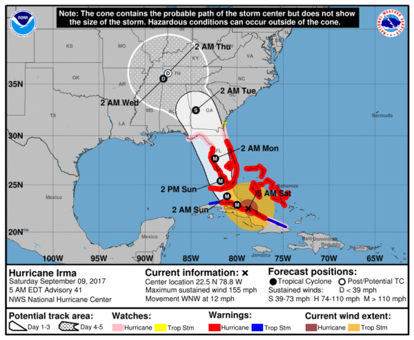
The eye of Irma is on the north coast of Cuba early this morning. A turn toward the northwest is expected by late today, with a turn toward the north-northwest expected tonight or on Sunday. On the forecast track, the center of Irma will move near the north coast of Cuba today, near the Florida Keys Sunday morning, and then near the southwest coast of Florida tomorrow afternoon.
Maximum sustained winds are near 130 mph with higher gusts. There was some temporary weakening due to land interaction, but the hurricane will strengthen again today. This is a very dangerous tropical cyclone.
Some fluctuations in intensity are likely during the next day or two, but Irma is expected to remain a powerful hurricane as it approaches Florida.
Hurricane-force winds extend outward up to 70 miles from the center and tropical-storm-force winds extend outward up to 195 miles. The estimated minimum central pressure is 930 mb (27.47 inches).
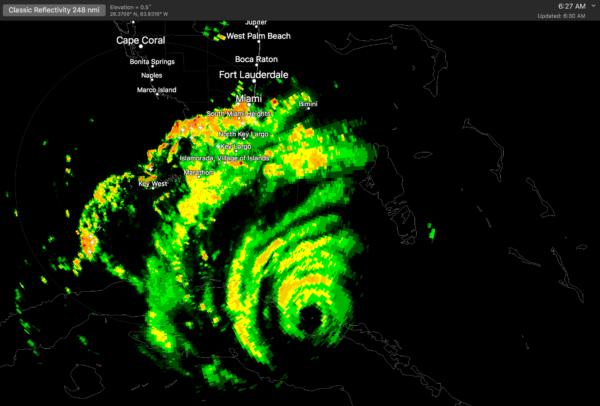
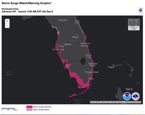
FLORIDA PENINSULA: Hurricane force winds will be felt over most all of Florida Peninsula with potential for structural damage, downed trees, and widespread power outages tomorrow, tomorrow night, and into early Monday morning. Severe storm surge damage and flooding is also likely across the Florida Keys, and along BOTH coasts.
People across the peninsula MUST heed evacuation orders. Here is the impact statement from NWS Tampa early this morning…
POTENTIAL IMPACTS: Devastating to Catastrophic
– Structural damage to sturdy buildings, some with complete
roof and wall failures. Complete destruction of mobile
homes. Damage greatly accentuated by large airborne
projectiles. Locations may be uninhabitable for weeks or
months.
– Numerous large trees snapped or uprooted along with fences
and roadway signs blown over.
– Many roads impassable from large debris, and more within
urban or heavily wooded places. Many bridges, causeways,
and access routes impassable.
– Widespread power and communications outages.
Get specific impact statements from these Florida NWS offices…
FLORIDA PANHANDLE: Little to no rain for Pensacola, Navarre Beach, and Destin. It will be windy, of course, with a gusty north wind of 15-30 mph tomorrow through Monday. This is a dry, offshore flow.
At Panama City, they will most likely get into the outer rain shield of Irma Monday with north winds of 25-40 mph. They will remain on the “good” west side of the circulation, meaning an offshore flow and no storm surge issues.
Winds will be higher east of Panama City… Port St. Joe, Apalachicola, Cape San Blas will have winds of 30-50 mph Monday. But even there they will be on the “good” west side.
ALABAMA GULF COAST: No rain for Dauphin Island, Gulf Shores, or Orange Beach. Monday will be windy with a north wind of 15-30 mph. Again, a dry, offshore flow.
The weather for the rest of next week on the Central Gulf Coast will be delightful with ample sunshine each day.
ALABAMA: We will be on the “good” west side of Irma, and there is no tornado risk anywhere in the state. The tornado threat is well to the east on the “bad” east side of the circulation over eastern Georgia and the Carolinas.
It becomes windy Monday, Monday night, and Tuesday. Highest wind will be over the eastern third of the state, where winds will average 20-30 mph, with higher gusts. The highest wind gusts will be on ridge tops. There could be some scattered tree and power line damage over the eastern third of the state Monday night into Tuesday morning as Irma passes to the east. Rain amounts over the eastern half of Alabama will be in the 1-3 inch range.
Winds across West Alabama will be in the 15-25 mph range with rain amounts generally of one inch or less. No rain at all is expected in the broad area from Demopolis to Mobile, across Southwest Alabama.
GEORGIA: The circulation center of Irma will come up through Georgia; winds will average 30-40 mph during Monday night and Tuesday morning with potential for gusts to 50 mph (this includes the Atlanta metro). This will bring potential for downed trees and power outages. Rain amounts of 2-4 inches are likely, with isolated amounts to 5 inches.
This is a high confidence forecast. However, you still need to be working with current information. Using products that are over six hours old means you are using bad information. We will have frequent updates on the blog for the duration of this event…
Category: Alabama's Weather, ALL POSTS, Tropical
About the Author (Author Profile)
James Spann is one of the most recognized and trusted television meteorologists in the industry. He holds the AMS CCM designation and television seals from the AMS and NWA. He is a past winner of the Broadcast Meteorologist of the Year from both professional organizations.Subscribe
If you enjoyed this article, subscribe to receive more just like it.


