Irma Moving Northwest Now Toward Keys, Slowly Strengthening
Irma continues to slowly strengthen tonight and lift away from the Cuban coast. The long expected northwestward turn looks like it is established now. So let’s do some observations and analysis:
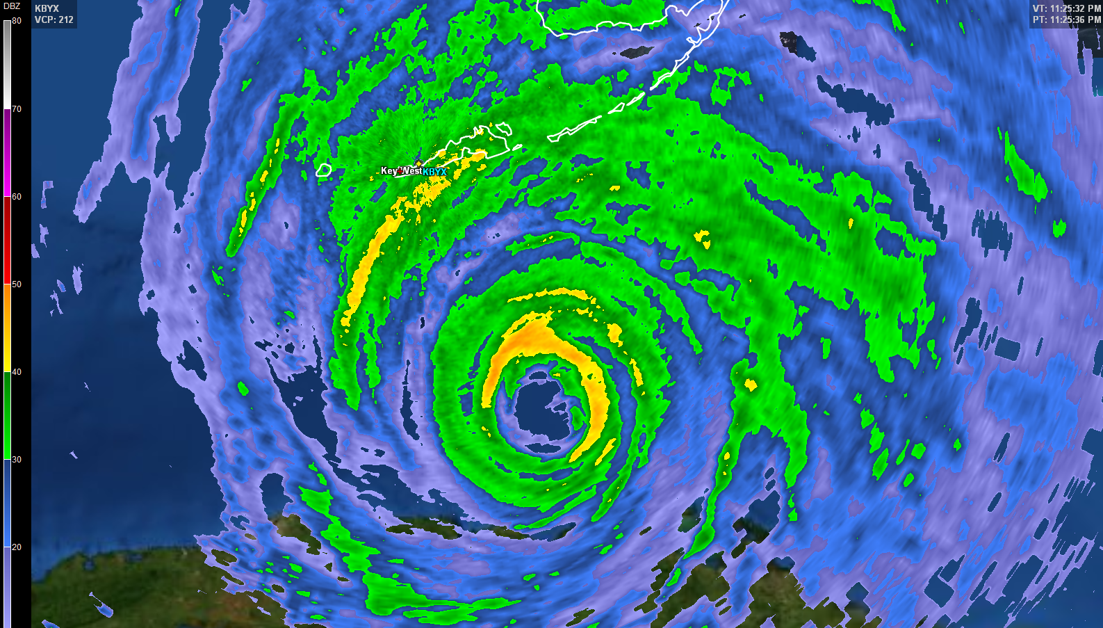
…Air Force Reserve Hurricane Hunters found a central pressure of 932 mb at 936 p.m. They also measured surface winds of 11 mph with their SFMR instrument and found flight level winds of 120 mph. The 120 mph was the highest reading of the afternoon and evening. The surface winds have been steadily increasing.
…The central pressure has fallen 7 mb since 1:30 p.m. Certainly not rapid intensification (1.5 mb/hour) but steady. Now that the center has moved away from Cuba, I fear that the rate of strengthening may increase.
..I think the eyewall replacement cycle is about complete. This may help the strengthening begin in earnest.
…Convection continues to increase around the center with the coldest cloud tops expanding and cooling.
…Irma has a very good chance to make landfall as a top ten intense U.S. landfalling hurricane.
…The plane is inbound again for another fix at 11 p.m.
…On the 10 p.m. advisory, top winds were reported at 120 mph and the central pressure was 933 mb. There will be a new intermediate advisory at 1 a.m.
…The new forecast track from the NHC is adjusted slightly FURTHER to the west. It keeps edging westward. Landfall on the skinny black line is now slated to be over Key West and eventually just west of Fort Myers. The center is still 6-7 hours from Key West. Winds are gusting to 56 mph most recently there but there have been several gusts to 67-68 mph. Their barometer reads 29.23 inches. It will be interesting to watch their observations over the next few hours.
…This could bring a devastating storm surge of over 9 feet to a large part of Naples, Cape Coral and Fort Myers and 6 feet to Punta Gorda and Port Charlotte. The track takes it near the mouth of Tampa Bay, which could deliver 6-9 feet of surge to parts of Tampa and St. Pete.
…Further north, the center emerges over the water again and makes landfall in the Florida Big Bend near or just west of Cedar Key. This will bring a 3-9 foot storm surge to that area, including perhaps more than 9 feet in areas near Cedar Key.
…This would carry the storm’s center near or just east of Tallahassee still as a 90 mph hurricane Monday morning.
…The center eventually ends up crossing Central Alabama Monday evening still as a tropical storm. Scott Martin has a great post about potential impacts in Alabama. It will slow down over southern Tennessee for midweek.
About the Author (Author Profile)
Bill Murray is the President of The Weather Factory. He is the site's official weather historian and a weekend forecaster. He also anchors the site's severe weather coverage. Bill Murray is the proud holder of National Weather Association Digital Seal #0001 @wxhistorianSubscribe
If you enjoyed this article, subscribe to receive more just like it.


