At This Point, Here Are Irma’s Possible Impacts To Central Alabama
I know there have been a lot of questions on the blog and on our social media feeds concerning how Hurricane Irma will impact Central Alabama’s weather. I’ll give you the best information that I can at this point since we are waiting to see where exactly the eye will make landfall and what the exact path will be.
SUNDAY
Wind speeds will actually start to pick up throughout the day on Sunday, out of the northeast for much of the day and into the evening hours at 10-20 MPH, but we shouldn’t see any rain up this way until the pre-dawn hours on Monday. For much of the day, skies will be mostly clear for much of Central Alabama with the exception of the southeast corner, where clouds from Irma will be slowly moving in. Afternoon highs will be in the upper 70s to the lower 80s throughout the area.
MONDAY
Winds will really start to pick up a couple of hours before dawn on Monday morning in the southeastern parts of the area, becoming sustained at 30-50 MPH with gusts up to 60 MPH. As the center of Irma starts her approach to the southeastern locations as a tropical storm, winds will gradually increase over much of the area.
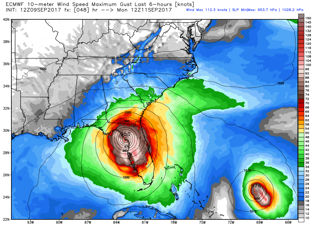
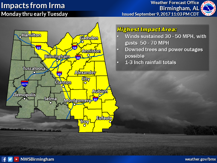
At 1:00 PM CDT, nearly everyone east of the I-59 and I-20/59 corridor will be experiencing sustained winds of 20-50 MPH and gusts up to 70 MPH, with the stronger winds occurring the farther southeast you go. All of Central Alabama will have a chance of rain, but the eastern half of the area will have a heavy tropical showers likely. Good news is that tornadoes will be highly unlikely as we’ll be on the “good side” of the center, but some wind damage could be possible, especially as those higher wind gusts move into the area along with the soil becoming highly saturated. These conditions should continue throughout the remainder of the afternoon hours.
MONDAY NIGHT
As we reach the evening hours in Central Alabama, much of the heavy tropical rain threat from Irma will have now moved over nearly the entire area with the exception of the extreme southern and southwestern locations. At 10:00 PM CDT, the strongest winds that Irma will have to offer Central Alabama will have entered into the southeastern corner of the area along and around the center. At this time, some weakening has occurred from the daytime, but you can still expect wind over the eastern half of the area to range between 20-40 MPH with gusts up to 55 MPH possible closer to the center.
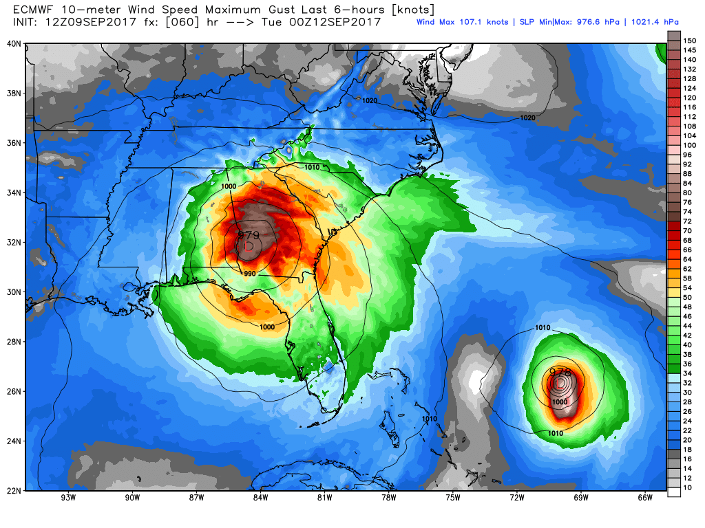
The center will make its track northwesterly across the area, which will be moving along just to the north of the US-280 corridor. By midnight, it should be located somewhere between Alexander City and Anniston. By that time, some slight weakening will have occurred but wind speeds will have stayed pretty similar in the 20-40 MPH range, with gusts up to 50 MPH close to the center. At this point, we may have to watch for the possibility of a few tropical-type tornadoes for locations that will be north and east of the center, east of a line from Centre to Anniston to Alexander City to Eufaula.
TUESDAY
A couple of hours before dawn, the center will be located somewhere between Birmingham and Oneonta, with wind speeds still expected to be pretty similar at 20-40 MPH, but wind gusts possibilities will have dropped to 45 MPH. Only problem with this is that the tornado threat will now include pretty much all of the northeastern corner of Central Alabama… east of the I-65 corridor and along and north of the I-20 corridor. That threat could extend as far south as the US-280 corridor, but we’ll have to wait and see on that.
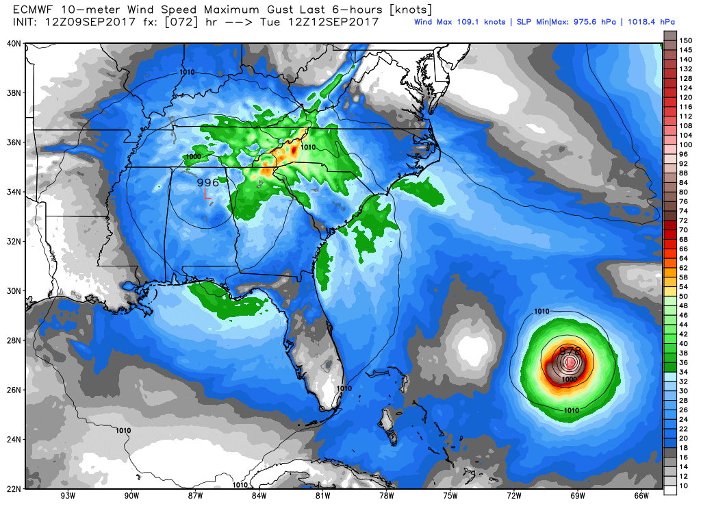
By the time we reach the 1:00 PM CDT hour in Central Alabama, we could have some tropical showers lingering behind for the northern parts of the area, but all of the really strong winds will have exited the area. Winds at this time will be back down into the 10-20 MPH range with gust of 20 MPH possible. We’ll actually have clearing skies to start to move in from the south starting during the late afternoon hours. Those wind speeds will continue to die down throughout the evening hours and be around 5-10 MPH by midnight.
RAINFALL TOTALS
Much of the eastern half of Central Alabama, along with locations mainly north of the I-22 corridor, could see rainfall totals in the 1-3 inch range, with locations in the southwestern part of Central Alabama maybe not receiving much at all throughout the beginning of the week.
THREATS
At this time, spotty wind damage is possible with the higher wind gusts (trees, limbs, weak roofing, power lines, etc.), and some power outages could be possible. There could be some localized flash flooding due to the heavy downpours from Irma, mainly in the eastern half of the area. A tornado threat is small, but possible, for locations east and northeast of the center of Irma once it moves through.
STAY CALM BUT BE PREPARED
This is a rare event that we have a tropical storm or hurricane that moves through our area. This will be a great time to have your severe weather supplies ready to go, and to have fresh batteries in that NOAA Weather Radio. Much of the area will experience some gusty winds and heavy rain with no damage or flooding, but a few could have something happen. Keep up to date with the latest from the National Weather Service, your favorite local TV news, and the AlabamaWx Weather Blog. We’ll have updates throughout the event.
Category: Alabama's Weather, ALL POSTS
About the Author (Author Profile)
Scott Martin is an operational meteorologist, professional graphic artist, musician, husband, and father. Not only is Scott a member of the National Weather Association, but he is also the Central Alabama Chapter of the NWA president. Scott is also the co-founder of Racecast Weather, which provides forecasts for many racing series across the USA. He also supplies forecasts for the BassMaster Elite Series events including the BassMaster Classic.Subscribe
If you enjoyed this article, subscribe to receive more just like it.


