Extreme Wind Warning Issued for the Lower Keys
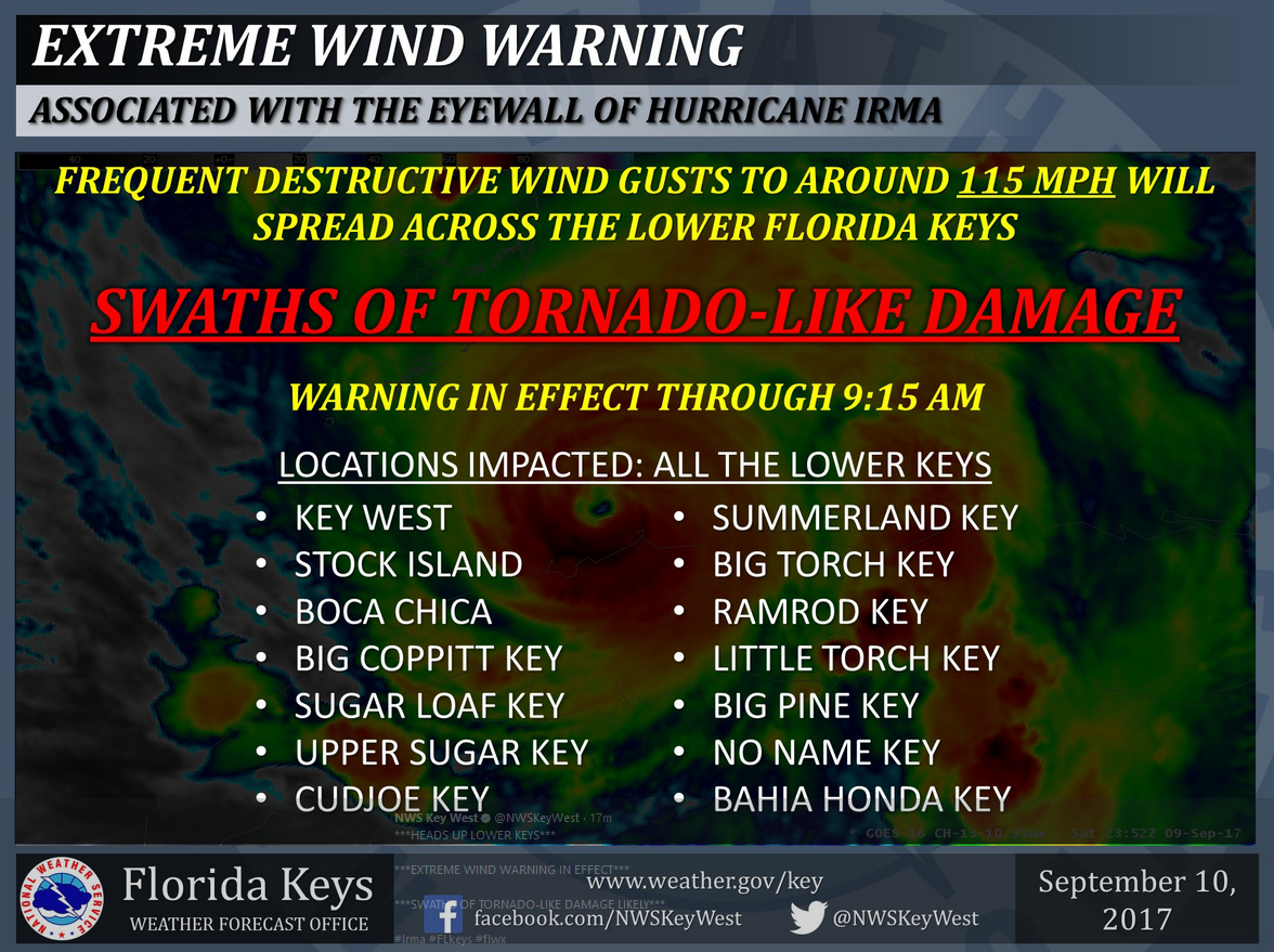
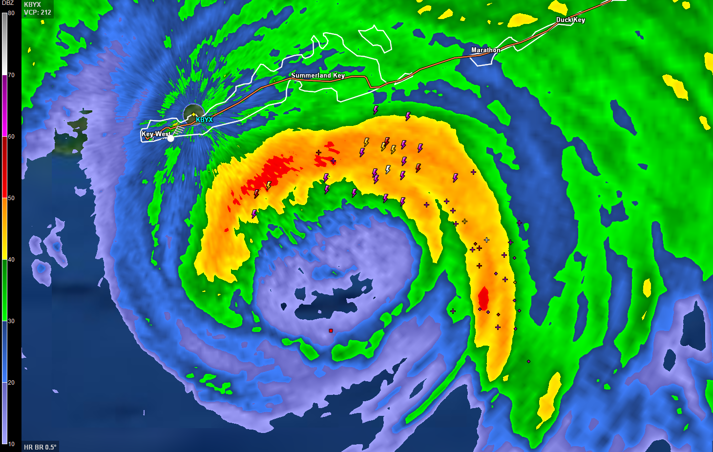
The NWS in Key West has issued an Extreme Wind Warning for the Lower Florida Keys as the eyewall will be moving over places from Key West to the Seven Mile Bridge.
Winds will reach at least 115 mph in frequent gusts.
The NWS Key West warns that this will result in swaths of tornado like damage.
The eye will arrive in the keys east of Key West around 6:30 a.m. CDT.
Landfall will occur around 7:30 a.m. CDT.
The back side of the eyewall will return with a vengeance within a few minutes to 90 minutes later.
The Air Force crew and plane that did a yeoman’s work all night is en route back to Biloxi. Another flight is en route now and should be in the storm by 630 a.m. CDT.
About the Author (Author Profile)
Bill Murray is the President of The Weather Factory. He is the site's official weather historian and a weekend forecaster. He also anchors the site's severe weather coverage. Bill Murray is the proud holder of National Weather Association Digital Seal #0001 @wxhistorianSubscribe
If you enjoyed this article, subscribe to receive more just like it.


