1:30 p.m. Notes on Irma
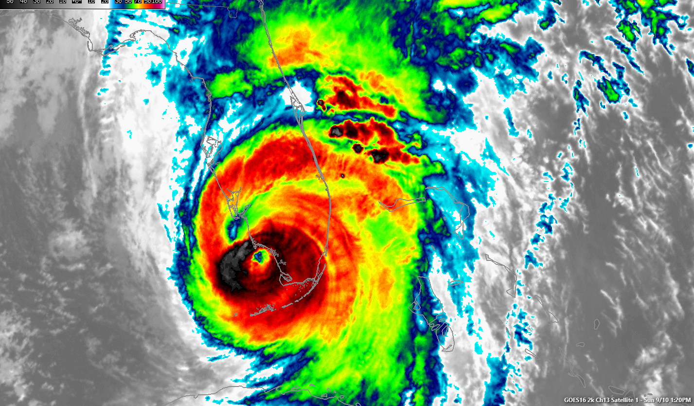
The Irma’s eyewall is approaching the SW Florida Coast near Marco Island. The most intense winds are out two hours from Naples.
The offshore winds are pushing the water out of Tampa Bay and Charlotte Harbor. The water will start coming back in with a vengeance when the wind shifts. That will occur in Marco Island around 2 pm CDT, Naples around 6pm CDT, in Fort Myers around and Tampa around midnight.
Tides will run 9-12 feet along the coast Captiva and Sanibel through Fort Myers/Cape Coral, Naples, Marco Island and the SW Coast of Florida.
Port Charlotte and Punta Gorda will see 3-9 feet, with isolated spots to 12 feet.
Tampa/St. Pete is looking like 3-6 feet. The Nature Coast/Big Bend is looking like 3-6 feet mostly.
The storm is less organized, with dry air surrounding the center now. Winds are officially down to 120 mph and data from the plane, making it a category three storm.
The severe weather threat is elevated across the East Coast of Florida and in the Slight Category over most of the Peninsula. Tornado watches cover all of the North and Central parts of Florida. There have been several tornado warnings along the East Coast from Brevard down through Broward County.
Moderate to heavy is falling now across most of the Florida Peninsula. Rainfall amounts will run 7-12 inches across all of the Florida Peninsula.
Irma will make landfall between Marco Island and Naples. There could be a third U.S. landfall near Crystal River if the center goes back offshore at Tampa.
About the Author (Author Profile)
Bill Murray is the President of The Weather Factory. He is the site's official weather historian and a weekend forecaster. He also anchors the site's severe weather coverage. Bill Murray is the proud holder of National Weather Association Digital Seal #0001 @wxhistorianSubscribe
If you enjoyed this article, subscribe to receive more just like it.


