Sunday 3:45PM Notes On Hurricane Irma
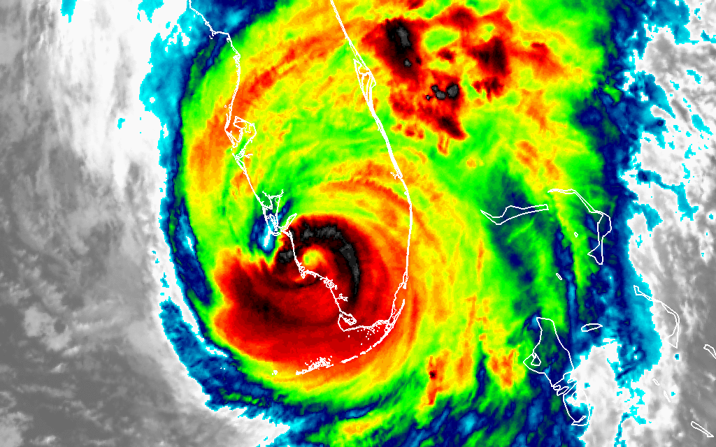
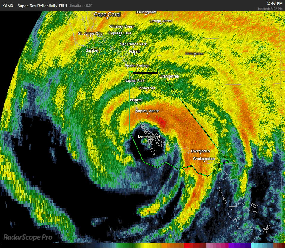
The eye of Irma has completely moved onshore and is approaching the Naples area at this point. Latest recon reports the wind field is far diminishing, and more than likely the next update from the National Hurricane Center will show that trend.
The latest update from the National Hurricane Center now has Irma down to a weaker Category 3 storm, with maximum sustained winds at 115 MPH. Movement continues to be just a tick west of due north at 12 MPH. The next locations in the immediate path of the eye will be Bonita Springs, Cypress Lake, Cape Coral, Punta Gorda, and Port Charlotte.
Taking a look at radar estimates, rainfall amounts range from 1.00 inch to over 14.00 inches already at Fort Pierce, which is just north of Port St. Lucie on the eastern side of the peninsula. More is expected to fall as Irma continues her movement to the north.
Wind gusts of over 131 MPH was recorded at the Naples Municipal Airport Mesonet site just a little over 40 minutes ago. A spotter has reported that significant roof damage and trees are shredded all over Marco Island. The island is littered with debris. Another Mesonet site reported a gust of 122 MPH at 3:04 CDT at the Collier County Emergency Services Center.
Latest report from FPL has an estimated 2.3 million without power in Florida at this point, with the number only expected to climb as Irma continues on her path.
About the Author (Author Profile)
Scott Martin is an operational meteorologist, professional graphic artist, musician, husband, and father. Not only is Scott a member of the National Weather Association, but he is also the Central Alabama Chapter of the NWA president. Scott is also the co-founder of Racecast Weather, which provides forecasts for many racing series across the USA. He also supplies forecasts for the BassMaster Elite Series events including the BassMaster Classic.Subscribe
If you enjoyed this article, subscribe to receive more just like it.


