Here’s a Mid-Evening Look at the Alabama Weather Situation
Hurricane Irma is 55 miles east northeast of Fort Myers, FL tonight. Max winds are 105 mph and the pressure is 942 mb. The storm is moving north at 14 mph and is expected to turn to the north northwest tonight.
Showers along the outer edge of Irma have moved into Southeast Alabama this evening, but are mostly dissipating in a fairly dry airmass with dewpoints around 50F. Clouds have thickened in areas east of I-65.
All the models are in agreement that the turn will occur overnight and that Irma will be moving through North Florida and into Southwest Georgia early tomorrow afternoon and into East Central Alabama tomorrow night. This wind forecast is based on that idea.
Winds of 10-20 mph have overspread the southeastern quarter of Alabama by midnight tonight. Winds will increase during the day on Monday as the storm moves closer to Alabama.
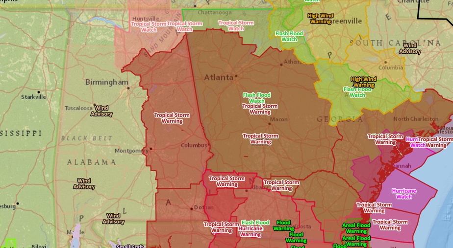
Tropical storm warnings cover the eastern half of Alabama from Blount, Etowah and Cherokee COunties all the way to the South. A tropical storm watch is in effect for Northeast Alabama.
MONDAY MORNING
Winds will average 15-30 mph across Central Alabama, with the strongest winds over the southeast part of the area. Winds will gust to 20-30 mph northwest of Birmingham, with 30-35 mph southeast of Birmingham. Winds will gust to 50-60 mph over southeastern portions of the area.
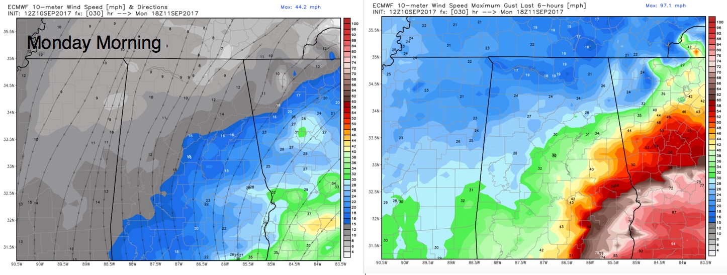
Click image to enlarge.
MONDAY AFTERNOON
Winds will be averaging 20-30 mph across Central Alabama. Peak gusts will range from 35-45 in Birmingham. For Gadsden, Anniston and points east, gusts of 50-60 mph are likely with a few gusts close to hurricane force near the Georgia border in southeastern parts of Central Alabama.
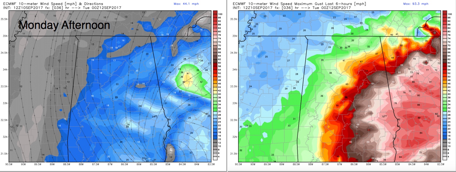
Click image to enlarge.
MONDAY EVENING
Winds will average 12-25 mph across much of the area with the center near Alex City. Gusts could reach 45-55 mph during the evening.
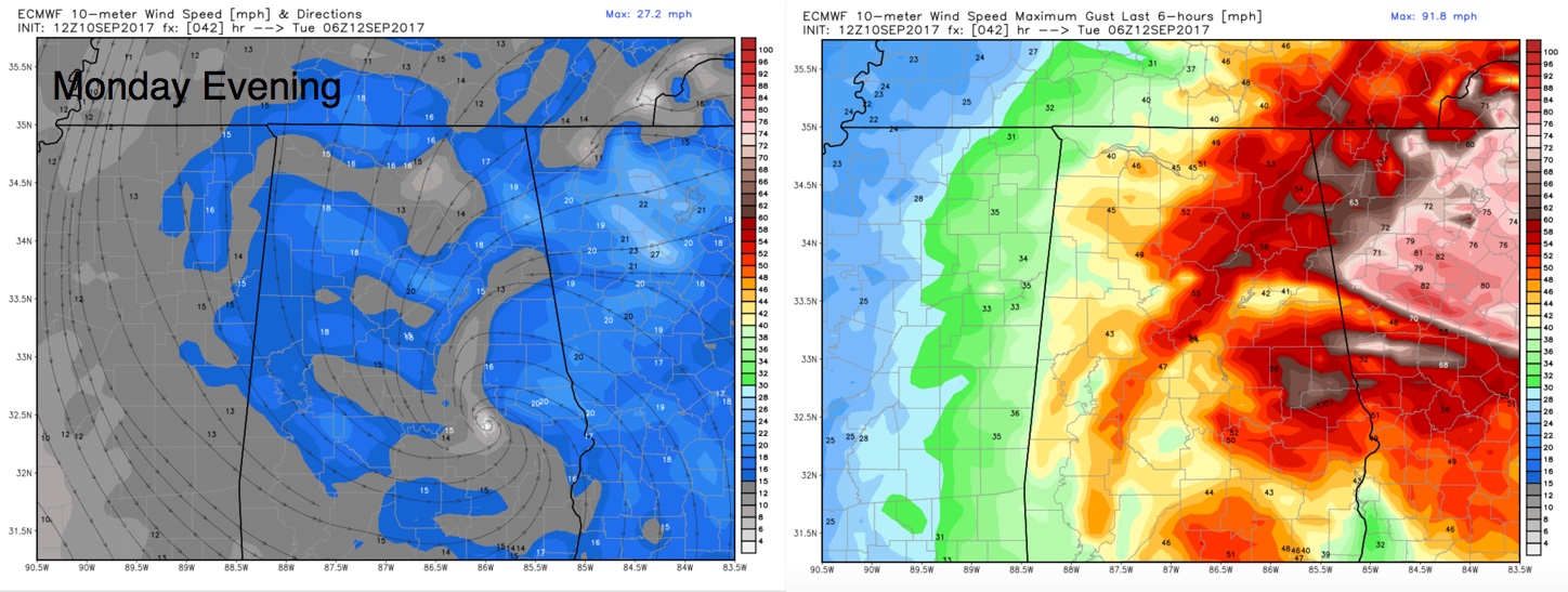
Click image to enlarge.
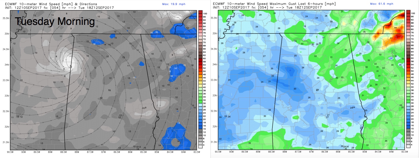
TUESDAY MORNING
Winds should diminish as the center moves into northern Mississippi. It will be breezy and winds could still gust to 25-35 mph.
The forecasted winds will cause large tree limbs to fall, some trees to be uprooted and power lines to come down. Lots of people could lose power. Travel will become hazardous during the peak winds.
Stay tuned to the latest information, as the potential impacts depend largely on the track of Irma. We will have frequent updates.
Category: Alabama's Weather, ALL POSTS
About the Author (Author Profile)
Bill Murray is the President of The Weather Factory. He is the site's official weather historian and a weekend forecaster. He also anchors the site's severe weather coverage. Bill Murray is the proud holder of National Weather Association Digital Seal #0001 @wxhistorianSubscribe
If you enjoyed this article, subscribe to receive more just like it.


