An Evening Look at the Alabama Weather Situation
Click image to enlarge.
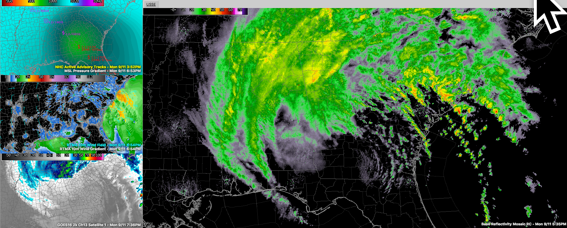
Tropical Storm Irma is centered about 55 miles southeast of Columbus GA this evening. Top winds are down to 45 mph and the central pressure is 986 millibars. Barometers in that area are reading as low as 29.12 inches!
Tropical Storm Warnings continue for the following counties in Central Alabama: Barbour, Blount, Bullock, Calhoun, Chambers, Cherokee, Clay, Cleburne, Coffee, Coosa, Dale, Elmore, Etowah, Geneva, Henry, Houston, Lee, Macon, Montgomery, Pike, Randolph, Russell, St. Clair, Talladega and Tallapoosa.
A Wind Advisory remains in effect for these counties in Central Alabama: Autauga, Bibb, Chilton, Dallas, Fayette, Greene, Hale, Jefferson, Lamar, Lowndes, Marengo, Marion, Perry, Pickens, Shelby, Sumter, Tuscaloosa, Walker and Winston. It goes until 6 a.m.
7 p.m. Winds looked like this:
Tuscaloosa…N-16
Anniston…N-21 G 33
Pell City…N-15 G 21
Birmingham…N-20 G 31
Bessemer…N-18
Calera…NW-13 G 25
Montgomery…No Report
Auburn…No Report
The center of Irma is expected to track west northwestward East Central and Northeast Alabama tonight. It will weaken to a depression during the early morning hours.
In the Tropical Storm Warning, winds will average up to 35-45 mph with a few gusts over 50 mph. That will continue to bring down a few trees. It would be a good night to sleep in a safer room which is not vulnerable to trees or large limbs falling. In the Wind Advisory area, winds will average 15-25 mph and gusts to 35-40 mph. This could also bring down a few trees.
Power outages are possible, but they shouldn’t be widespread.
Rainfall amounts are generous, especially over East Alabama but not especially heavy, and the rain band is pushing northwest steadily now.
Some Damage Reports:
…Several trees down in Cherokee County in NE Alabama; including one near Centre, one on County Road 86 and 22, Road Blocked. Another near Blanche.
…Power pole downed by large limb in Cherokee County…near New Moon.
…Trees down near Sand Rock in Cherokee County causing power outages.
…Calhoun: trees down near Alexandria and one fell on car and pool house on Hale Street in Oxford at 542 p.m. Multiple trees reported down in Oxford.
…Power lines down on East Fort Williams Street in Sylacauga around 650 p.m.
…Trees down in Gadsden in Etowah County around 528 p.m.
…Trees down near Pell City…blocking Mineral Springs Road.
…Fire Department reports trees down across highway 77 just north of highway 275 in Talladega around 647 pm.
…Tree on house in Alex City in Tallapoosa County at 639 p.m.
…Tree down in Hayden at 625 p.m.
…Tree on house in Coates Bend in Etowah County around 615 p.m.
…Tree down on highway 75 in Blountsville in Blount County around 609 p.m.
…There are numerous other reports across Russell, Cherokee, Calhoun and Blount Counties.
Category: Alabama's Weather, ALL POSTS
About the Author (Author Profile)
Bill Murray is the President of The Weather Factory. He is the site's official weather historian and a weekend forecaster. He also anchors the site's severe weather coverage. Bill Murray is the proud holder of National Weather Association Digital Seal #0001 @wxhistorianSubscribe
If you enjoyed this article, subscribe to receive more just like it.


