Much Better Weather At Midday Throughout Central Alabama
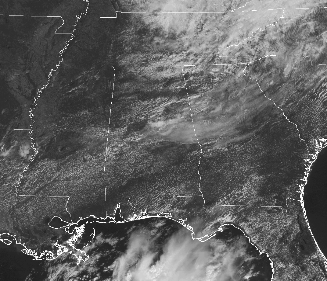
RADAR CHECK AT 12:20 PM
It is a much better day outside at the midday hour than it has been for the past three days across Central Alabama. Even though we have some cumulus clouds across the area, we are free from any rain, and skies are mostly clear to partly cloudy.
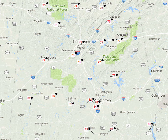
We don’t have to worry about breaking a record for lowest maximum temperatures today, as our highs will be approaching our normals for this time of year. At this point, we’re ranging from the mid-70s to the mid-80s throughout the area. Birmingham is currently at 79 degrees, while Eufaula is the warm spot in the area at 85 degrees.
REST OF THE DAY
We will continue to have partly cloudy skies throughout the rest of the afternoon and into the early evening hours, with a very small chance of an isolated shower mainly in the northeastern part of Central Alabama. Those chances will actually diminish as we get later into the day. Afternoon highs will be in the lower to mid-80s. For this evening, clouds will be on the decrease but a few of us could have some patchy fog to deal with during the overnight hours. Lows will be in the mid to upper 60s.
FRIDAY’S WEATHER
We can expect pretty close to the same conditions for tomorrow as we have today, except slightly warmer temperatures. Skies will be partly cloudy and we’ll mention a small chance of a shower or thunderstorm. Not everyone will get a shower, and the overall odds for any one location getting rain is around 1-in-5. Afternoon highs will be back in the mid to upper 80s. For high school football games tomorrow night, rain chances will be diminishing by 6:00 PM with temperatures in the upper 70s to the mid-80s, and falling into the lower to mid-70s by 10:00 PM. Overnight lows will be in the mid to upper 60s.
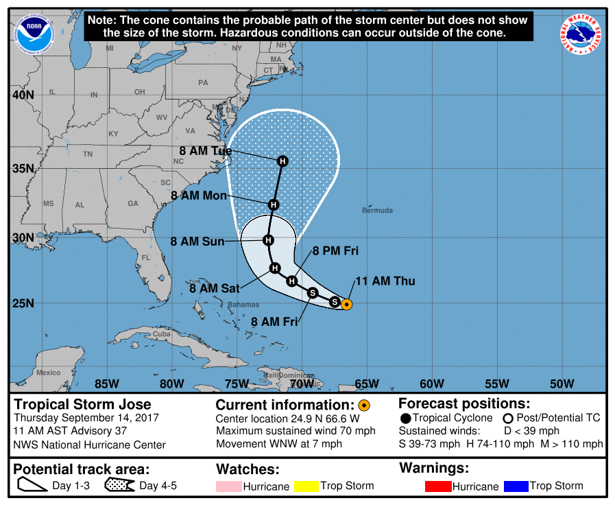
LATEST ON JOSE
At 10:00 AM, maximum sustained speeds are down to 70 MPH which makes Jose a very strong tropical storm. Jose is currently moving to the west-northwest and is forecast to curve around to the north-northeast, and possible riding along the Atlantic Coastline offshore. Jose is expected to strengthen back to a hurricane by tomorrow night. As of now, the only threat to the US mainland will be rough surf and rip currents. We’ll have to watch Jose to see if he continues to stay offshore.
OUR TROPICAL WEATHER CATEGORY HAS THE LATEST ON ALL ACTIVE STORMS
Stay up-to-date with the latest updates on all of the tropical systems out in the Atlantic Ocean, Caribbean Sea, or in the Gulf of Mexico with the latest posts in our Tropical Weather section. Click here to see the latest.
GOT BEACH PLANS?
Be sure to keep up to date with the detailed forecasts from Fort Morgan over to Panama City Beach with the AlabamaWx Weather Blog. Click here to see the AlabamaWx Beach Forecast Center page.
The Beach Forecast is partially underwritten by the support of Brett/Robinson Vacation Rentals in Gulf Shores and Orange Beach. Click here to see Brett/Robinson’s Hot Deals now!
ADVERTISE WITH ALABAMAWX
Now is the time to set your marketing campaign on AlabamaWX. The site has enjoyed a 71% jump in page views this year! The website has already enjoyed over 12 MILLION page views this year. We can customize a creative, flexible and affordable package that will suit your organization’s needs. Contact Bill Murray at (205) 687-0782.
E-FORECAST
Get the AlabamaWx seven-day forecast delivered directly to your inbox by email twice daily. It is the most detailed weather forecast available in Central Alabama. Click here to subscribe. It’s free!
ON THIS DAY IN WEATHER HISTORY
1988 – Hurricane Gilbert made the first of its two landfalls on Mexico, producing 170 mph winds at Cozumel.
WEATHERBRAINS
Check out the show at www.WeatherBrains.com. You can also subscribe on iTunes. You can watch the show live at live.bigbrainsmedia.com on Monday nights starting at 8:30 PM CDT. You will be able to see the show on the James Spann 24×7 weather channel on cable or directly over the air on the dot 2 feed.
Category: Alabama's Weather, ALL POSTS
About the Author (Author Profile)
Scott Martin is an operational meteorologist, professional graphic artist, musician, husband, and father. Not only is Scott a member of the National Weather Association, but he is also the Central Alabama Chapter of the NWA president. Scott is also the co-founder of Racecast Weather, which provides forecasts for many racing series across the USA. He also supplies forecasts for the BassMaster Elite Series events including the BassMaster Classic.Subscribe
If you enjoyed this article, subscribe to receive more just like it.


