

Saturday’s Weather Xtreme: A Few Showers & Storms Possible As Moisture Levels Rise Today
MOISTURE RETURNS TO CENTRAL ALABAMA TODAY
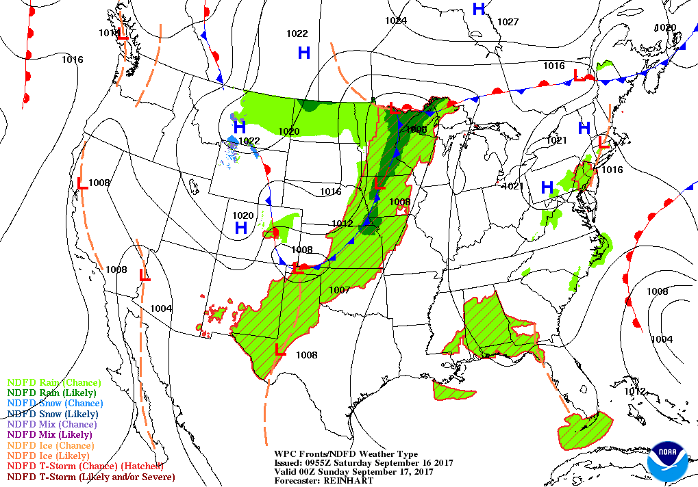
That’s right, after a few days of nice and cool air after Irma moved through, the typical summertime pattern returns for Saturday. We’ll have a mix of sun and clouds throughout the day with a chance of scattered afternoon and early evening showers and thunderstorms, with the better coverage falling over the southeastern parts of the area. Rain chances for the northern half of the area will be in the 20-30% range, while the south will be in the 40-50% range. Afternoon highs will be in the mid to upper 80s. Rain chances will diminish during the early evening hours but we may have some patchy fog form across parts of the area. Lows will be in the mid-60s to the lower 70s throughout the area.
COLLEGE FOOTBALL WEATHER
UAB hosts Coastal Carolina at Legion Field, with kickoff scheduled at 12:00 PM CDT. Temperature at kickoff will be around 83 degrees and climbing to near 88 degrees by the fourth quarter. Skies will feature a mix of sun and clouds, and a brief shower or thunderstorms is possible.
Auburn hosts Mercer down on the Plains, with kickoff scheduled at 3:00 PM CDT. Temperature at kickoff will be around 87 degrees and falling into the upper 70s by the fourth quarter. Skies will feature a mix of sun and clouds, and a brief shower or thunderstorms is possible.
Alabama hosts Colorado State at Bryant-Denny, with kickoff scheduled for 6:00 PM CDT. A brief shower or storm is possible during the first half, but becoming fair afterwords. Temperature at kickoff will be around 82 degrees and falling into the mid-70s by the fourth quarter.
SUNDAY’S WEATHER
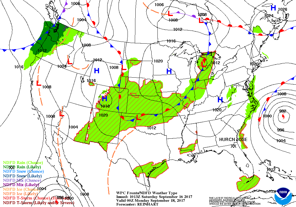
Moisture levels drop for Sunday, but the temperatures do not. We’ll have a mix of sun and clouds with a very small chance of an isolated shower mainly during the afternoon hours. Highs will be in the mid to upper 80s. Skies will become clear for the night time and overnight hours, and lows will drop into the mid to upper 60s.
THE WORK WEEK AHEAD
To start off the week, an upper ridge will be in control across the eastern half of the nation, and that will mean warm and mostly dry weather for Central Alabama on Monday and Tuesday, with isolated showers possible. Moisture levels rise to finish out the remainder of the week, and that will bring an increase of showers and storms throughout the area. Highs will be in the mid to upper 80s with a few locations touching 90 degrees on Monday and Tuesday.
AN ACTIVE PATTERN IN THE TROPICS
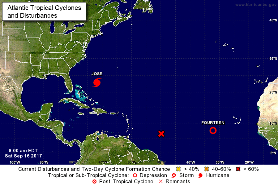
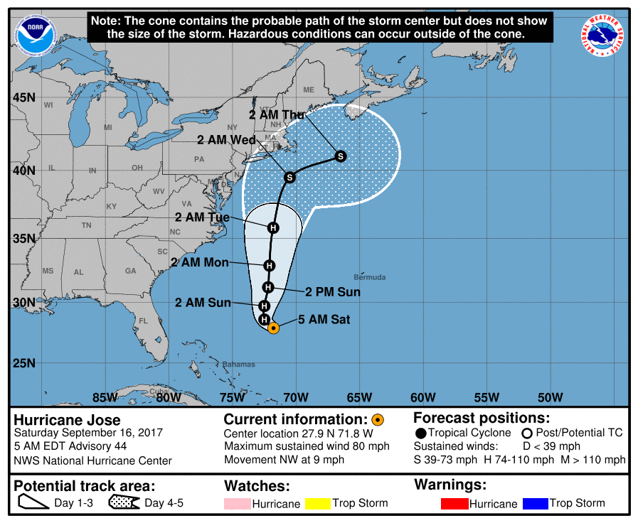
Hurricane Jose is still out there in the Atlantic and is forecast to eventually turn from the northwest to northward by this afternoon. Through the next five days, Jose’s forecast track takes it up the Eastern Seaboard but well offshore. Unfortunately, dangerous rip currents and swells will be felt all along the coast.
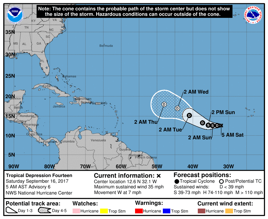
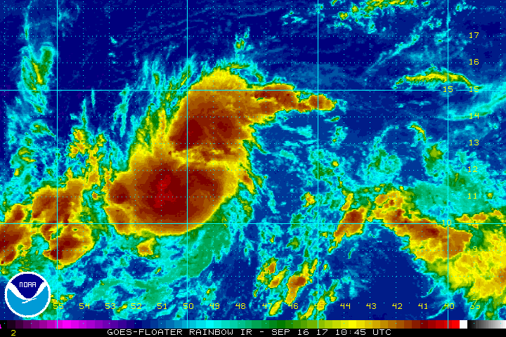
Tropical Depression Fourteen is well out in the Atlantic just southwest of the Cabo Verde Islands. Throughout the next five days, it is expected to strengthen into a storm and move in a west-northwesterly motion, and then gradually weaken back to a depression. Too far out for specifics, but we’ll keep an eye out on it.
We also have a tropical wave out there just east of Fourteen, that has a very high chance of becoming a depression or storm within the next two days. This one looks like it may head toward the Leeward Islands, but it is still too early to tell as well. Will this disturbance or TD14 become Lee? The race is on…
OUR TROPICAL WEATHER CATEGORY HAS THE LATEST ON ALL ACTIVE STORMS
Stay up-to-date with the latest updates on all of the tropical systems out in the Atlantic Ocean, Caribbean Sea, or in the Gulf of Mexico with the latest posts in our Tropical Weather section. Click here to see the latest.
GOT BEACH PLANS?
Be sure to keep up to date with the detailed forecasts from Fort Morgan over to Panama City Beach with the AlabamaWx Weather Blog. Click here to see the AlabamaWx Beach Forecast Center page.
The Beach Forecast is partially underwritten by the support of Brett/Robinson Vacation Rentals in Gulf Shores and Orange Beach. Click here to see Brett/Robinson’s Hot Deals now!
ADVERTISE WITH ALABAMAWX
Now is the time to set your marketing campaign on AlabamaWX. The site has enjoyed a 71% jump in page views this year! The website has already enjoyed over 12 MILLION page views this year. We can customize a creative, flexible and affordable package that will suit your organization’s needs. Contact Bill Murray at (205) 687-0782.
E-FORECAST
Get the AlabamaWx seven-day forecast delivered directly to your inbox by email twice daily. It is the most detailed weather forecast available in Central Alabama. Click here to subscribe. It’s free!
ON THIS DAY IN WEATHER HISTORY
1988 – Hurricane Gilbert moved ashore into Mexico. The hurricane established an all-time record for the western hemisphere with a barometric reading of 26.13 inches. Winds approached 200 mph, with higher gusts. Gilbert devastated Jamaica and the Yucatan Peninsula. (The Weather Channel) Hurricane Gilbert made landfall 120 miles south of Brownsville TX during the early evening. Winds gusted to 61 mph at Brownsville, and reached 82 mph at Padre Island. Six foot tides eroded three to four feet off beaches along the Lower Texas Coast, leaving the waterline seventy-five feet farther inland. Rainfall totals ranged up to 8.71 inches at Lamar TX. Gilbert caused three million dollars damage along the Lower Texas Coast, but less than a million dollars damage along the Middle Texas Coast.
WEATHERBRAINS
Check out the show at www.WeatherBrains.com. You can also subscribe on iTunes. You can watch the show live at live.bigbrainsmedia.com on Monday nights starting at 8:30 PM CDT. You will be able to see the show on the James Spann 24×7 weather channel on cable or directly over the air on the dot 2 feed.
Category: Alabama's Weather, ALL POSTS
About the Author (Author Profile)
Scott Martin is an operational meteorologist, professional graphic artist, musician, husband, and father. Not only is Scott a member of the National Weather Association, but he is also the Central Alabama Chapter of the NWA president. Scott is also the co-founder of Racecast Weather, which provides forecasts for many racing series across the USA. He also supplies forecasts for the BassMaster Elite Series events including the BassMaster Classic.Subscribe
If you enjoyed this article, subscribe to receive more just like it.


