Early Afternoon Notes On TD 16
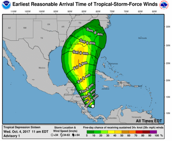
Tropical Depression 16 is expected to become Tropical Storm Nate during the next 18 hours, and possibly reach hurricane strength by the time it reaches the Gulf Coast Sunday. Here are some important points…
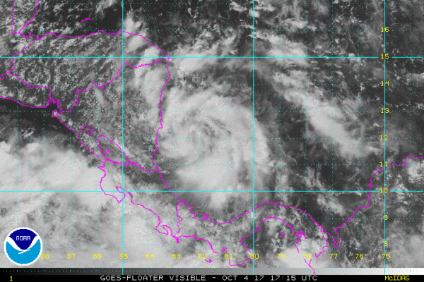
*This is a new system, and until we get better data from hurricane hunters and research aircraft in the area confidence in the forecast track and intensity will remain fairly low. Don’t focus on the exact forecast track, especially at the longer ranges, since the average NHC track errors are about 175 and 225 statute miles at days 4 and 5, respectively.
*For now, NHC is forecasting “Nate” to be a category one hurricane at the time of landfall Sunday.
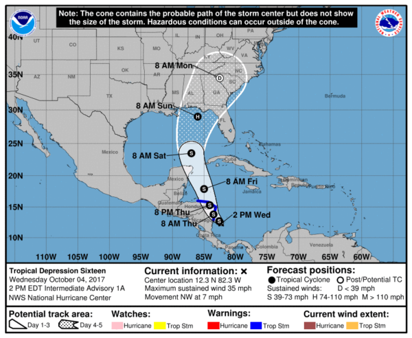
*If you have a trip planned this weekend to the Gulf Coast, it is simply too early to know the conditions at any specific point. For now, based on the current NHC forecast, highest impact would seem to be from Fort Walton Beach eastward to Destin, Panama City Beach, and Cape San Blas Saturday night and Sunday. Places like Gulf Shores and Pensacola would be on the “good” side of the storm. But, it is very important to note that this forecast can, and probably will change over the next few days.
If it was me, I would wait until tomorrow (when forecast confidence will be higher) before changing travel plans.
*Remember, the “bad” side of the system is east of the circulation center. This is where most of the storm surge/flooding issues will be found as “Nate” approaches the coast and moves inland. On the “good” west side, no storm surge issues, although there will be some wind and rain.
*”Nate” will be long gone by the National Shrimp Festival in Gulf Shores October 12-15.
*On the current forecast track from NHC, much of Alabama will be on the “good” west side of the circulation. Some rain and wind will be possible for the eastern counties of the state Sunday and Monday, but the really big rains will be to the east over Georgia and South Carolina. Again, this could change.
*Concerning Orlando, Tampa, Daytona Beach, and the Florida Peninsula, there will be some wind and rain Sunday, but the main impact will be to the west based on the current forecast.
*Always use fresh, updated weather information from a credible source. There is a cesspool of bad information floating around Facebook, and I would not use any forecast that is more than 6 hours old.
I will have a new blog discussion and Weather Xtreme video posted a little later this afternoon…
About the Author (Author Profile)
James Spann is one of the most recognized and trusted television meteorologists in the industry. He holds the AMS CCM designation and television seals from the AMS and NWA. He is a past winner of the Broadcast Meteorologist of the Year from both professional organizations.Subscribe
If you enjoyed this article, subscribe to receive more just like it.


