

Conditions In Central Alabama At 2:00 PM
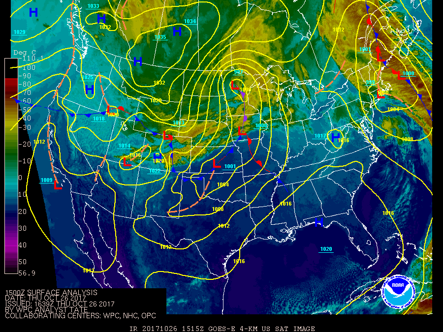
What’s Happening With Our Weather At 1:50 PM
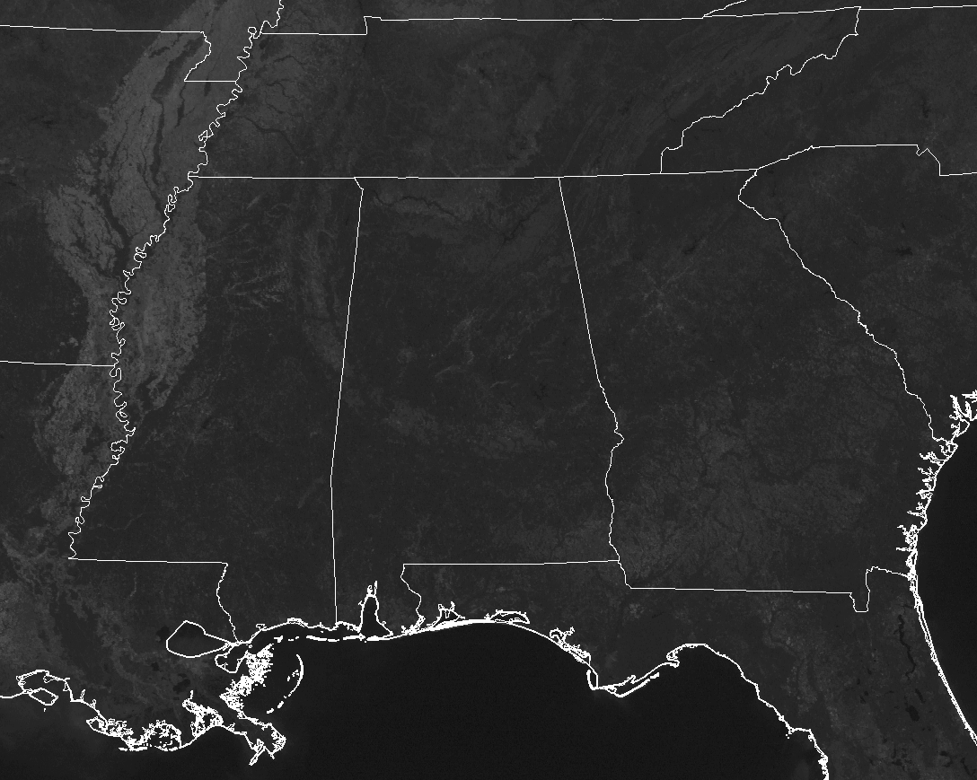
Not a cloud out there across not only Central Alabama, but across nearly the entire southeastern United States. Maximum sunshine with a shift in our winds at the surface has allowed our temperatures to be much warmer than just 24-hours ago.
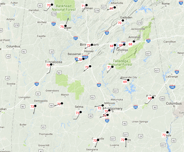
Temperatures are in the upper 60s to the mid-70s across the area at this point. Montgomery is currently the warm spot at 75 degrees, while Anniston and Pell City are tied as the cool spots at 68 degrees. Winds are mainly out of the southwest at 5-10 MPH.
Weather For The Rest Of Your Thursday
Sunny skies and warmer temperatures throughout the remainder of the afternoon and early evening hours, with afternoon highs reaching the lower to mid-70s throughout the area. Clear skies but not as cool throughout the late night and overnight hours. Overnight lows will be in the upper 40s to the lower 50s.
Showers And Storms Arrive On Friday With A Cold Front
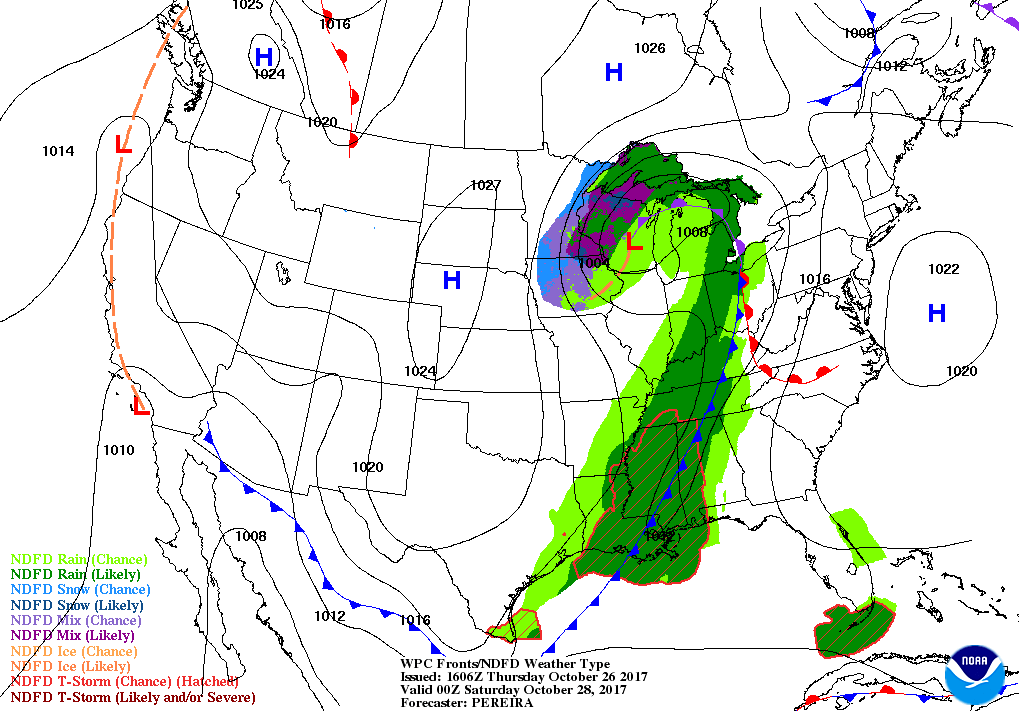
A trough will be moving towards the area on Friday pushing a cold front into Central Alabama during the latter part of the day and into the night time hours. Looking at the latest model trends, there could be a broken line of scattered showers and storms that form out ahead of the front affecting the western half of the area through the late morning through the early evening hours before the main line associated with the cold front catches up with it. Those lines appear to merge before making it to the I-65 corridor before midnight. The line will continue through the rest of the area, exiting the Birmingham metropolitan area by 2:00 PM, and out of the state Friday night by 10:00 PM – midnight. Afternoon highs will be in the lower to mid-70s for much of the area with upper 70s in the southeast.
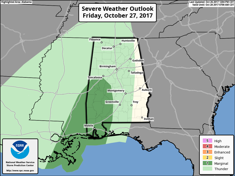
The Storm Prediction Center has the southwestern parts of Central Alabama defined in a Marginal Risk for severe weather from Friday afternoon through Saturday morning at 7:00 AM. A few storms could reach marginally severe levels, but this system seems to lack enough shear, surface-based instability, lift, and moisture out ahead of the front for any organized convective severe storms to form. The tornado threat is very, very low with this system, but not zero. Main threat will mainly be from gusty thunderstorm winds that are below severe limits, but one or two storms could have gusts that reach severe criteria.
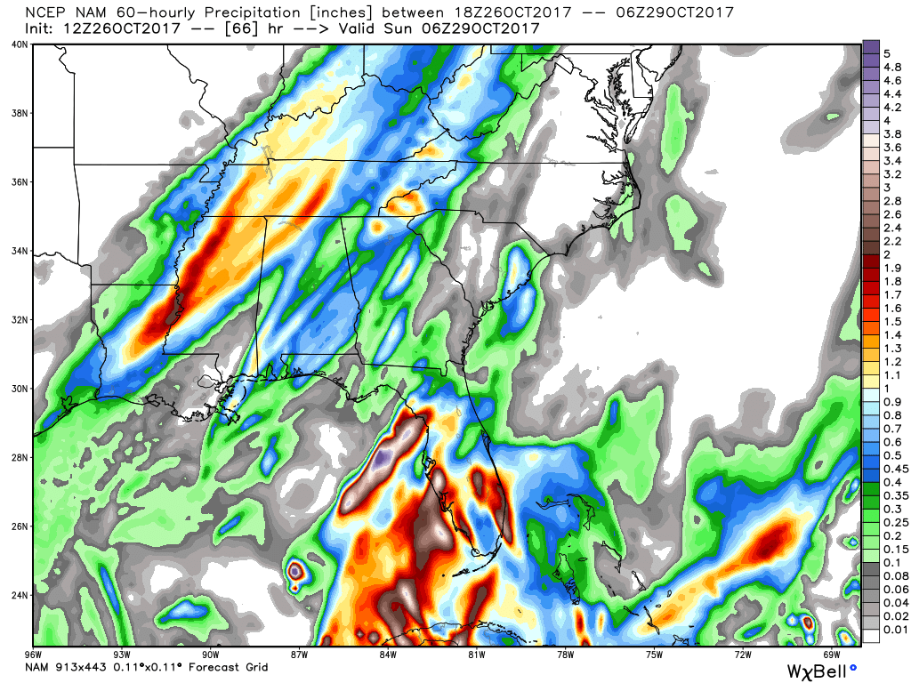
More good news is that rainfall amounts will be around 1 inch or less, with slightly higher amounts possible in the northwestern corner of the state. The flash flood threat will almost be zero, but some ponding could occur underneath a heavier thunderstorm, especially in poor drainage areas.
The Tropics
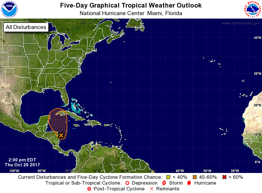
For the North Atlantic, Caribbean Sea and the Gulf of Mexico, disorganized cloudiness and thunderstorms over the western Caribbean Sea are associated with a trough of low pressure. Conditions could be conducive for some development on
Friday and Saturday as the system moves slowly northward over the northwestern Caribbean Sea, but strong upper-level winds associated with an approaching cold front will make conditions less favorable by Sunday. South Florida and
the Keys will see tropical rainfall on Saturday. Chance of tropical depression development within the next 5 days is at 40%.
Stay up-to-date with the latest updates on all of the tropical systems out in the Atlantic Ocean, Caribbean Sea, or in the Gulf of Mexico with the latest posts in our Tropical Weather category. Click here to see the latest.
Gulf Coast Weather
The Beach Forecast is partially underwritten by the support of Brett/Robinson Vacation Rentals in Gulf Shores and Orange Beach. Click here to see Brett/Robinson’s Off Season Deals now!
On This Day In Weather History
1988 – Thunderstorms moving out of northern Texas spawned five tornadoes in Louisiana during the morning hours. The thunderstorms also produced wind gusts to 75 mph at Jennings LA, and the driver of a vehicle was killed by a falling tree near Coushatta LA. Snow squalls in the Lower Great Lakes Region produced heavy snow in western New York State, with 12 inches reported at Colden.
WeatherBrains
Check out the show at www.WeatherBrains.com. You can also subscribe on iTunes. You can watch the show live at live.bigbrainsmedia.com on Monday nights starting at 8:30 PM CDT. You will be able to see the show on the James Spann 24×7 weather channel on cable or directly over the air on the dot 2 feed.
Category: Alabama's Weather, ALL POSTS
About the Author (Author Profile)
Scott Martin is an operational meteorologist, professional graphic artist, musician, husband, and father. Not only is Scott a member of the National Weather Association, but he is also the Central Alabama Chapter of the NWA president. Scott is also the co-founder of Racecast Weather, which provides forecasts for many racing series across the USA. He also supplies forecasts for the BassMaster Elite Series events including the BassMaster Classic.Subscribe
If you enjoyed this article, subscribe to receive more just like it.


