Frost Advisories Tonight; Temperatures Begin Moderating on Monday
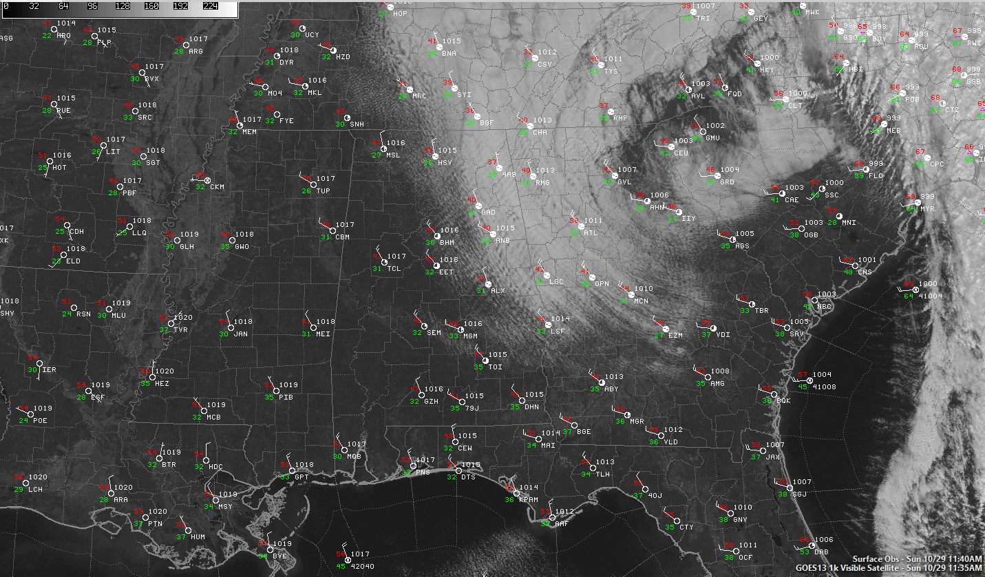
The western two-thirds of the area is mostly sunny now as the low stratus deck continues to slowly burn off across Northeast and East Alabama.
Temperatures have remained cool, heading toward highs mainly in the 50s. Most eastern Alabama locations won’t get out of the 40s however. It is currently 37F at Fort Payne, 40F at Gadsden, 40F at Anniston and only 42F at Alex City.
Frost advisories are posted for nearly the entire state tonight as clear skies and calm winds will combine with temperatures in the lower to middle 30s in spots to produce widespread frost. Protect any plants whose lives you want to prolong against a damaging frost overnight.
Temperatures will begin to moderate Monday and we will actually see above normal readings by the end of the week. Showers will re-enter the forecast by Thursday as disturbances slide towards Alabama from the west. The best rain chances look like they might come during the day on Saturday. It will be a moving target.
Tropical Storm Philippe is accelerating northeastward at 50 mph. That is not a misprint. Fifty mph. It is 200 miles east of Cape Canaveral. Top winds are 50 mph. It is expected to lend its energy and moisture to the developing coastal low that will bring high winds and heavy rain to the Northeast and New England.
Category: Alabama's Weather, ALL POSTS
About the Author (Author Profile)
Bill Murray is the President of The Weather Factory. He is the site's official weather historian and a weekend forecaster. He also anchors the site's severe weather coverage. Bill Murray is the proud holder of National Weather Association Digital Seal #0001 @wxhistorianSubscribe
If you enjoyed this article, subscribe to receive more just like it.


