

Rain Returns This Weekend
RADAR CHECK: An approaching cold front is pushing clouds into North Alabama this afternoon, and we have a few sprinkles on radar over the Tennessee Valley. We will maintain the chance of widely scattered showers this evening over the northern quarter of the state, otherwise dry tonight with mid/high level clouds.
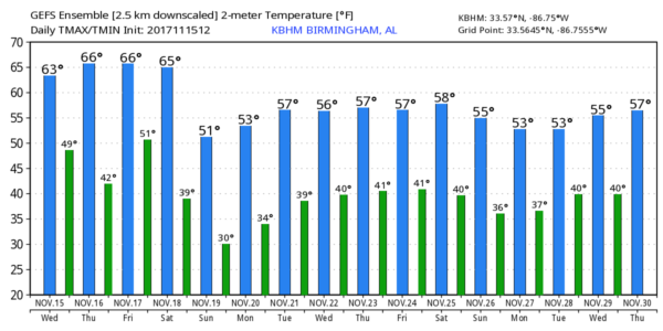
TOMORROW/FRIDAY: These two days will be dry with a good supply of sunshine along with highs mostly in the upper 60s. We note Friday morning will be cold; latest data suggests temperatures will drop into the mid 30s with a good chance of frost; colder spots will see a freeze.
THE ALABAMA WEEKEND: Clouds increase Saturday ahead of a cold front, and a band of showers will move through the state late in the day into Saturday night. We still believe the main threat of rain comes from about 4:00 p.m. Saturday through 6:00 a.m. Sunday. No threat of severe weather, probably no thunder, and rain amounts generally under 1/2 inch. Then, the sky becomes mostly sunny Sunday, but the day will be breezy and cool with a high in the 50s.
Sunday night will be cold; a freeze is likely Monday morning with lows in the 26-32 degree range.
FOOTBALL WEATHER: For high school playoff games Friday night, the weather looks pleasant and dry with temperatures falling from the mid 60s at kickoff, into the upper 50s by the final whistle.
Saturday, Alabama hosts the Mercer Bears at Bryant-Denny Stadium (11a CT kickoff)… the sky will be mostly cloudy, and we will mention just a small chance of a shower during the second half of the game. Best chance of showers in Tuscaloosa should come after 4:00 p.m. Temperatures will be in the 60s.
Auburn will host Louisiana-Monroe Saturday at Jordan-Hare Stadium (11a CT kickoff)… Mostly cloudy but dry; best chance of rain in Auburn comes after 6:00 p.m. Temperatures will also be in the 60s.
UAB will be down in Gainesville to take on the Florida Gators (3p CT kickoff)… the sky will be mostly sunny with a kickoff temperature near 80 degrees at kickoff… dropping back into the mid 70s by the second half.
THANKSGIVING WEEK: Monday and Tuesday will be dry; beyond that forecast confidence drops considerably. The latest GFS suggests we will need to mention a chance of showers Wednesday, but other runs have been dry for the northern two-thirds of the state. And, very cold air will move southward into the continental U.S. late in the week, but exactly when that reaches Alabama remains up for grabs. The new GFS is much slower, but we will continue to forecast colder weather for our state late in the week. We will be able to be much more specific this weekend; see the Weather Xtreme video for maps, graphics, and more details.
BEACH FORECAST: Click here to see the AlabamaWx Beach Forecast Center page. The Beach Forecast is partially underwritten by the support of Brett/Robinson Vacation Rentals in Gulf Shores and Orange Beach. Click here to see Brett/Robinson’s Hot Deals now!
WEATHER BRAINS: Don’t forget you can listen to our weekly 90 minute netcast anytime on the web, or on iTunes. This is the show all about weather featuring many familiar voices, including our meteorologists here at ABC 33/40.
CONNECT: You can find me on all of the major social networks…
Facebook
Twitter
Google Plus
Instagram
Pinterest
Snapchat: spannwx
Look for the next Weather Xtreme video here by 7:00 a.m. tomorrow…
Category: Alabama's Weather, ALL POSTS, Weather Xtreme Videos
About the Author (Author Profile)
James Spann is one of the most recognized and trusted television meteorologists in the industry. He holds the AMS CCM designation and television seals from the AMS and NWA. He is a past winner of the Broadcast Meteorologist of the Year from both professional organizations.Subscribe
If you enjoyed this article, subscribe to receive more just like it.


