Strong Storms Entering The Northwest Corner Of Alabama
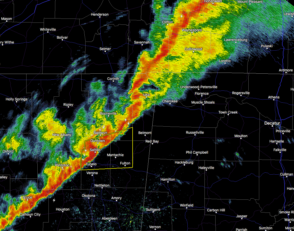
At 4:21 PM CST, Doppler radar was tracking strong thunderstorms along a line extending from near Walnut Grove to near Burton in Mississippi. Movement was east at 40 mph. Wind gusts up to 50 mph will be possible with these storms.
Therefore, a SIGNIFICANT WEATHER ADVISORY had been issued until 4:45 PM for Western Lauderdale and Western Colbert Counties.
Locations impacted include…
J.P. Coleman State Park, Cherokee, Waterloo, Malone, Posey Loop, Allsboro, Wright, Riverton, Oakland and Red Rock.
Strong gusty winds will be capable of knocking down small tree limbs along with other small unsecured items. Seek safe shelter until this line of storms has passed.
Category: Alabama's Weather, ALL POSTS
About the Author (Author Profile)
Scott Martin is an operational meteorologist, professional graphic artist, musician, husband, and father. Not only is Scott a member of the National Weather Association, but he is also the Central Alabama Chapter of the NWA president. Scott is also the co-founder of Racecast Weather, which provides forecasts for many racing series across the USA. He also supplies forecasts for the BassMaster Elite Series events including the BassMaster Classic.Subscribe
If you enjoyed this article, subscribe to receive more just like it.


