Severe Weather Threat Has Ended For North/Central Alabama
The isolated severe weather threat has ended for all of Central Alabama, but we could still see wind gusts of 40-50 MPH along and ahead of the squall line that may continue to bring down trees and power lines. There may be a few significant weather advisories issued by the National Weather Service, but Severe Thunderstorm Warnings will be highly unlikely.
At this point of the evening, Alabama Power is reporting 26,000 people statewide without power… 13,700 around Birmingham, 10,400 in the western parts of the state, and 2,300 in the east. Damage reports are coming in from all over North/Central Alabama, mainly from downed trees and power lines. Up in Florence, a roof was blown off of the Advanced Auto Parts store on Cloverdale Road, along with damage to several windows. Two minor injuries were reported from inside the store. So far, that is the only report seen with injuries. A few houses in Moulton sustained roof damage as well.
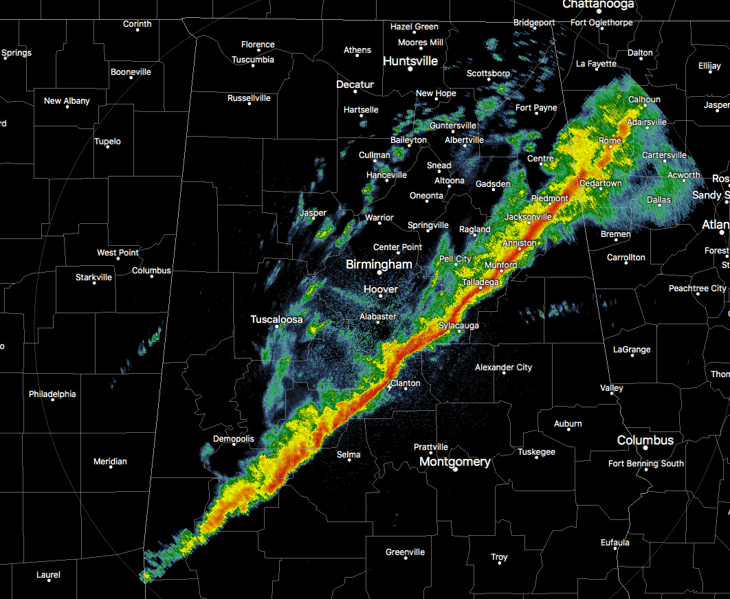
The line has completely moved out of the North Alabama area, and currently stretches from Piedmont to Oxford to Sylacauga to Sweet Water. There are a few lingering showers or sprinkles behind the main line, but those will quickly move through. The main line will be out of Central Alabama and into Georgia by 11PM-12AM and the lingering post-frontal showers and sprinkles about 1 hour later.
Category: Alabama's Weather, ALL POSTS
About the Author (Author Profile)
Scott Martin is an operational meteorologist, professional graphic artist, musician, husband, and father. Not only is Scott a member of the National Weather Association, but he is also the Central Alabama Chapter of the NWA president. Scott is also the co-founder of Racecast Weather, which provides forecasts for many racing series across the USA. He also supplies forecasts for the BassMaster Elite Series events including the BassMaster Classic.Subscribe
If you enjoyed this article, subscribe to receive more just like it.


