Mild for Today and Monday
Mild weather for early December will continue for Central Alabama today and Monday, but there is still the big pattern change projected to occur at midweek.
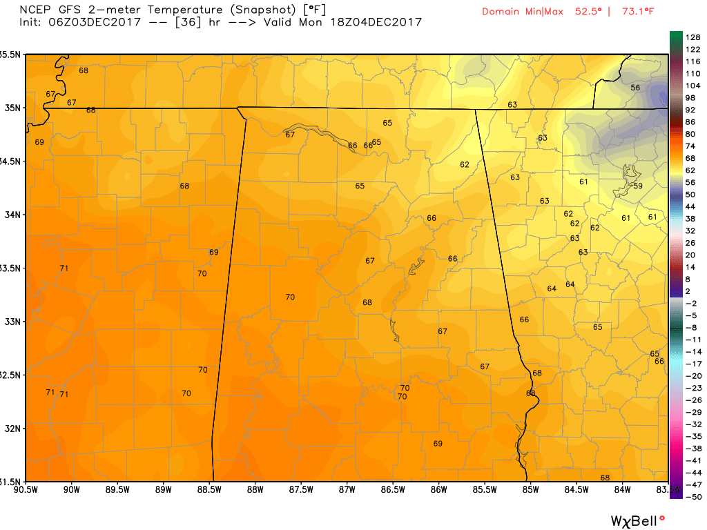
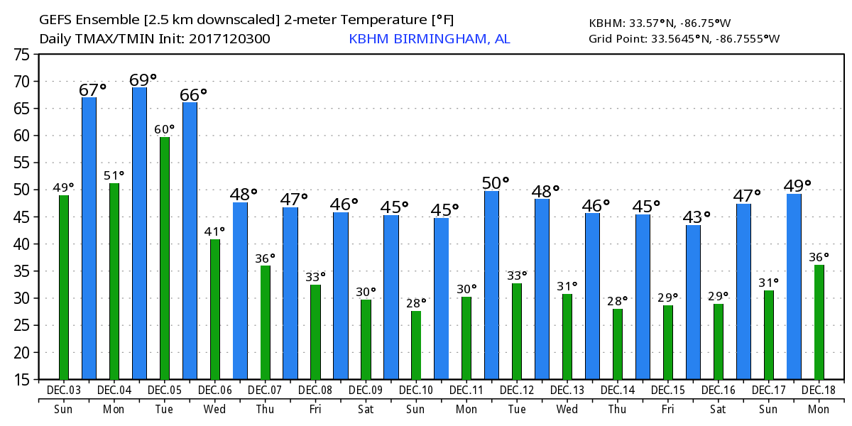
Fog was an issue once again this morning. Visibilities were reduced to below a mile at many locations across the Southeast US with dense fog advisories stretching from Georgia and East Tennessee to Southeast Texas. Much like yesterday we should see the fog lift into a low cloud layer as the morning goes by, but by late morning and afternoon we should see lots of sunshine. Looks like with the combination of a clear sky and the upper ridge we should see the highs climb into the middle and upper 60s.
Monday we should remain mild as the upper ridge slides off to the east of us with the upper short wave gathering strength coming out of the northern Rockies. This trough is forecast to carve out a broad trough over the eastern half of the country by Wednesday. Strong short wave impulses rotating through the broad trough will help to reinforce the eastern US troughiness and provide additional shots of cold air. Monday, however, will be another mild day with the highs for Central Alabama likely to hit the 70-degree mark in many locations.
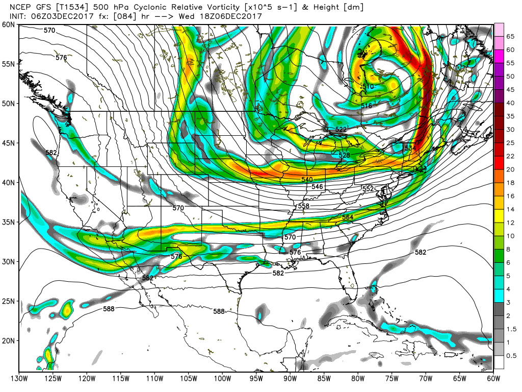
The surface low will move into Canada just north of the Great Lakes on Tuesday with the cold front trailing from western New York southwestward into the Lower Mississippi River Valley. Rain with some embedded thunderstorms will occur along and just ahead of the front. As we saw yesterday, the main run chances for Central Alabama will come from noon on Tuesday into early Wednesday. Looks like the front will be moving briskly and will clear Alabama by sunrise on Wednesday. Then the bottom drops out of the temperatures. The highs Tuesday will vary a great deal with many areas to the southeast of Birmingham getting into the middle and upper 60s. But for areas to the northwest of Birmingham, the frontal passage will cap the temperature rise holding temperatures to the upper 50s or lower 60s.
SPC is outlooking an area ahead of the front in Missouri and Arkansas on Day 2 for a marginal risk for severe storms. Day 3 as the front makes its way into Alabama, the SPC outlook only includes thunderstorms. As you’ll see in the video, CAPE values are sufficient for some embedded thunderstorms, but the risk for severe weather for Alabama is pretty low.
By Wednesday an upper broad trough will be established over the eastern US as seen in the chart immediately below. Temperature forecasts for Wednesday will be challenging. Cold air advection will be strong, so it looks like we could see one of those days where the temperatures actually fall for a good portion of the day with the highs occurring in the very early morning hours while the lows occur right before midnight. Instead of forecasting highs and lows, I think the day will see temperatures mainly in the 40s.
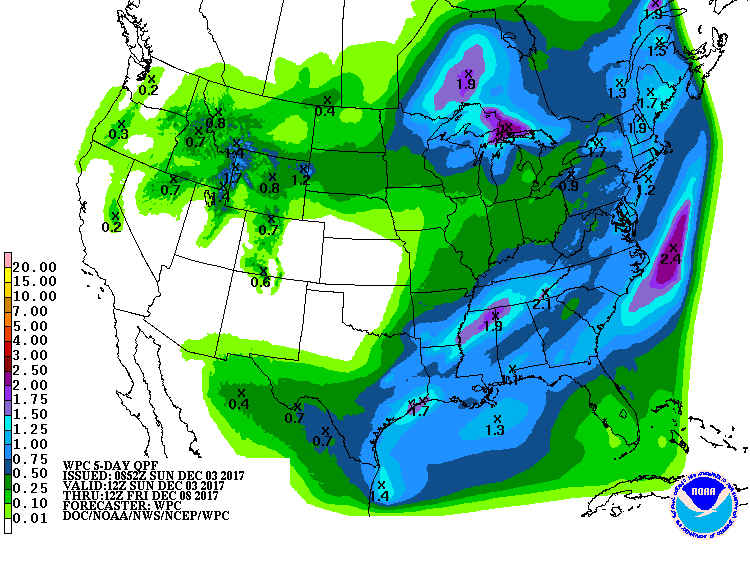
Drought conditions have returned to a large portion of Alabama since we did not see any significant rain events in November. This front will be moving fairly quickly, so we probably will not see any large rainfall totals with this system. But it does look like there will be enough moisture for us to see widespread rain amounts of one half to three-quarters of an inch. Some spots may see rainfall amounts around one to one and a quarter inches with the strong storms.
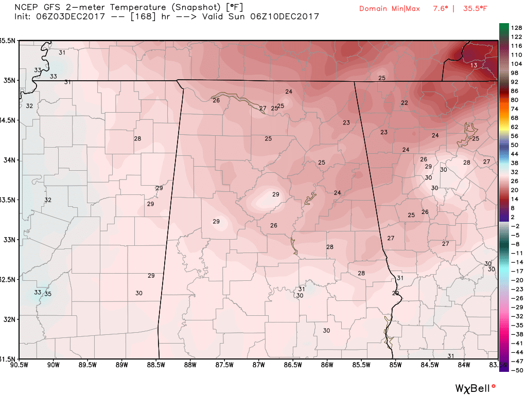
From Thursday through Sunday, the upper trough established on Wednesday will see a parade of strong short waves rotating through the trough as each short wave helps to reinforce the cold air grip on the eastern US. Thursday and Friday will be chilly days with lows around 30 and highs in the lower 50s. These temperatures are 6 to 8 degrees below the 30-year seasonal averages for early December. By Saturday and Sunday, it will be downright cold with morning lows in the 20s and afternoon highs only in the upper 30s to lower 40s. The GFS MOS guidance table paints a 21-degree low for Sunday morning. Those disturbances may eke out a few snow flurries across extreme northern Alabama, but moisture will be very limited so nothing really serious is expected.
Looking out into voodoo country, the cold pattern with the trough in the East remains in place all the way out to the 16th of December. But the GFS is advertising another pattern change as riding develops around the 18th of December. It is just a gut feeling here, but the ridge is not terribly strong, so I can’t help but believe that the ridge pattern will not last long and we return to the cold pattern of an eastern US trough. But that goes way behind even voodoo country.
Beach Forecast: Click here to see the AlabamaWx Beach Forecast Center page. The Beach Forecast is partially underwritten by the support of Brett/Robinson Vacation Rentals in Gulf Shores and Orange Beach. Click here to see Brett/Robinson’s Hot Deals now!
WEATHER BRAINS: Don’t forget you can listen to our weekly 90 minute netcast anytime on the web, or on iTunes. This is the show all about weather featuring many familiar voices, including our meteorologists here at ABC 33/40.
Thanks for visiting the blog. I had a wonderful time emceeing the Christmas Parade in Helena yesterday. It was a great parade and my hat is off to the committee that makes it all happen. It was also nice that the weather was perfect with sunshine and temperatures in the middle 60s. I will be filling in again this evening for Charles Daniel on ABC 3340 News at 5 and 10 pm, so be sure to tune in for the latest forecasts. James Spann will be back with the next edition of the Weather Xtreme Video bright and early Monday. Have a great day and enjoy the last couple of mild days. Godspeed.
-Brian-
Category: Alabama's Weather, ALL POSTS
About the Author (Author Profile)
Brian Peters is one of the television meteorologists at ABC3340 in Birmingham and a retired NWS Warning Coordination Meteorologist. He handles the weekend Weather Xtreme Videos and forecast discussion and is the Webmaster for the popular WeatherBrains podcast.Subscribe
If you enjoyed this article, subscribe to receive more just like it.


