The Last Midday With Mild Temperatures For A Little While
THE GREAT TEMPERATURE DIVIDE
Be sure to enjoy as much of this mild weather that we’ll have throughout the remainder of the day because the highs throughout the rest of the week will be drastically cooler. Here is a good example…
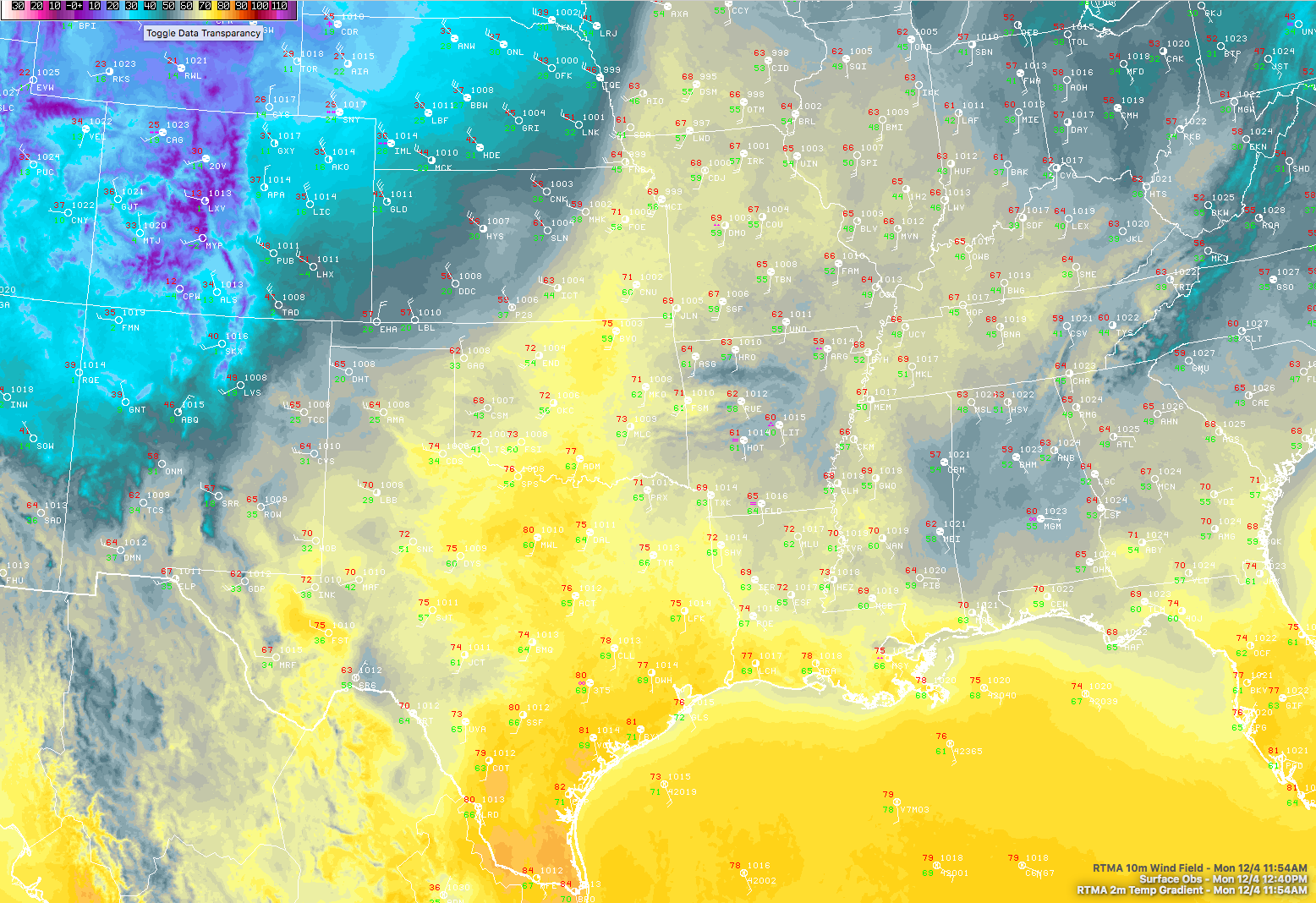
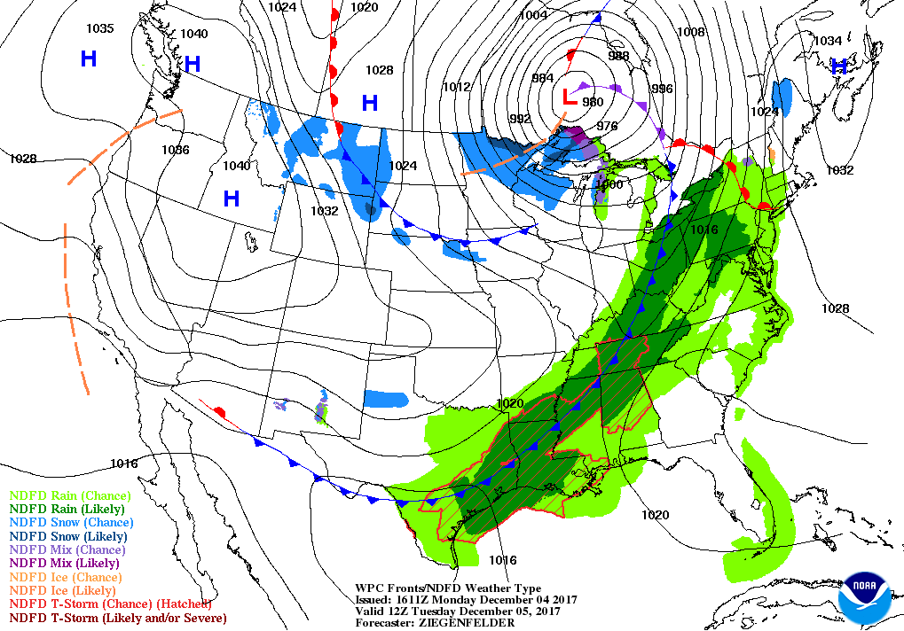
These are the latest observations taken at 12:40 PM from across the middle of the country, and as you can see there is a big difference just a few miles on either side of the cold front that is currently draped over western Iowa down into Kansas, Oklahoma, and Texas. Right now it is 71 degrees in Chanute, Kansas (southeastern part of the state), while at the same time in Woodland (northwest corner) it is currently 42 degrees. That colder air will begin to move into Central Alabama on Tuesday and will stay around for the remainder of the week and weekend.
CONDITIONS IN CENTRAL ALABAMA AT 12:55 PM
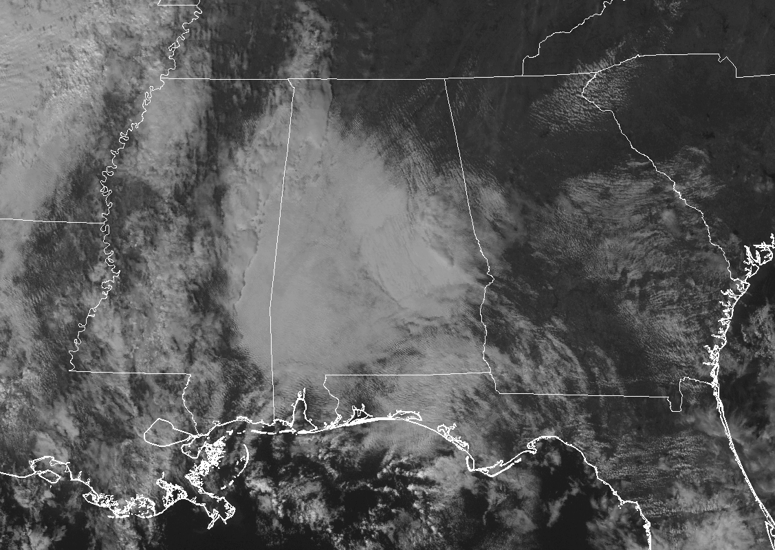
We are currently blanketed with clouds for the most part as we approach the 1:00 PM hour, with the exception of the northeastern corner of the area. This cloud cover is holding the temperatures back a little, with mid-50s to the mid-60s showing up across the area.
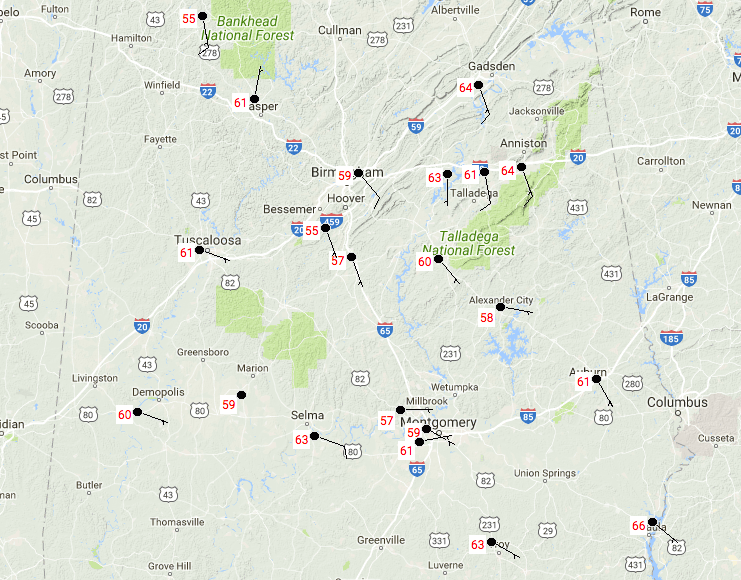
The warmer temperatures at this point are where there are fewer clouds, especially over the Gadsden and Anniston areas, where they are both sitting at 64 degrees. Birmingham is currently at 59 degrees, while the warm spot is currently Eufaula at 66 degrees.
WEATHER FOR THE REST OF YOUR MONDAY
Clouds will break up a little for the afternoon hours, but skies will remain partly to mostly cloudy throughout Central Alabama. Afternoon highs should top out in the mid-60s to the lower 70s, but the clouds could keep some of the highs down in the lower 60s. The cold front will begin its approach to the area tonight and more clouds will begin to roll in. We could have a few scattered light showers move into the northwestern parts of the area before midnight, but more numerous showers and a few thunderstorms will begin to move into that part of the area during the pre-dawn hours on Tuesday. Overnight lows will only fall into the mid-50s to at or just over 60 degrees.
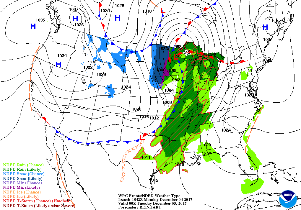
THE BIG DAY OF CHANGE ON TUESDAY
By daybreak on Tuesday morning, the cold front should be entering or have already entered the northwest corner of the state. We can expect numerous showers and a few rumbles of thunder possible throughout the progression of the front through Central Alabama. The highs will be reached for communities west of I-59 and I-20/59 before noon, and during the main heating of the day for the rest. As soon as the front passes your location, expect for the temperatures to start a quick and steady decline throughout the remainder of the day. Highs will range from the lower 60s to the mid-70s across the area. Rain chances will continue behind the front for a little while, but most, if not all, rain activity should be limited to the southern half of the area before daybreak on Wednesday. Rainfall totals look to be in the 1/2 to 1-inch range for much of Central Alabama, with higher totals up in the extreme northern parts of the area. Lows will be in the mid-30s to the mid-40s.
THE BEACH FORECAST
Be sure to keep up to date with the detailed forecasts from Fort Morgan over to Panama City Beach with the AlabamaWx Weather Blog. Click here to see the AlabamaWx Beach Forecast Center page. The Beach Forecast is partially underwritten by the support of Brett/Robinson Vacation Rentals in Gulf Shores and Orange Beach. Click here to see Brett/Robinson’s Off-Season Deals now!
ON THIS DAY IN WEATHER HISTORY
2002 – An early season winter storm brought an expansive shield of snow and ice through much of the eastern U.S., from the lower Ohio Valley, southern Appalachians and into the Northeast. Snow accumulations of 4-8 inches were common along the northern edge of the precipitation shield, while a significant accrual of glaze occurred in the Carolinas. The storm caused at least 17 fatalities, mostly from traffic accidents. In the Carolinas, electric utility provider Duke Power characterized the ice storm as the worst in the company’s history, with 1.2 million customers or nearly half its entire customer base without power on the morning of the 5th. This surpassed electrical outages inflicted by Hurricane Hugo as it swept through the central Carolinas in September 1989.
WEATHERBRAINS
Check out the show at www.WeatherBrains.com. You can also subscribe via iTunes. You can watch the show live at live.bigbrainsmedia.com. You will be able to see the show on the James Spann 24×7 weather channel on cable or directly over the air on the dot 2 feed.
Category: Alabama's Weather, ALL POSTS
About the Author (Author Profile)
Scott Martin is an operational meteorologist, professional graphic artist, musician, husband, and father. Not only is Scott a member of the National Weather Association, but he is also the Central Alabama Chapter of the NWA president. Scott is also the co-founder of Racecast Weather, which provides forecasts for many racing series across the USA. He also supplies forecasts for the BassMaster Elite Series events including the BassMaster Classic.Subscribe
If you enjoyed this article, subscribe to receive more just like it.


