Thursday Night Update For Friday’s Wintry Weather Event
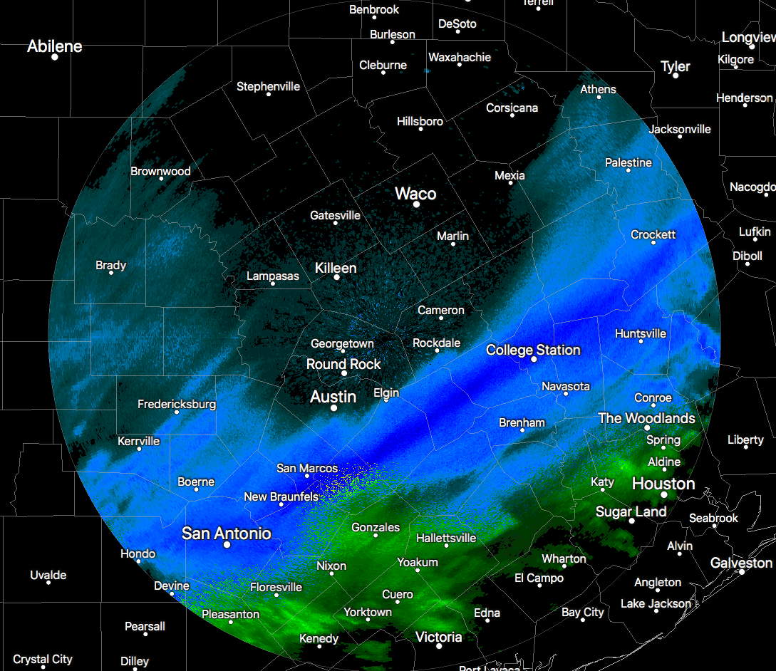
As we have now entered the 8 o’clock hour here in Central Alabama, we are now starting to get a good look at the system that will bring us some rain, some snow, and a rain/snow mix. It’s amazing that back in the southeastern part of Texas it is snowing decently, with some heavier snow showers reported from San Antonio up to College Station. Winter Weather Advisories and Winter Storm Warnings are in effect for a good bit of southern Texas as they are expecting 1 to 3 inches of wet snow, which could cause slushy roads and slick spots on bridges and overpasses. This is what is headed to Central Alabama starting tomorrow morning.
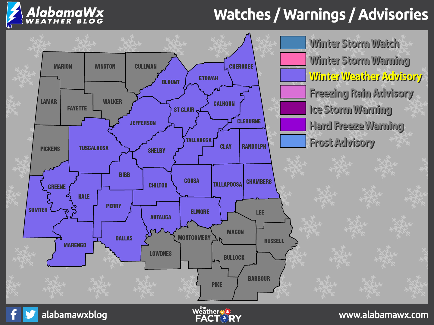
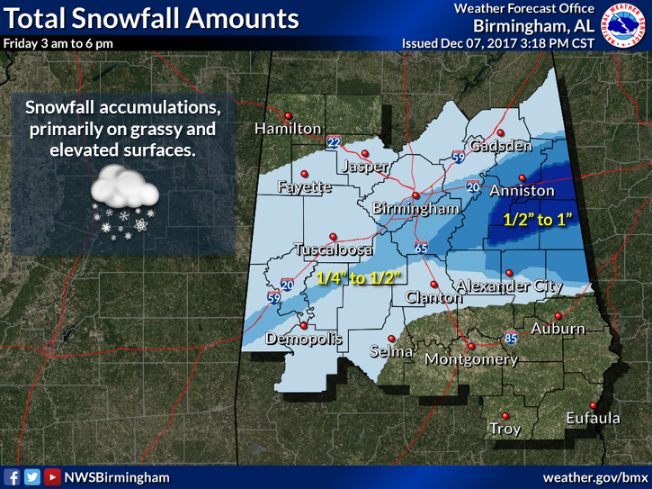
In Central Alabama, a Winter Weather Advisory goes into effect starting at 3:00 AM on Friday morning and the expected expiration time is 6:00 PM Friday evening. It continues to look that accumulations will be around 1-inch or less, with that occurring mostly on grassy areas and elevated surfaces. I wouldn’t be surprised if a deformation axis sets up and leaves a swath of locally heavier accumulations, but there is no way to tell where that will be until the event gets here.
We have to remember that some people will have disappointment and some will be surprised. Not everyone in the advisory will see snow, as some on the northern periphery may see nothing at all, while on the south end may only see rain.
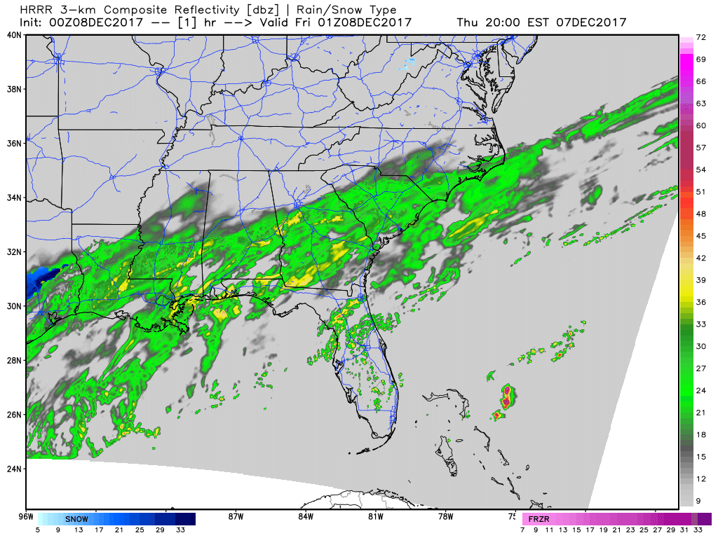
HRRR Simulated Radar through noon tomorrow.
TIMING
A mix of rain, sleet, and snow will start to move into Central Alabama right around the 12:00 AM – 2:00 AM time frame and change to mostly snow by the 4:00 AM – 6:00 AM time frame as a very cold airmass works slowly to the south. The best chances for heavier snowfall should occur from 5:00 AM to 12:00 PM before the precipitation starts to taper off and change mostly back to rain, with some sleet mixed in.
IMPACT
Temperatures will be in the upper 20s to the mid-30s throughout Central Alabama at the start of the morning, so there could be a few icy spots on bridges and overpasses. As the temperatures slowly climb into the mid to upper 30s for the late morning and afternoon hours, any icy spots should melt. Just remember that we’ll be going back well below freezing tomorrow night starting as early as 6:00 PM in the north. Any water that lingers on the roadways could freeze, causing “Black Ice” issues that could linger well into Saturday morning.
Keep up to date throughout the evening tonight and through the day as surprizes usually happens during winter weather events in Central Alabama. Just as James Spann said earlier, “Any forecast that is 6 hours old is bad information.” We’ll keep you posted on the blog.
Category: ALL POSTS, Winter Weather
About the Author (Author Profile)
Scott Martin is an operational meteorologist, professional graphic artist, musician, husband, and father. Not only is Scott a member of the National Weather Association, but he is also the Central Alabama Chapter of the NWA president. Scott is also the co-founder of Racecast Weather, which provides forecasts for many racing series across the USA. He also supplies forecasts for the BassMaster Elite Series events including the BassMaster Classic.Subscribe
If you enjoyed this article, subscribe to receive more just like it.


