The Snow Of December 8, 2017
Yesterday’s snow across Central Alabama was the biggest one for so early in the season. Data is still being compiled, but for Birmingham, with an official total of 4 inches, it was the third snowiest December day on record. Only surpassed by 8 inches during the famous New Year’s Eve event on December 31, 1963… and 5.5 inches on December 22, 1929.
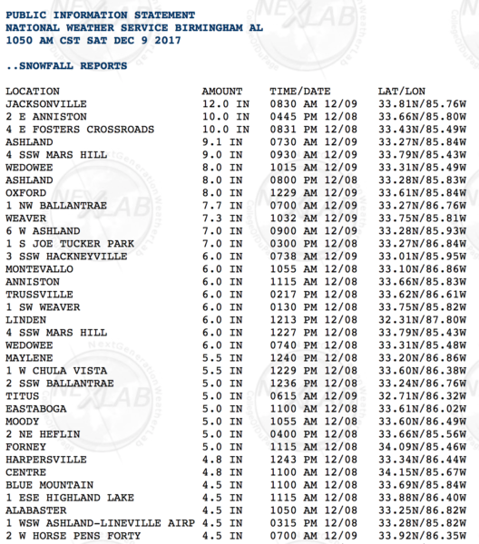
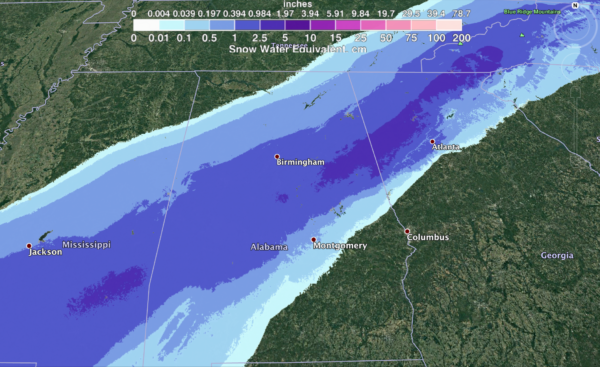
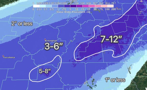
NWS data reveals up to one foot of snow over parts of East Alabama.
At one point approximately 50,000 were without power due to the weight of the wet snow pulling down limbs and branches.
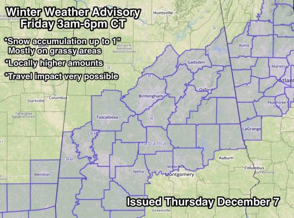
THE FORECAST LEADING UP TO THE DAY: While the placement of the snow was excellent in the forecast, snow amounts were woefully under-forecast. About 24 hours before the event, a Winter Weather Advisory was issued by NWS Birmingham, suggesting snow amounts up to 1 inch, with isolated heavier totals.
During the pre-dawn hours Friday, the NWS upgraded the Winter Weather Advisory to a Winter Storm Warning, for potential of 1-3″ of snow…
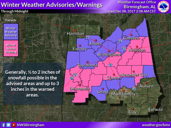
The forecast 1-3″ of snow become 4-12″ across the warned area by Friday evening. Thankfully, in most areas roads remained just wet and travel was not impacted seriously. Of course, there were exceptions in East Alabama in the zone of the heaviest snow.
And, most all school systems in the “snow zone” started the day with a two hour delay, which was a great call. They were able to call off classes for the day when it became obvious that this was turning into something bigger.
WHAT WENT WRONG: Bottom line is that the computers beat the humans this time. Trust me, it doesn’t work this way often, but sometimes it happens. The high resolution 3 km NAM model looked like this on the 12Z run the day before the event (Thursday December 7)…
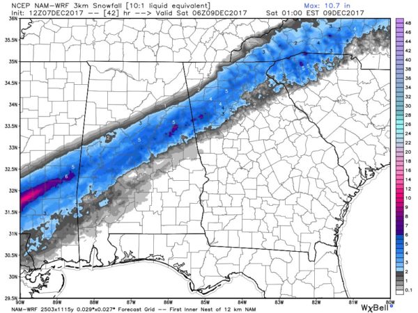
The model showed 3-6 inch totals, but still nothing nearing a foot.
The reasoning behind the original 1″ or less forecast…
*Soil temperatures across Central Alabama were in the low 50s; this always leads to lower accumulations due to melting.
*Higher precipitable water values were expected to be over the southern half of the state. Accordingly, snow rates were not expected to be high enough across Central Alabama to overcome the warm ground temperatures.
*Climatology doesn’t support a big snow in Alabama in early December. Odds of something like this so early in the season are extremely low.
LESSONS LEARNED: Quit look at model output and actually look at observed weather upstream. The system over performed with snow amounts in Texas Thursday night, and that should have given us a good clue we were in for more than we bargained for. And, don’t be so arrogant to think that humans can beat the models every time.
I often tell the young interns, and new atmospheric science graduates that this business will teach you humility, no matter how smart you think you are. This one is just another example, yet at the same time, another opportunity to learn. I am sure there will be many research papers on this event in months and years to come.
Category: Alabama's Weather, ALL POSTS, Winter Weather
About the Author (Author Profile)
James Spann is one of the most recognized and trusted television meteorologists in the industry. He holds the AMS CCM designation and television seals from the AMS and NWA. He is a past winner of the Broadcast Meteorologist of the Year from both professional organizations.Subscribe
If you enjoyed this article, subscribe to receive more just like it.


