Dry with Relatively Cold Temperatures
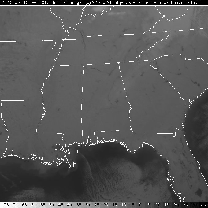
The view from the satellite this morning showed a clear sky across all of the Southeast US. Early morning temperatures were in the 20s across nearly all of Alabama with the exception of Mobile and Dothan.
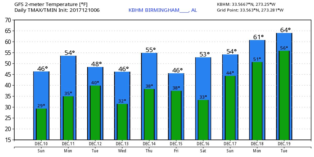
We will see plenty of sunshine today that will kill off any remaining snow. The deep upper trough remained in place, so it is going to remain chilly, but the sunshine should help to propel temperatures into the upper 40s. The high Saturday in Birmingham was only 43 degrees.
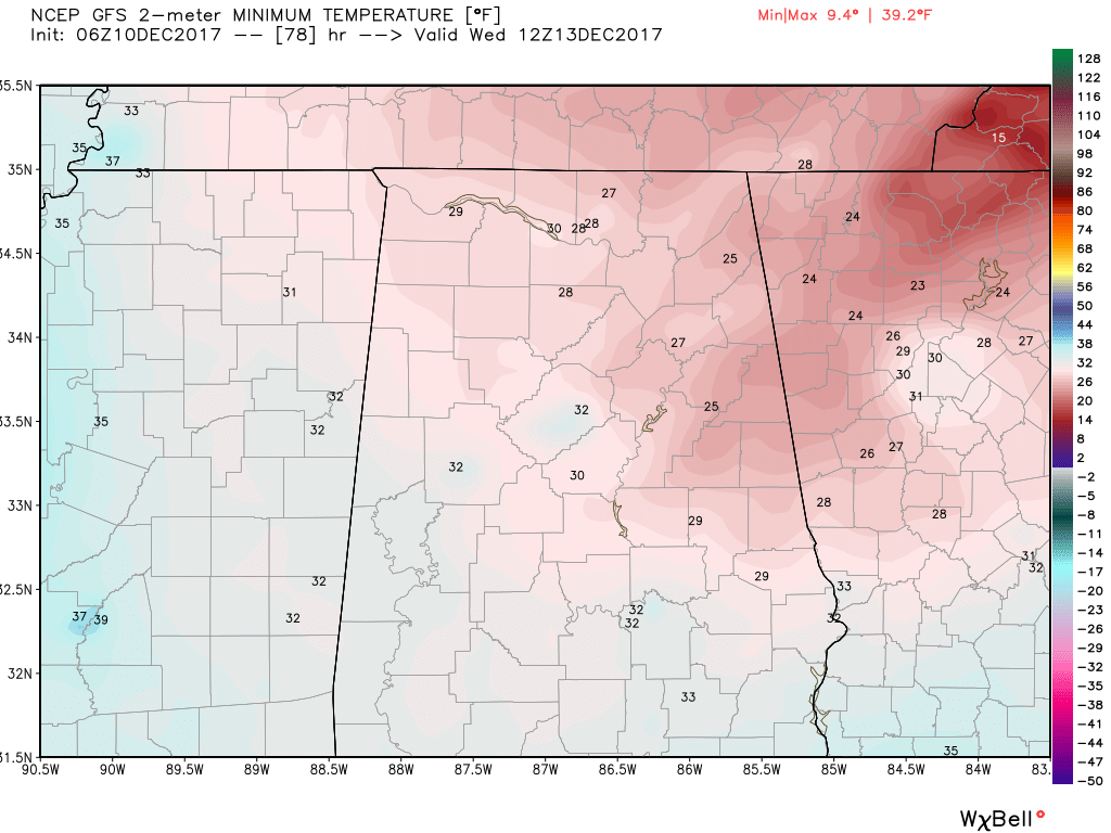
Two fast moving short waves over the North Central US will impact us on Tuesday as they move quickly through the deep upper trough that has set up over the eastern US. Those upper troughs will bring a dry cold front through Alabama during the early morning Tuesday. I think it is quite possible that we once again do not see the afternoon highs climb out of the 40s. The cold air intrusion will be responsible for sending the morning lows Wednesday below freezing once again.
Another fast moving short wave over northern Missouri at midday on Wednesday will move across the Southeast US late Wednesday heading out into the Atlantic on Thursday morning. This will reinforce the cold air keeping highs Wednesday to near 50. But hold on, yet another short wave over the Dakotas at midday on Thursday will bring more cold air to the Southeast US as it digs into the bottom of the trough on Friday. MOS guidance paints a 59 high for Friday, but I think a high much closer to 50 degrees is likely.
Saturday and Sunday the upper air pattern begins to shift into a ridge as a strong closed low digs into southern California. This helps to pump up a weak ridge on Saturday as highs climb toward the 60-degree mark. The closed low over southern California will detach from the short wave moving through the Great Lakes on Sunday, so Sunday should see temperatures much like Saturday. The southwesterly flow aloft could bring enough moisture into the Gulf Coast area to produce some scattered showers, but we’re verging on voodoo country, so I’m not going to introduce showers into the forecast just yet.
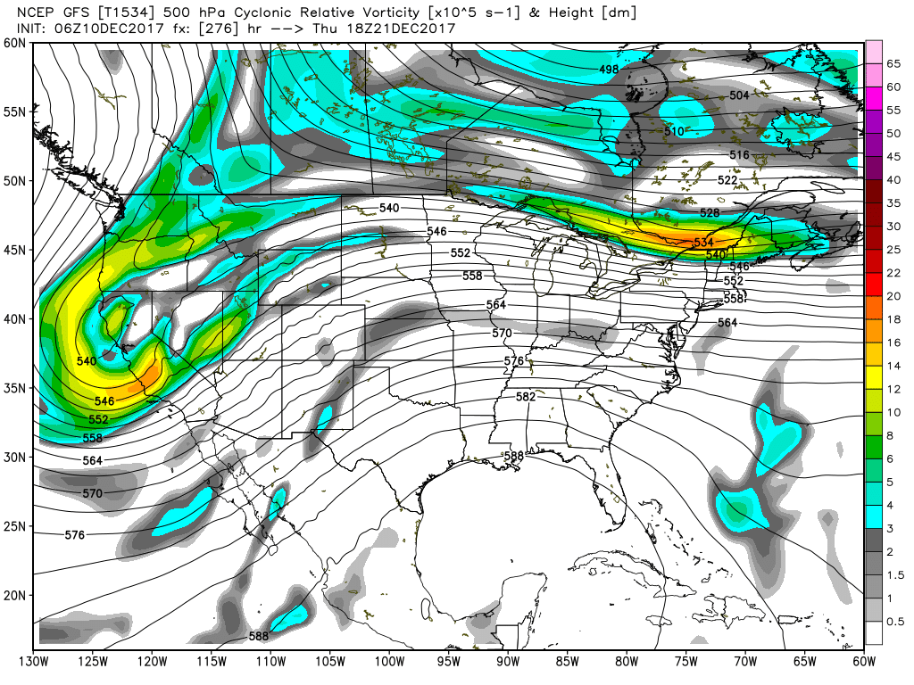
Speaking of voodoo country, the GFS has flipped on us from the run yesterday morning. The latest run projects a fairly substantial upper ridge for the Southeast US from the 19th through the 23rd when a strong impulse reestablishes the trough over the eastern US by the 25th. We could see some precipitation coming with this change leading up to Christmas, but it looks like Christmas will be dry and somewhat chilly.
Beach Forecast: Click here to see the AlabamaWx Beach Forecast Center page. The Beach Forecast is partially underwritten by the support of Brett/Robinson Vacation Rentals in Gulf Shores and Orange Beach. Click here to see Brett/Robinson’s Hot Deals now!
WeatherBrains: Don’t forget you can listen to our weekly 90 minute netcast anytime on the web, or on iTunes. This is the show all about weather featuring many familiar voices, including our meteorologists here at ABC 33/40.
Thanks so much for tuning into the Weather Xtreme Video. After hopefully getting some rest over the weekend, James Spann will have the next video first thing on Monday morning. I hope you have a great day. Stay warm and Godspeed.
-Brian-
Category: Alabama's Weather, ALL POSTS
About the Author (Author Profile)
Brian Peters is one of the television meteorologists at ABC3340 in Birmingham and a retired NWS Warning Coordination Meteorologist. He handles the weekend Weather Xtreme Videos and forecast discussion and is the Webmaster for the popular WeatherBrains podcast.Subscribe
If you enjoyed this article, subscribe to receive more just like it.


