A Late Tuesday Night Look At Wednesday’s Possible Severe Weather
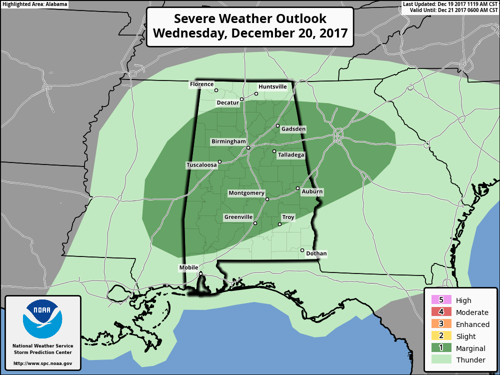
Nearly all of Central Alabama, with the exception of the extreme southeastern corner of the area, has been defined in a Marginal Risk for severe storms during the day on Wednesday. The latest update continues to have the main threat as isolated damaging thunderstorm winds up to 60 MPH, with a smaller threat of a brief tornado or two within a squall line that will be making its way through the area. The latest HRRR model run has the squall line moving through Central Alabama earlier than what we are forecasting, but the main window for strong to severe storms will be from 4AM-3PM Wednesday. Here is what the latest HRRR says…
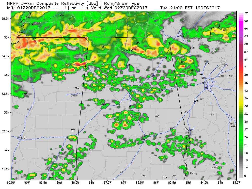
HRRR simulated radar through 1PM CST Wednesday.
The window for stronger to marginally severe storms to start in Central Alabama will be around 4AM-6AM in the northwestern parts of the area (including Hamilton, Sulligent, Guin, and Vernon). By 5AM-6AM, the main line will be affecting the cities of Cullman to Jasper to Gordo to Aliceville, and eventually making it into Tuscaloosa, Birmingham, Trussville, and Gadsden just one hour later (6AM-7AM). The line will continue across the area and eventually reach the Selma, Clanton, Sylacauga, and Heflin areas by 8AM-10AM time frame. The strongest part of the line will exit the state before the noon hour. There is a risk of a few stray storms lingering behind the main squall line that could be strong, but the main severe risk in those will be for brief gusty winds.
Much of the instability (CAPE) throughout the morning will be along and south of the I-20 corridor until the main squall line passes through the area before those values increase during the early afternoon. Helicity values will be highest ahead and along the squall line as it moves through the area, and along with decent low-level shear, the possibility is there for a brief spin-up tornado or two (even though the threat looks rather low at this point). The Significant Tornado Parameter values along and ahead of the squall line stay below 1.0 throughout the morning, but it does increase during the early afternoon hours as the line pushes into Georgia. This is really looking more like an isolated damaging wind event.
Winds will be breezy after the passing of the squall line due to a tight pressure gradient, perhaps with gusts as high as 25 MPH, but winds shall stay below Wind Advisory criteria.
Be sure to have your smartphones charged and your place of safety and supplies ready to go, just in case a warning is issued for your location. This is a low-end severe weather threat, but with thunderstorms, you have to expect the unexpected. I’ll be manning the blog throughout the day on Wednesday with updates, along with James Spann and his Weather Xtreme posts. Have a great Tuesday night.
Category: Alabama's Weather, ALL POSTS
About the Author (Author Profile)
Scott Martin is an operational meteorologist, professional graphic artist, musician, husband, and father. Not only is Scott a member of the National Weather Association, but he is also the Central Alabama Chapter of the NWA president. Scott is also the co-founder of Racecast Weather, which provides forecasts for many racing series across the USA. He also supplies forecasts for the BassMaster Elite Series events including the BassMaster Classic.Subscribe
If you enjoyed this article, subscribe to receive more just like it.


