A Quick Check On Our Weather Situation At 2:30 AM
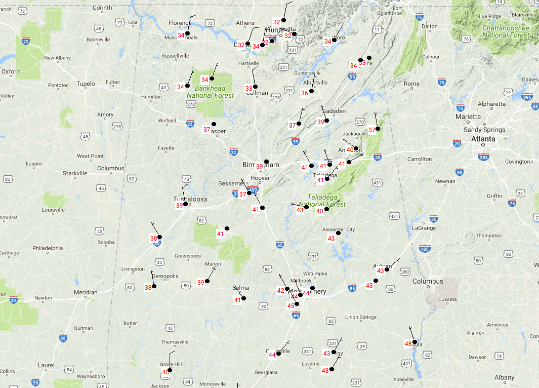
So far, we have good news at this point with no travel issues and all reporting stations south of the Tennessee River above freezing at this point. Temperatures at 2:15 AM are running in the 33-40 degree range in the extreme northern parts of Central Alabama north of the I-20 corridor. There have been reports of sleet falling in some locations in this general area, but no icing reported at this point.
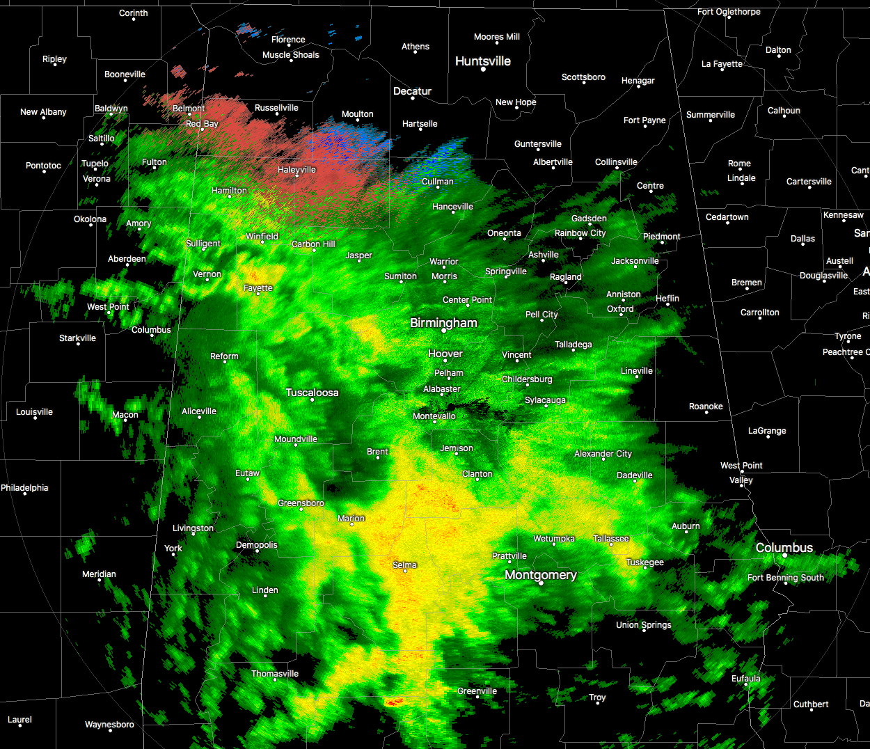
Looking at the latest radar image a 2:13 AM, a mix of rain and sleet is falling on the northern periphery of the rain shield in portions of Marion, Winston, Franklin, and Lawrence counties. There could be a few snowflakes mixed in, especially in Lawrence and Cullman counties. No accumulations are taking place as surface air temperatures are above freezing, but a few icy spots on bridges and overpasses could be an issue when those temperatures drop below 32 degrees.
Looking at the latest HRRR model run, temperatures in the extreme northern parts of the area (mainly Marion, Winston, and Cullman counties) will eventually dip into the 29-31 degree range only for a few hours this morning before sunrise. Some of the precipitation on radar may not be reaching the ground up in that part of the area, so the National Weather Service has decided that an advisory is not necessary at the moment. There could be a few slick spots on bridges and overpasses, so if you have to travel, please use caution.
As far as everyone south of a line from Sulligent to Carbon Hill to Locust Fork to Piedmont, there will be no travel problems as low temperatures are expected to stay above freezing for the rest of the morning.
Category: Alabama's Weather, ALL POSTS
About the Author (Author Profile)
Scott Martin is an operational meteorologist, professional graphic artist, musician, husband, and father. Not only is Scott a member of the National Weather Association, but he is also the Central Alabama Chapter of the NWA president. Scott is also the co-founder of Racecast Weather, which provides forecasts for many racing series across the USA. He also supplies forecasts for the BassMaster Elite Series events including the BassMaster Classic.Subscribe
If you enjoyed this article, subscribe to receive more just like it.


