A Late Night Look at Alabama’s Weather
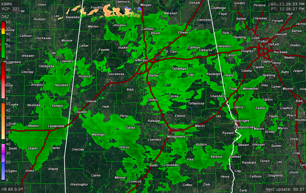
The first wave of precipitation is swinging eastward through North and East Alabama at this hour. On its northern extent, the precipitation is falling as sleet and a few snowflakes across Franklin, Lawrence and Morgan Counties. The blue echoes are snow and the peach ones are sleet.
Another wave of light rain is pushing northeastward out of Central Mississippi now. It is moving into Lamar, Pickens, Greene and Sumter Counties.
Temperatures are in the lower to middle 30s across North Alabama. In the US-278 corridor, readings include 36 at Haleyville and Cullman and 37 at Albertville.
In the I-20 corridor, it is 41F at Tuscaloosa, 39F at Bessemer, 41F at the Birmingham Airport and 41F in Anniston. Dewpoints are a 29-36F range. This means that there is probably another degree or two of evaporative cooling available for the next round of precipitation.
As readings fall into the middle 30s, some sleet will mix with the rain at times overnight. Locations that can drop to freezing or just below will experience some light freezing rain on elevated surfaces. This could lead to a few icy spots, especially on bridges and overpasses across Marion, Winston, Walker, northern Lamar, northern Fayette, northern Jefferson, Cullman, Blount, northern St. Clair, Etowah, Cherokee, northern Calhoun and Cleburne Counties.
But for most of us, it will be a cold rain with some sleet mixed in at times.
The precipitation will end quickly from the west during the morning, with it out of Central Alabama by 10 a.m. Skies will gradually clear, but temperatures will remain in the 40s at best, with some spots staying in the 30s.
The next wave of precipitation on Thursday should remain well to our south, remaining along the Gulf Coast. Cold will be with us through the weekend, with highs in the 40s each day. Lows will range from 28-33F. A wintry mix appears possible late Sunday into New Years Day. It is too early to determine specific impacts due to the high uncertainty and model disagreement.
Football fans traveling to Atlanta or New Orleans for the Peach and Sugar Bowls will need to pay close attention to forecasts. For now, if the GFS solution materializes, We will have specific forecasts for travel to both games through the weekend.
For the Sugar, freezing rain and sleet could affect the I-59 COrridor from Birmingham through Tuscaloosa all the way to Hattiesburg on Sunday, when many fans will be traveling. New Orleans could have a brief period of freezing rain as the precipitation departs Monday morning.
For the Peach, light snow could affect I-20/85 between Birmingham and Auburn and Atlanta Sunday night and early Monday morning. Again, too early to tell if the precipitation will impact travel.
Category: Alabama's Weather, ALL POSTS
About the Author (Author Profile)
Bill Murray is the President of The Weather Factory. He is the site's official weather historian and a weekend forecaster. He also anchors the site's severe weather coverage. Bill Murray is the proud holder of National Weather Association Digital Seal #0001 @wxhistorianSubscribe
If you enjoyed this article, subscribe to receive more just like it.


