Mild Through Thursday; Arctic Blast For The Weekend
SHORT TERM WARM-UP: Clouds are hanging tough over much of our state this afternoon, but the sun is out over a decent part of East-Central Alabama, where temperatures have hit the mid 60s…
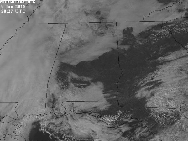
We have noticed a few small showers on radar today, but most of the state is dry. Tonight will be mostly cloudy with temperatures holding in the 50s through the night.
TOMORROW/THURSDAY: We project a high in the mid 60s tomorrow, and by Thursday we rise into the 67-70 degree range. The air will remain fairly moist, and we will mention a chance of scattered showers both days with a mostly cloudy sky. Nothing too widespread or heavy.
FRIDAY AND THE WEEKEND: Rain becomes widespread across the state late Thursday night into Friday as a cold front moves in from the west. Rain amounts of 1/2 to 1 inch are likely; no issues with severe storms. Then, during the day, cold air addictions means falling temperatures. We begin the day in the 50s, fall through the 40s during the midday hours, then reaching the 30s by late afternoon and Friday evening.
Models continue to suggest that rain could very well change to snow over parts of North Alabama Friday night in the colder air, and before the deeper moisture lifts out. As you might expect, there is a wide range of possibilities across model output, but consistency in the idea is good. The European model (12Z run) is the most aggressive, suggesting accumulating snow for about the northern third of the state, but the GFS shows little accumulation and nothing more than snow flurries or snow showers.
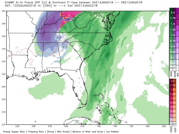
Bottom line is that it is simply too early to call at this point. We can’t rule out the chance of some snow accumulation or travel impact Friday night; we will be able to be much more specific in coming days as the event gets closer. But remember, there is a chance there will be nothing more than flurries.
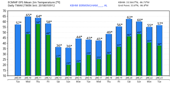
Saturday will be cold and dry with a clearing sky; a decent part of North Alabama won’t get out of the 30s with a brisk north wind making it feel colder. Sunday will be sunny; we start the day between 18 and 23; the high will be in the low 40s.
NEXT WEEK: A clipper will bring a reinforcing shot of cold air Tuesday; the first half of the week looks cold and dry… then warmer air returns Thursday and Friday with some risk of showers toward the end of the week. See the Weather Xtreme video for maps, graphics, and more details.
BEACH FORECAST: Click here to see the AlabamaWx Beach Forecast Center page. The Beach Forecast is partially underwritten by the support of Brett/Robinson Vacation Rentals in Gulf Shores and Orange Beach. Click here to see Brett/Robinson’s Hot Deals now!
WEATHER BRAINS: Don’t forget you can listen to our weekly 90 minute netcast anytime on the web, or on iTunes. This is the show all about weather featuring many familiar voices, including our meteorologists here at ABC 33/40.
CONNECT: You can find me on all of the major social networks…
Facebook
Twitter
Google Plus
Instagram
Pinterest
Snapchat: spannwx
I had a great time today visiting with the kindergarten students at Striplin Elementary in Gadsden… be looking for them on the Pepsi KIDCAM today at 5:00 on ABC 33/40 News! The next Weather Xtreme video will be posted here by 7:00 a.m. tomorrow…
Category: Alabama's Weather, ALL POSTS, Weather Xtreme Videos
About the Author (Author Profile)
James Spann is one of the most recognized and trusted television meteorologists in the industry. He holds the AMS CCM designation and television seals from the AMS and NWA. He is a past winner of the Broadcast Meteorologist of the Year from both professional organizations.Subscribe
If you enjoyed this article, subscribe to receive more just like it.


