Early Afternoon Notes
LIGHT SNOW/SIGNIFICANT TRAVEL IMPACT LIKELY TOMORROW: After a review of the morning computer model data, not much change in the thinking concerning the winter weather event tomorrow in Alabama…
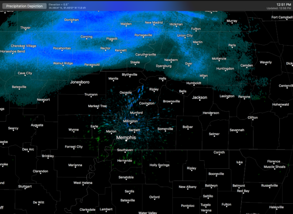
The leading edge of the snow is now on Memphis radar… over the northwest corner of Tennessee, far northern Arkansas, and southern Missouri…
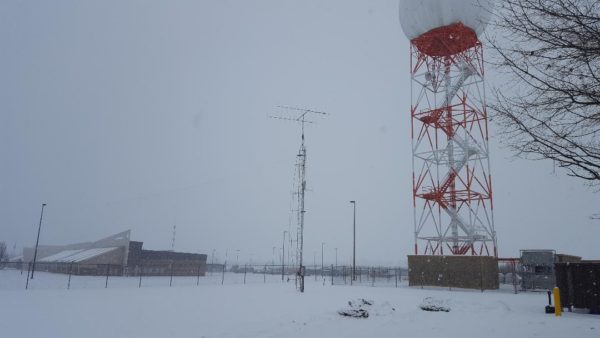
Snow amounts with the band so far have been in the 1-2″ range. This is what it looks like now at the National Weather Service office in Paducah, Kentucky…
Here are the important points concerning tomorrow’s weather in Alabama…
*Light snow will move into the northwest counties very early tomorrow, possibly before daybreak, then spreading southeast during the day.
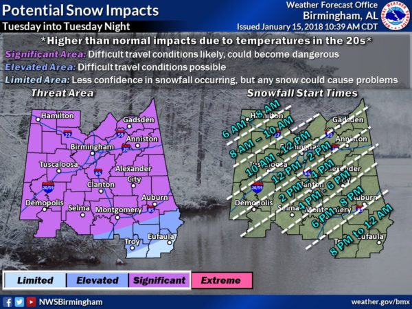
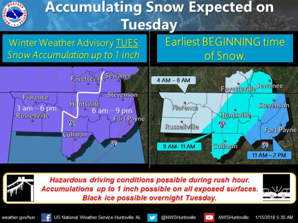
*Snow could reach Birmingham, Tuscaloosa, Anniston, and Gadsden as early as late morning (10 am-12 noon).
*Snow amounts should be light, generally one inch or less. Isolated heavier amounts are possible, however.
*Despite the light amount of snow, temperatures will drop into the 20s during the day tomorrow, and snow will initially melt on road surfaces, followed by a quick freeze, leaving a glaze of ice. This will make for rapidly deteriorating driving conditions soon after the snow begins.
*The “Snowmageddon” event of January 28, 2014 is a fair analog. This time it won’t be quite as cold, and we won’t get quite as much snow (most likely), but the impact could be similar. Once the snow begins to fall tomorrow, be in a place where you want to stay for 24-48 hours.
*Snow tapers off tomorrow night, but we drop into the 10-15 degree range early Wednesday morning with little improvement in driving conditions. Roads should improve to some degree Wednesday with very dry air and sunshine in full force, but patchy ice could linger into Wednesday night and Thursday morning since the high Wednesday will be only in the 30-35 degree range.
*As a meteorologist, I am not sure it is wise for me to issue travel go/no go opinions for tomorrow. Icy travel is likely once the snow begins, and temperatures will be in the 20s. I possess no special knowledge or skill about future road conditions. All depends on your specific route and risk tolerance, and that varies from person to person.
*I have noting do do with school closings; see them here (courtesy ABC 33/40).
*We warm into the 40s Thursday and 50s Friday with a good supply of sunshine both days.
*The NWS in Birmingham should be issuing a winter storm warning soon… stay tuned for frequent updates…
Category: Alabama's Weather, ALL POSTS
About the Author (Author Profile)
James Spann is one of the most recognized and trusted television meteorologists in the industry. He holds the AMS CCM designation and television seals from the AMS and NWA. He is a past winner of the Broadcast Meteorologist of the Year from both professional organizations.Subscribe
If you enjoyed this article, subscribe to receive more just like it.


