A Brief Update On Our Weather Situation At 9:50AM
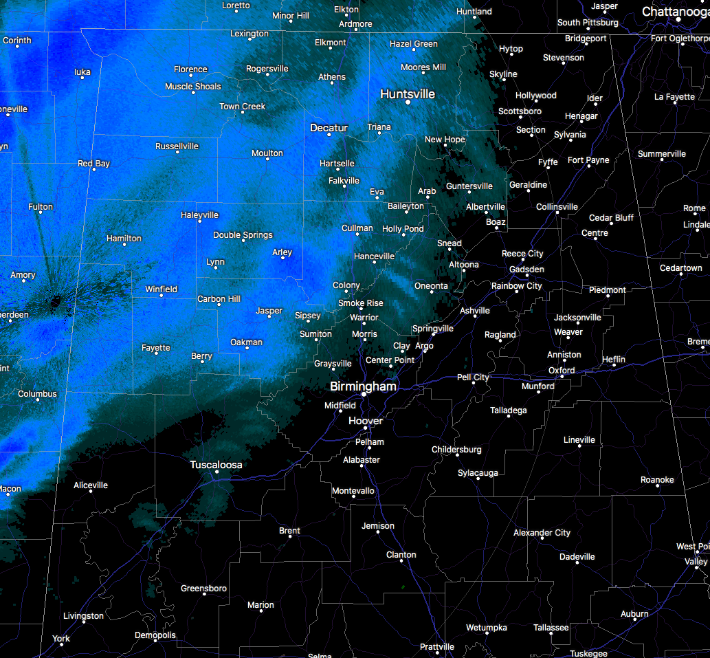
Snow is now starting to approach the Jefferson and Blount County lines from the northwest and is currently falling along and west of a line from Hytop to Hanceville to Cordova to Millport. Temperatures are currently ranging from 21 degrees at Muscle Shoals to 34 degrees at Birmingham to 37 degrees at Montgomery.
As reported earlier, roadways and elevated surfaces are becoming treacherous in the northwestern parts of North and Central Alabama. The Madison County Sheriff reporting that all secondary roads in Madison County are becoming icy & treacherous and asks that people stay off the roads this morning. From the EMA Director of Colbert County, all roads and bridges in Colbert County should be considered impassable until further notice. Dusting is also occurring on I-565 in Morgan County.
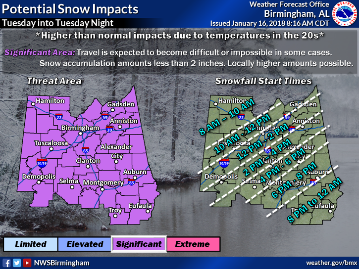
Earlier reports have been stating that the front is coming in stronger than modeled, with temperatures dropping more quickly than expected. Also, due to frontogenetic forcing, some localized banding is occurring leading to heavier snowfall. Earlier radar returns from Central Mississippi was showing the precipitation breaking up some but has since filled back in. NWS Huntsville thinks the latest model guidance is underestimating the precipitation a bit. Higher totals could be seen in the banding.
Along with the snow threat comes a major cooldown, as very frigid arctic air will invade the state behind the cold front. A Wind Chill Advisory has been issued for all of North and Central Alabama, along with a Hard Freeze Watch for all of Central Alabama, both until 9:00 AM Wednesday. Low temperatures are expected to bottom out in the 5 to 15-degree range from the Tennessee state line down to Troy and Eufaula. Combine those temperatures with winds out of the north up to 15 MPH, wind chills will be in the -5 to 5-degree range. Frostbite and hypothermia can occur very quickly if precautions are not taken. Make sure you wear a hat and gloves.
Please remember the 4-Ps… People, Pets, Plants, and Pipes. The cold air that will be in place can cause damage to plants and property, so be sure you take the proper steps to protect those. Be sure to check on the elderly and make sure they have proper and safe ways of staying warm. Bring those pets indoors as this cold will be harmful or even deadly.
Keep checking back with us on the blog throughout the day for the latest updates, and follow us on Twitter and Facebook (@AlabamaWxBlog).
Category: Alabama's Weather, ALL POSTS
About the Author (Author Profile)
Scott Martin is an operational meteorologist, professional graphic artist, musician, husband, and father. Not only is Scott a member of the National Weather Association, but he is also the Central Alabama Chapter of the NWA president. Scott is also the co-founder of Racecast Weather, which provides forecasts for many racing series across the USA. He also supplies forecasts for the BassMaster Elite Series events including the BassMaster Classic.Subscribe
If you enjoyed this article, subscribe to receive more just like it.


