11 O’Clock Last Look for the Night
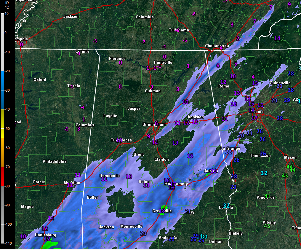
Radar and wind chill values just before 11 p.m. tonight.
Patches of moderate to heavy snow continue to push across South Central Alabama tonight. The snow has basically ended for areas north of I-59.
Areas from Greenville in Butler County up I-65 to Montgomery and up I-85 to are receiving the heaviest snow. Areas east of this will receive the most snow over the next few hours.
Road conditions are treacherous across much of the area. Stay put until we see improvement, which won’t come quickly tomorrow, as temperatures over the northern half of Alabama will remain below freezing all day.
Wind chills will be dangerously low, below freezing in many spots.
Air temperatures are going to be in the single digits across North Alabama overnight. Lower teens will be common in the I-20 Corridor. Middle and upper teens will extend into South Central Alabama.
This will be the last update of tonight. Scott Martin will be along at 5 a.m for the latest updates in the morning.
Category: Alabama's Weather, ALL POSTS
About the Author (Author Profile)
Bill Murray is the President of The Weather Factory. He is the site's official weather historian and a weekend forecaster. He also anchors the site's severe weather coverage. Bill Murray is the proud holder of National Weather Association Digital Seal #0001 @wxhistorianSubscribe
If you enjoyed this article, subscribe to receive more just like it.


