Dare We Say Spring-like?
A beautiful day is in progress across Central Alabama on this January Sunday.
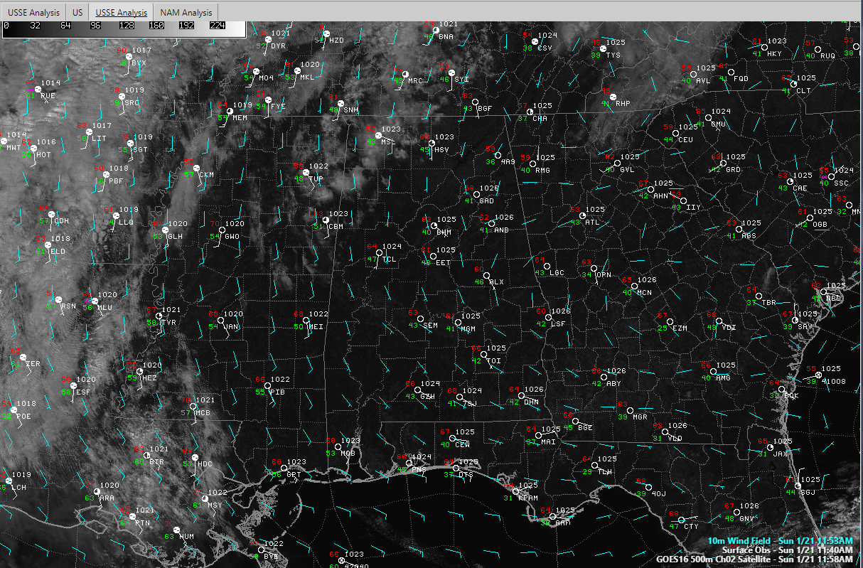
Skies are mostly sunny, except over the northwestern corner of the state, where some altocumulus clouds are moving across in an increasingly moist southerly flow.
That low-level flow is circulating around high pressure that is centered near Eufaula. A rather balmy southerly and southeasterly wind is the result across the state.
Dewpoints will begin increasing quickly late tonight and early Monday across Alabama ahead of the approaching trough. Central Alabama dewpoints should peak in the middle and upper 50s, which is really too low to expect severe weather for us. But they will reach the lower 60s across Southwest Alabama. There will be enough instability for much of the area Monday afternoon. CAPE values will reach to near 1,000 joules/kg over Southwest Alabama, with a narrow ribbon of positive instability values along and east of I-59 as the front approaches.
Skies become cloudy by 10 p.m. tonight for areas west of I-65 and the rest of the state by 1 a.m. Temperatures will fall into the middle and upper 40s over northeastern sections of the area, with lower 50s elsewhere. There could be a few light showers during the pre-dawn hours, but it appears that most of the precipitation will occur midmorning or later starting in the west. Showers will spread across areas west of I-59 through noon.
During the early afternoon, some storms will form along the back edge of the precipitation ahead of the cold front. There is a small chance that a few of the storms could reach severe limits tomorrow, with the main threat being gusty winds. The end of the precipitation will reach I-59 around 5 p.m. as the pre-frontal trough moves through. The precipitation should be weakening by that time as the system limps into eastern Alabama. The rain should be out of Central Alabama by midnight. Highs on Monday will be in the lower and middle 60s. Lows Monday night will be in the upper 30s to lower 40s.
Rainfall amounts will be light, averaging one-quarter of an inch. A few lucky spots over Northwestern Alabama could be closer to three-quarters of an inch. Some spots will get less than one-tenth of an inch, which isn’t good news in the…
DROUGHTWATCH DEPARTMENT: Nearly 61% of the State of Alabama is now in drought conditions, including 7 percent in severe drought. How are prospects for the future? The ensemble mean of the European predicts seven inches over the next 30 days at Birmingham, but I have to be honest, I have heard that before. And the 7 day EPS weeklies from the Euro aren’t encouraging, especially after February 15th, when we start looking really dry. So I will believe it when I see it. Two-week totals from the GFS through February 6th predict an average of 1.5 inches across the I-20 Corridor.
REST OF THE WEEK: Temperature forecast with highs in the 50s and lows in the 30s for the rest of the workweek.
Category: Alabama's Weather, ALL POSTS
About the Author (Author Profile)
Bill Murray is the President of The Weather Factory. He is the site's official weather historian and a weekend forecaster. He also anchors the site's severe weather coverage. Bill Murray is the proud holder of National Weather Association Digital Seal #0001 @wxhistorianSubscribe
If you enjoyed this article, subscribe to receive more just like it.


